
A Severe Thunderstorm Watch has been issued for all of metro Detroit until 7 p.m. and a chance for severe weather still exists tonight.
It comes after several tornado warnings were issued across Southeast Michigan from 3:30 p.m. to 5 p.m.
You can see the latest power outages here.
Watch live coverage below
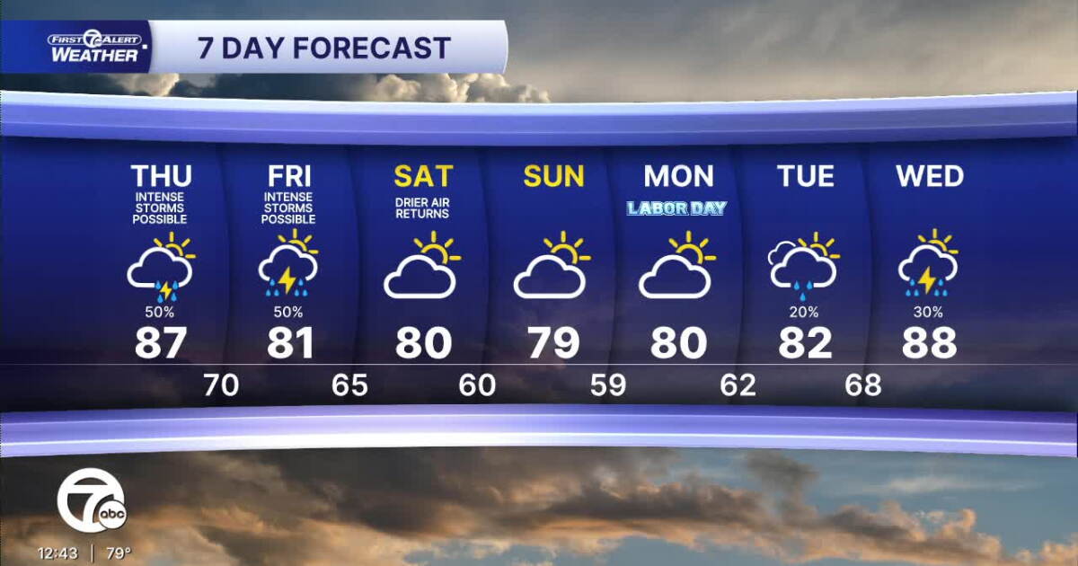
The chance for thunderstorms continues into Thursday night. It stays warm and humid with light winds, and temperatures only gradually fall. Overnight lows range from the mid 60s north of Detroit to around 70° in the city.
Changes arrive Friday as temperatures turn milder, but thunderstorms remain possible. Highs range from the mid 70s around the Thumb to the upper 70s and lower 80s across Metro Detroit, including around 81° in Detroit. A few storms could still become severe.
The weather improves heading into the weekend. Drier air returns Saturday with a high around 80°, followed by 79° Sunday and around 80° for Labor Day. Temperatures begin climbing again next week, reaching the lower 80s Tuesday and upper 80s Wednesday, when another chance for thunderstorms returns.
Today: Partly sunny with heavy storms possible. Highs in the upper 80s. Winds: W 5-10 mph.
Tonight: Storm chances continue. Mostly cloudy with lows in the low to mid 70s. Winds: Light.
Friday: Rain and storms still possible and some of them could be strong to severe. The pattern will be shifting south away from Metro Detroit, so the weekend is looking better with milder temps. Highs will return to the low 80s. Winds: NW 5-10 mph.
Connect with 7 First Alert Meteorologists on Facebook and X:
Facebook: Dave Rexroth , Hally Vogel, Marisa Woloszyn, Mike Taylor
X: Dave Rexroth , Hally Vogel, Marisa Woloszyn, Mike Taylor
Humidity: 89%Dew point: 69°Pressure: 29.91 inWind speed: 11 mphWind direction: NNWVisibility: 6.0 miSunrise: 07:00 AMSunset: 08:03 PM