Updated Sept. 26, 2026, 6:24 p.m. ET
Causeway reopens to Long Beach Island
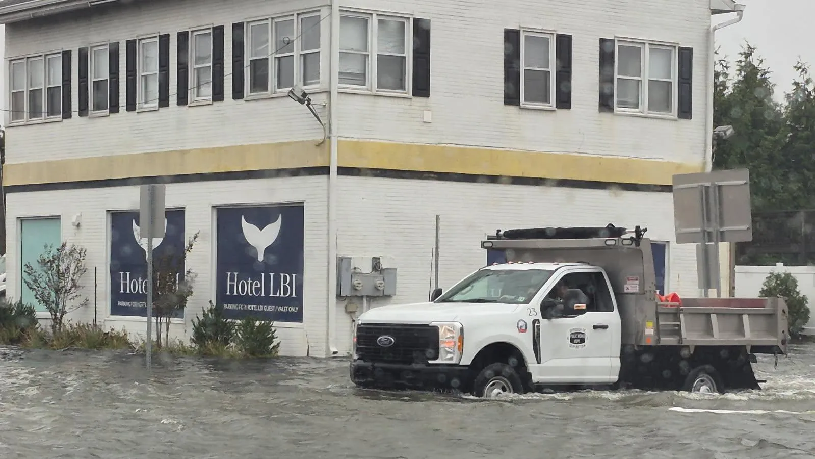
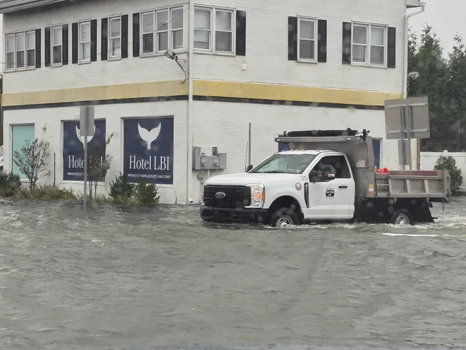
Route 72 to Long Beach Island has reopened, Ocean County Sheriff Michael Mastronardy said. On Long Beach Island, the Boulevard has one lane reopened as well, he said. Authorities were concerned about tonight’s expected high tide, Mastronardy said, urging residents to be careful.
NJ nor’easter forecast: Here’s what meteorologists expect for Saturday night, Sunday morning at Jersey Shore Flooding closes parts of Route 36 in Long Branch, Monmouth Beach
As of 2:30 p.m., flooding has closed Route 36 in Long Branch in both directions south of Seventh Avenue and north of Avenel Boulevard, according to 511nj.org. Route 36 also is closed in both directions at Valentine Street in Monmouth Beach.
The ramp lane on Route 35, County Route 3/Broadway in Keyport also is closed, according to the state’s traffic website.
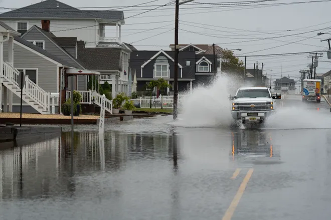
Flooding caused by the nor’easter, which pushed water from the Shrewsbury River into the streets of Sea Bright, has closed Route 36 in both directions, according to the state Department of Transportation.
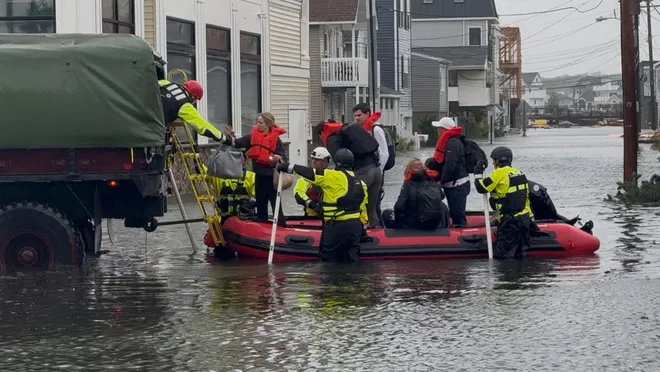
In the town, emergency responders have used a boat to help residents stranded by the floodwater. Sea Bright resident Chuck Gruber took photos of a rescue involving one family. “They were loading a family into that boat, and then bringing it up to put them in the rescue truck,” Gruber said. People were being taken to a recreation center in town to ride out the storm.
Sea Bright Deputy Fire Chief Charles F. Rivera said Sea Bright Fire Rescue has helped about 30 people who asked to be evacuated from their homes because of the flood waters. “We’ve been extremely busy,” Rivera said.
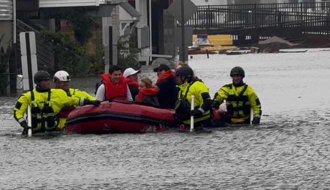
Another 25 to 40 people needed to be rescued from their vehicles after driving into floodwaters. “Turn around, don’t drown,” Rivera said.
“Just don’t drive down flooded roadways,” he said, adding that it puts emergency responders at risk to pull people out of their cars in three feet of floodwater. “There’s road flooded signs up on each end of town by the bridges. It’s very hard for somebody to say they didn’t know that there’s flooding.”
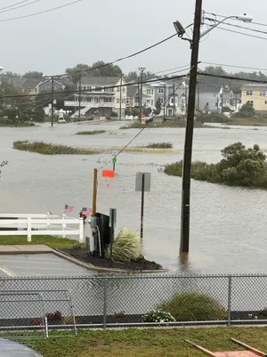
Major coastal flooding will remain an issue through at least Sunday as the nor’easter continues to develop and churn off the coast.
Six days of northeasterly winds pushed water into the Jersey Shore’s bays and inlets, a formula for flooding compounded and worsened by the storm, said Steven DiMartino, owner and chief meteorologist at NYNJPA Weather said Sept. 26.
“There’s been major flooding,” DiMartino said. “It’s going to continue to be an issue all the way until this storm peaks tomorrow.”
Wind from the northwest on Sunday will start to push water out of the bay, but flooding may possibly linger into Monday especially as the water is driven out of back bay areas.
“You have the core of this storm still evolving all the way through tonight into tomorrow morning with waves of heavy rainfall and strong winds,” DiMartino said.
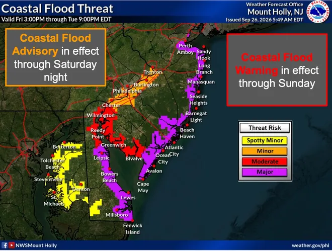
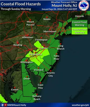
The Jersey Shore is under a coastal flood warning, the National Weather Service says. Residents can expect one to two feet of flooding in low-lying areas near shorelines and tidal waterways, the weather service said.
The flooding is likely to damage vulnerable structures and make roads impassable, the weather service said. “Significant beach erosion is expected. Breaching of sand dunes is possible.”
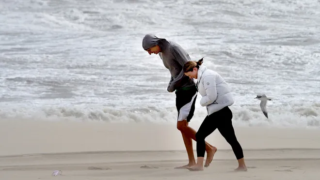
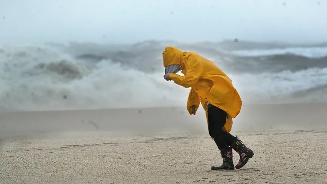
There’s also a high surf advisory with large breaking waves of four to 13 feet in the surf zone along with the dangerous swimming conditions and rip currents. “Rip currents can sweep even the best swimmers away from shore into deeper water,” the weather service said.
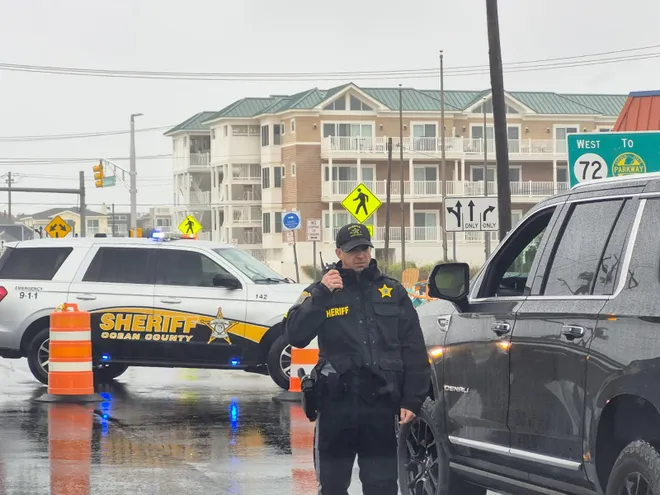
Police have closed off access to Long Beach Island as a result of “significant flooding and hazardous roadway conditions.”
“Due to significant flooding and hazardous roadway conditions, Route 72 eastbound is currently closed at the Boatyard,” police said in a Facebook post. “There is no access to Long Beach Island via Route 72 at this time.”
Motorists are asked to avoid the area, and reserve 911 for emergencies only.
Flooding has closed The Boulevard from 31st Street in Ship Bottom south towards Beach Haven, Ocean County Sheriff Michael Mastronardy said. Stafford police are regulating traffic going over the causeway bridge onto Long Beach Island.
How strong was the wind overnight?
The National Weather Service in Mount Holly said the highest wind speeds in Monmouth and Ocean counties were:
Sea Girt 57 mph Belmar 56 mph Lake Como 54 mph Monmouth Beach 48 mphKeansburg 46 mphSurf City 74 mphIsland Beach SP 70 mphHarvey Cedars 69 mphShip Bottom 67 mphHarvey Cedars 66 mphBarnegat Light 61 mphBeach Haven 58 mphSeaside Heights 57 mphTuckerton 55 mphSeaside Park 54 mphMantoloking 52 mphBeach Haven 51 mphToms River 48 mphLong Beach Township 48 mphSurf City 46 mphPoint Pleasant Beach 45 mph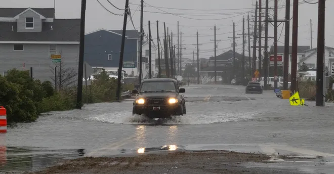
Asbury Park police have issued a flooding alert, warning people to move their cars immediately if parked along Lake Avenue as the water is rising above the lake.
The Oceanic Bridge between Middletown and Rumson is closed due to flooding, police said.
As a nor’easter batters the Jersey Shore with gusty winds, heavy rain and flooding, the National Weather Service says moderate to heavy tidal flooding is expected to last into the weekend.
“The highest tides are forecast to occur during the Saturday morning and/or Saturday night high tide,” the National Weather Service said early Sept. 26., “Rainfall may also lead to higher water levels in some areas.”
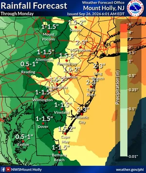
Along the Atlantic Coast, a high wind warning is in effect. Sustained winds are near 30 to 40 mph with gusts up to 60 mph. As much as 3 inches of rain is expected over much of eastern New Jersey through Monday, the weather service said in its morning update.
NWS alert: Coastal flood warning issued for Jersey Shore area
The storm is already causing some problems. An electric power line has come down over the Route 37 J. Stanley Tunney Bridge over the Barnegat Bay between Toms River and Seaside Heights, closing the bridge to westbound traffic, Ocean County Sheriff Michael Mastronardy said at 8:30 a.m.
JCP&L spokesperson Christopher Hoenig said utility crews cut the ling shorly before 10 a.m. so the bridge could be reopened. About 2,000 customers are without power in the Ortley Beach section of Toms River, according to the JCP&L outage map.
A total of 5,243 customers total are without power in Ocean County, with reported outages in Manchester, Brick and Point Pleasant. In Monmouth County, 3,480 customers are without power with reported outages in several towns including Colts Neck, Marlboro and Middletown.
As of 9 a.m., JCP&L crews have restored power to more than 50,000 customers since the storm’s onset, Hoenig said. Out of more 70,000 customers affected by the storm, approximately 17,000 remain without power
About 3,200 JCP&L workers are responding to weather-related outages as they come in. This includes nearly 1,600 line workers, more than 580 foresters, as well as damage assessors, hazard responders, substation electricians and support personnel.
There’s also reports of about 20 trees down throughout Ocean County, from Lacey to Jackson. “We have no major problems there,” Mastronardy said.
In southern Ocean County, Tuckerton Beach, a flood zone area, is flooded. Patrols in high-water vehicles are in the area to aid residents, Mastronardy said.
In Sea Bright, Ocean Avenue is closed in all directions because of flooding. Flooding also closed Route 36 at the intersection with Valentine Street in Monmouth Beach.
This story will be updated throughout the day.