
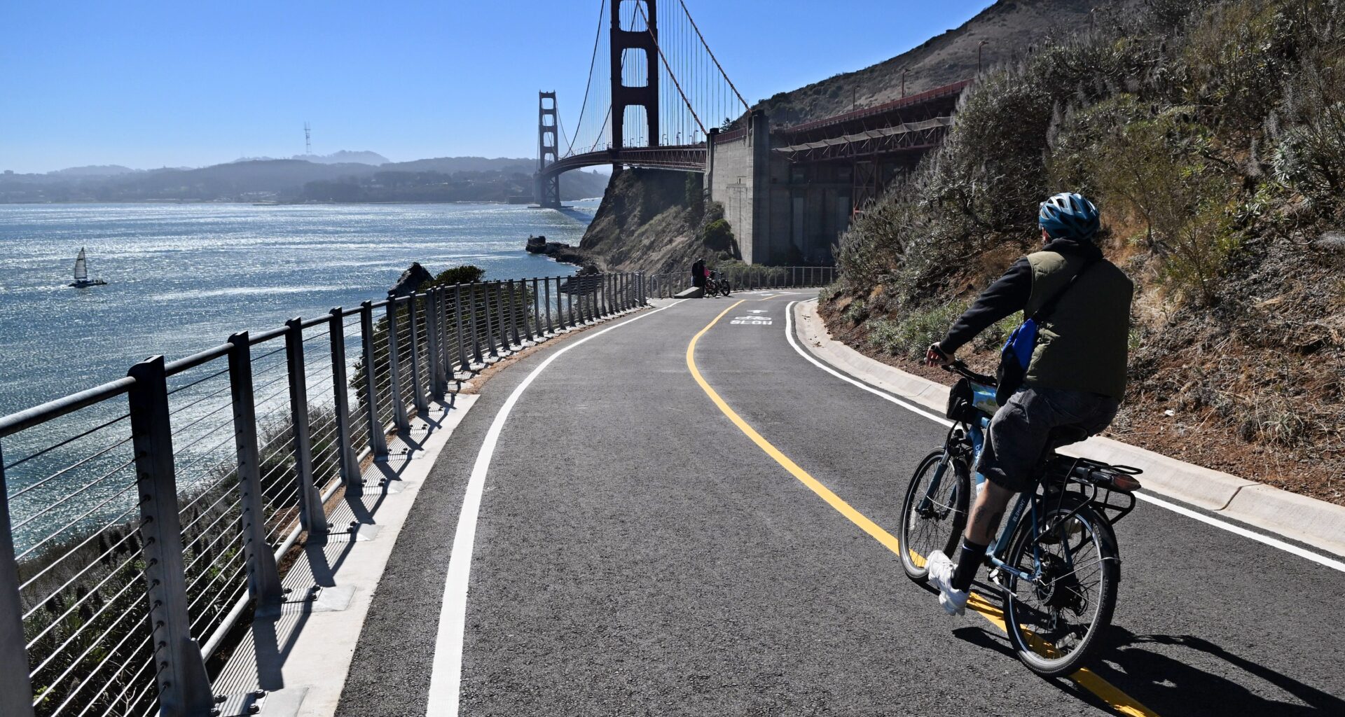
Bicyclists have a new paved route north of the Golden Gate Bridge that allows them to bypass a dangerous road on the way to Sausalito.
The $6 million Vista Point Trail enables northbound cyclists from the bridge to skirt the treacherous stretch of Alexander Avenue that is a known high-risk area for collisions.
“We’re thrilled,” said Tarrell Kullaway, executive director of the Marin County Bicycle Coalition. “It’s going to fix part of what’s called Marin’s most dangerous mile, and we’ve been asking for this for a long time.”
The project converted an unpaved service road into a 15-foot-wide paved trail, with benches, paved drainage ditches, bollards and signs, said Joshua Winchell, a spokesperson for the Golden Gate National Recreation Area, which led the project.
Winchell said the trail “offers some of the best views of the Bay, the city of San Francisco and the Golden Gate Bridge.”
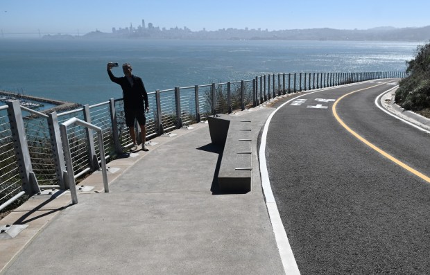 Maximo Olivas of Valencia, Spain, takes a selfie with the San Francisco skyline in the background as he visits the new Vista Point Trail in Sausalito, Calif., on Tuesday, Sept. 29, 2026. (Alan Dep/Marin Independent Journal)
“This connection has long been planned to improve safety and visitor experience for the thousands of bikes and pedestrians that cross the bridge daily to recreate in federal lands in Marin,” he said. “As a result, pedestrians and cyclists can avoid the vehicle congestion on Alexander Avenue and walk or ride on a trail which cars can’t access.”
The project is on the historic Vista Point Road, which provided non-motorized public access until 1999, when it was closed for the Golden Gate Bridge seismic upgrade. Cyclists were diverted onto the heavily used Alexander Avenue.
Kullaway said that span of Alexander Avenue was the site of more than 80 crashes between 2010 and 2020. Even for experienced riders who knew the area, the route was challenging, forcing cyclists to jockey for position with vehicles on a high-speed, pothole-pocked road with no bike lane.
“In the past, you would approach the road and wouldn’t know which way to go, and it was really mayhem,” Kullaway said. “And this is a popular spot for tourists who didn’t know where they were going, and many of them riding on e-bikes for the first time. It was a recipe for disaster.”
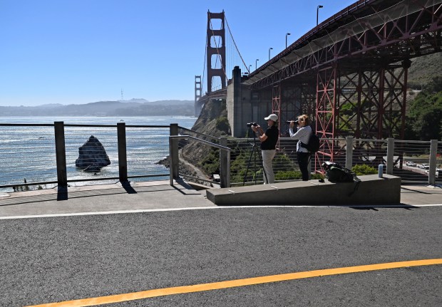 Anne-Marie Lamarche of Kenwood, left, and Karen Snow of Lafayette get a view of the bay from the new Vista Point Trail in Sausalito, Calif., on Tuesday, Sept. 29, 2026. (Alan Dep/Marin Independent Journal)
A ribbon-cutting ceremony took place on Wednesday, though the path had been opened two weeks earlier.
The $6 million grant to finish the project came from the Federal Lands Transportation Program of the Federal Highway Administration.
Construction began in 2025 after a period of planning and collaboration among stakeholder groups that began back in 2012, officials said.
Winchell said the stakeholders included the Golden Gate Bridge, Highway and Transportation District; the Marin County government; the Metropolitan Transportation Commission; Caltrans; Save the Bay; Sausalito; the San Francisco Bicycle Coalition; and the Marin County Bicycle Coalition.
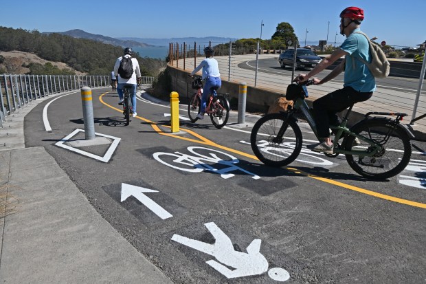 Bicyclists rides down the new Vista Point Trail from the Vista Point parking lot in Sausalito, Calif., on Tuesday, Sept. 29, 2026. (Alan Dep/Marin Independent Journal)
Golden Gate Bridge district officials are happy to see the path open, said Paolo Cosulich-Schwartz, spokesperson for the agency.
“The scenic trail provides stunning views and creates a new safe and accessible path from the Golden Gate Bridge east sidewalk to Fort Baker and Sausalito,” he said in an email. “We thank the National Park Service for being great partners in providing a world-class experience to people visiting the Golden Gate Bridge and surrounding park lands.”
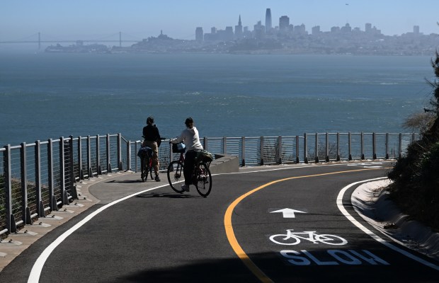 Bicyclists take in the view from the new Vista Point Trail in Sausalito, Calif., on Tuesday, Sept. 29, 2026. (Alan Dep/Marin Independent Journal)