
Rain, strong winds and potentially damaging surf are in the forecast as this week’s heat gives way to a cooldown, more clouds and tropical moisture this weekend.
The significant weather changes are due in part to Tropical Storm Rachel and a storm system to the north with the most dramatic shift coming Sunday. Tropical moisture associated with the Pacific storm is expected to move into Southern California.
The storm could make landfall in northern Baja California this weekend.
“There are two things coming together that bring us this change in our forecast,” said NBC4 meteorologist Belen De Leon. “The first is a storm well to our north. Right now, it’s barely moving into the Pacific Northwest, but this storm system is going to move in a bring us much cooler temperatures.
“As we look to the south, it’s tropical storm Rachel. That’s bringing us that large swell as it moves toward the northeast. It’s going to be skirting us, bringing some moisture.”
Below, a look ahead to this weekend’s weather.
When will it rain in Los Angeles?
Temperatures will cool Friday and into the weekend with extreme heat warnings, which had been in effect for a widespread area, expiring. By Saturday, high temperatures are expected to be 5 to 10 degrees cooler, bringing most areas back to near seasonal averages.
Sunday brings the most likely possibility of rain, but showers could develop as early as Saturday night. Showers could continue Monday into Tuesday.
Rainfall totals in Los Angeles County are most likely to range from a tenth to a quarter-inch with locally higher amounts possible in the mountains.
Orange County could see periods of moderate to heavy rainfall, depending on Rachel’s track. Heavier showers could produce localized flooding.
The severity of rainfall, winds and possible coastal flooding will depend heavily on Rachel’s eventual track and intensity.
Powerful surf on the coast
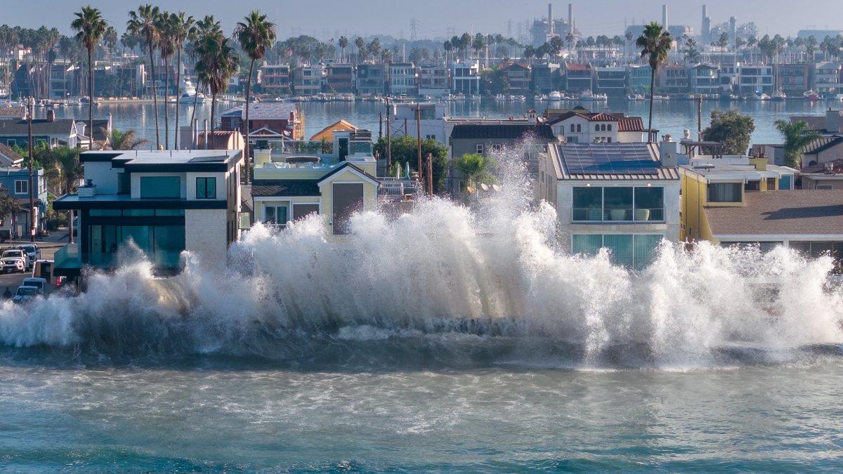
Elevated surf and high tides are expected to create hazardous conditions along beaches in Los Angeles and Orange counties. A coastal flood advisory will remain in effect through 2 p.m. Tuesday for coastal areas of Los Angeles and Orange counties.
Preparations were being made in Long Beach, where recent elevated surf caused damaged along the shoreline in some areas. After building inspectors reviewed structures threatened by high surf Thursday, two structures were issued preliminary red tags and another building was issued a yellow tag at the 6400 and 6500 blocks of Seaside Walk, according to the city of Long Beach.
Waves pounded Long Beach during high during Friday morning with water reaching streets near the coastline.
In Orange County, surf of 3 to 5 feet, with occasional sets reaching 6 feet, is expected Friday along south- and southwest-facing beaches.
A stronger southerly swell associated with Rachel is expected to arrive Sunday, potentially producing surf of 6 to 9 feet before decreasing to 3 to 6 feet Monday and Tuesday.
“Sunday is the day to watch when we could have those larger swells,” said De Leon.
Strong rip currents, elevated surf and unusually high tides could produce coastal flooding and beach erosion, particularly in low-lying areas.
Morning high tides approaching 7 feet, combined with large waves and increasing winds, could create the greatest coastal flooding threat Sunday.
Los Angeles County beaches could also see significant impacts. A coastal flood warning may become necessary in southern portions of the county if high tides, swells and strong winds coincide.
Winds over coastal waters are expected to increase Saturday and Sunday, potentially reaching 20 to 30 knots and generating steep, choppy seas hazardous to small vessels.