
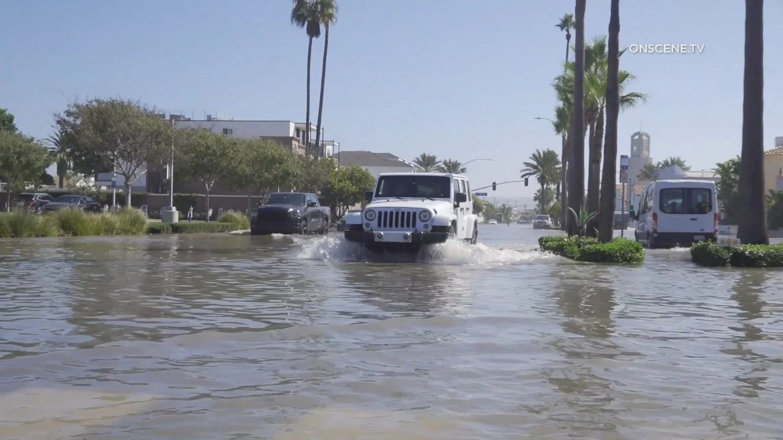
Southern California’s prolonged heat wave was giving way to cooler temperatures Friday as forecasters predicted several days of rain associated with Tropical Storm Rachel and warned that dangerous surf and unusually high tides could cause damaging coastal flooding through the weekend.
The National Weather Service issued coastal flood warnings through 3 p.m. Sunday for beaches in Los Angeles and Orange counties, with the greatest threat expected Sunday morning as large waves, strong winds and high tides combine.
Forecasters said damaging coastal flooding is likely along vulnerable south-facing beaches, particularly in Long Beach and Malibu, while other coastal areas could experience minor flooding and significant beach erosion.
Rachel is expected to track well south of Los Angeles County, but moisture drawn northward by a low-pressure system will bring periods of light to moderate rain beginning as early as Saturday evening, according to the weather service.
The greatest chances of rain are expected early Sunday morning through the afternoon, with additional showers possible Sunday night and Monday as a second, colder low-pressure system moves into California, forecasters said.
Rainfall totals from the two systems are expected to range from a quarter-inch to 1 inch, with locally higher amounts possible in the mountains, particularly the eastern San Gabriel Mountains.
“We’re not expecting widespread freshwater flooding at this point, but some areas of minor roadway flooding is possible,” according to the weather service. “The more significant impacts are likely going to come from the coastal flooding side of things, especially for south facing beaches in Los Angeles County.”
A 5% to 10% chance of thunderstorms was forecast for eastern Los Angeles County on Sunday, with a similar chance of thunderstorms across the region Monday.
Temperatures will continue falling Saturday as a deepening marine layer and increasing onshore winds bring relief from the heat wave that gripped much of Southern California earlier in the week.
“Temperatures will cool region wide through the weekend and into early next week,” according to the weather service.
A second low-pressure system arriving late Sunday into Monday will bring some of the coolest temperatures the region has experienced in recent weeks, forecasters said.
Along the Los Angeles County coast, high tides of 7.3 to 7.6 feet are expected each morning, with waves of 4 to 7 feet and dangerous rip currents. A high surf advisory will be in effect from 6 a.m. to 10 p.m. Sunday for the Malibu coast and Los Angeles County beaches.
“Sunday carries the widest range of coastal flooding outcomes due to chances of rain, wind, low pressure tidal enhancements, and swells from multiple directions,” according to the weather service.
Forecasters warned that coastal flooding Sunday could be substantially worse if high tides, strong winds and large waves peak simultaneously.
The coastal flood warning could be extended beyond Sunday or replaced by a coastal flood advisory through Tuesday.
In Long Beach, waves battered homes and a boardwalk along the Alamitos Peninsula Friday, with city officials reporting two red-tagged structures and three yellow-tagged buildings. Crews were assessing damage as the city prepared for additional flooding, while officials reported distributing 7,600 sandbags ahead of the latest storm.
Newport Beach declared a local emergency Friday after high surf and elevated tides flooded streets on the Balboa Peninsula. City crews were rebuilding protective sand berms, operating pumps and opening tide valves to drain flooded areas, while officials urged motorists to avoid the peninsula.
Orange County beaches are also under a coastal flood warning through 3 p.m. Sunday, with forecasters warning of potentially significant flooding and erosion. Surf of 5 to 7 feet, with occasional sets reaching 9 feet, is expected Sunday, when high tides exceeding 7 feet could combine with increased swells and onshore winds.
A coastal flood advisory for Orange County beaches will take effect at 3 p.m. Sunday and remain in place until 2 p.m. Tuesday.
The weather service urged beachgoers to remain out of the water and warned motorists not to drive through flooded roads or around barricades.
Meanwhile, winds over coastal waters are expected to increase Saturday and Sunday, potentially reaching small craft advisory levels and generating steep, choppy seas hazardous to smaller vessels.
Showers could linger into Tuesday before the weather begins drying out Wednesday, with forecasters predicting a rapid warming trend Thursday and Friday.
The warming could be accompanied by weak to moderate Santa Ana winds as offshore flow develops later in the week, according to the weather service.