
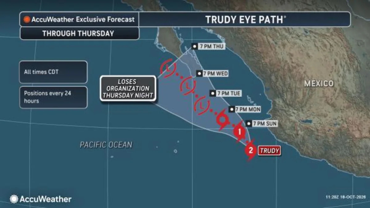
Southern California and the Southwest have experienced multiple storms this fall that have featured an infusion of tropical moisture from the eastern Pacific Ocean, and the stage is set for that to happen again this week.
This time around, moisture from Hurricane Trudy off of Mexico’s southwest coast will stream northward ahead of a non-tropical storm that is approaching the West Coast. Once again, tropically-enhanced downpours will raise the risk for flash flooding across the Southwest and Rockies beginning around midweek.

The storm will initially approach California between Tuesday and Wednesday and is expected to spread rain and even some mountain snow beginning Tuesday night. As the core of the storm approaches into the day on Wednesday, pockets of heavy rain and thunderstorms can raise the risk for flash flooding across portions of central and Southern California. Los Angeles will be just one of the cities in the path of this storm that will face these risks.

Following a stretch of hot and windy conditions across Southern California this past week, multiple wildfires have broken out. Conditions coming up around midweek will drastically improve firefighting efforts, but the recent burn scars can also pose a new threat for mudslides and debris flows as heavy rain falls over the scorched ground.
As the storm continues to press inland around midweek, an influx of tropical moisture will infuse itself into the storm as it streams into the Southwest.
“This storm will pull moisture from the tropics into the Southwest, which will lead to the risk of heavy rain and flash flooding, especially on Wednesday and Thursday across Arizona, Utah, western Colorado and New Mexico,” AccuWeather Meteorologist Kai Kerkow stated.
The AccuWeather Local StormMax™ for rainfall between Wednesday and Thursday in the Southwest is 6 inches.

This includes the cities of Phoenix, Flagstaff and Tuscon, Arizona.
Heading into late week, the storm will slowly shift through the Southwest and Rockies and continue to bring a risk for additional rain. As the storm lifts through the Rockies into cooler air, mountain snow is also expected, bringing a beneficial boost to the snowpack to the high terrain.
While the stormy pattern has brought instances of flash flooding across the Southwest so far this fall, it has helped to incrementally chip away at some of the drought conditions across the region. A continuation of the stormy pattern is needed this fall and winter across much of the western United States in order to raise the levels of many major reservoirs.
Historically speaking, El Niño favors above average precipitation during the winter season across Central and Southern California and the Southwest.
Want next-level safety, ad-free? Unlock advanced, hyperlocal severe weather alerts when you subscribe to Premium+ on the AccuWeather app. AccuWeather Alerts™ are prompted by our expert meteorologists who monitor and analyze dangerous weather risks 24/7 to keep you and your family safer.