
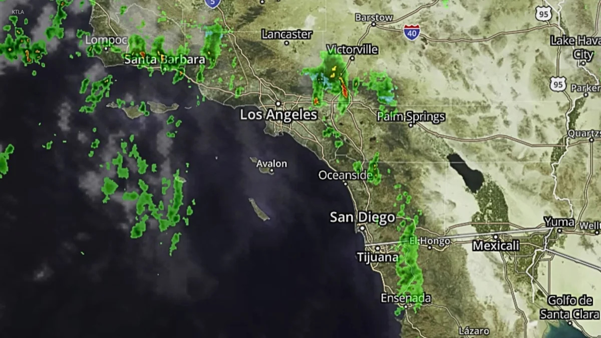
A powerful Pacific storm dumped heavy rain overnight across Southern California, which remains under flood watches and a beach hazards statement Thursday.
“Another day of scattered showers and some thunderstorms expected to continue, with all of the rainy weather still a factor,” KTLA’s Kirk Hawkins said.
Flood watch
A flood watch remains in effect for the Santa Monica Mountains recreational areas, including Malibu Bowl, Malibu, Pacific Palisades and Topanga, through Thursday afternoon, according to the National Weather Service.
“Flooding may occur in poor drainage and urban areas. Extensive street flooding and flooding of creeks and rivers are possible,” Weather Service officials said.
Preliminary rain totals
As of 10 p.m. Wednesday, roughly 0.25 to 0.5 inches of rain had fallen across Los Angeles County coastal and valley areas, while 0.5 to 1.5 inches had been recorded in mountain and foothill communities.
Steady rain continued overnight, and with more showers expected Thursday, those totals were expected to rise.

A satellite-radar image shows moisture over Southern California at 5 a.m. on Oct. 22, 2026. (KTLA)
The Weather Service is also calling for a 10% to 15% chance of thunderstorms, which could significantly boost rainfall totals in localized areas.
There is also the possibility of a brief, weak tornado touching down, according to weather officials.
Overnight flooding
Downpours caused debris flows and minor flooding across parts of Southern California overnight.
Video showed a car driving through flooded streets Wednesday night near Via Banderas and Calle Conejo in San Juan Capistrano. The intersection is located just downhill from the Norte Fire burn scar.
The Norte Fire burned 570 acres and destroyed six homes. It was 95% contained as of Wednesday night.
In the San Bernardino Mountains, heavy rain contributed to mudflows and flooding in several areas along highways 18 and 189.
Thick fog also rolled in with the storm, making visibility difficult for motorists.
Beach hazards statement
A beach hazards statement remains in effect through late Thursday evening due to dangerous rip currents and breaking waves associated with elevated surf of 3 to 6 feet.
In Long Beach, crews have been working on a dredging project for several days in an effort to restore sand along the damaged boardwalk beachfront.
City officials said they are prepared for the possibility of more high surf.
“We do have our public works teams that have those pumps deployed and ready to go in the event that we get higher rain totals than we’re expecting,” City of Long Beach spokesperson Melanie Miller said.
Drier skies ahead
Showers are expected to taper off later Thursday evening as Southern California looks ahead to a comfortable weekend.
“Maybe some light showers as we get into early evening hours and then for Friday, we’ll dry out and warm up. Saturday and Sunday, we’ll just see warmer weather continuing,” Kirk said.
Copyright 2026 Nexstar Media, Inc. All rights reserved. This material may not be published, broadcast, rewritten, or redistributed.For the latest news, weather, sports, and streaming video, head to KTLA.