
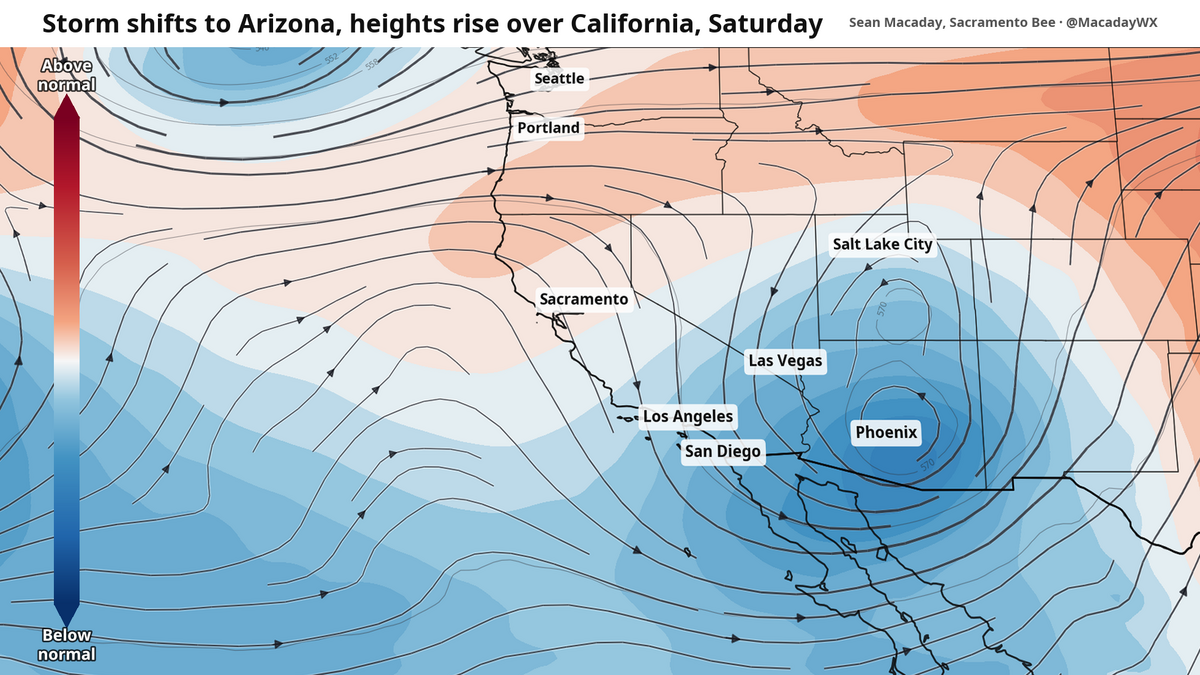
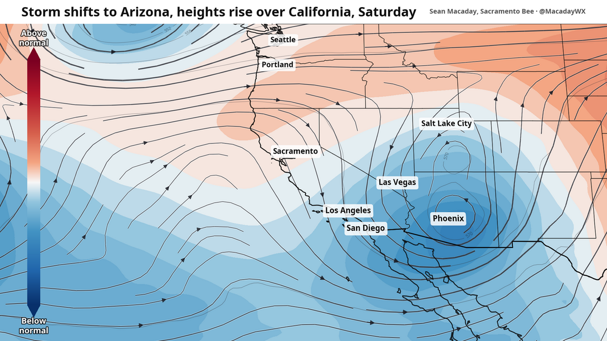
As unsettled weather pulls east into Arizona and New Mexico this weekend, temperatures will begin to return to normal across the California.
The Sacramento Bee
After two days of on-and-off showers that Central California has not seen months, the rain is coming to a close as of Friday morning.
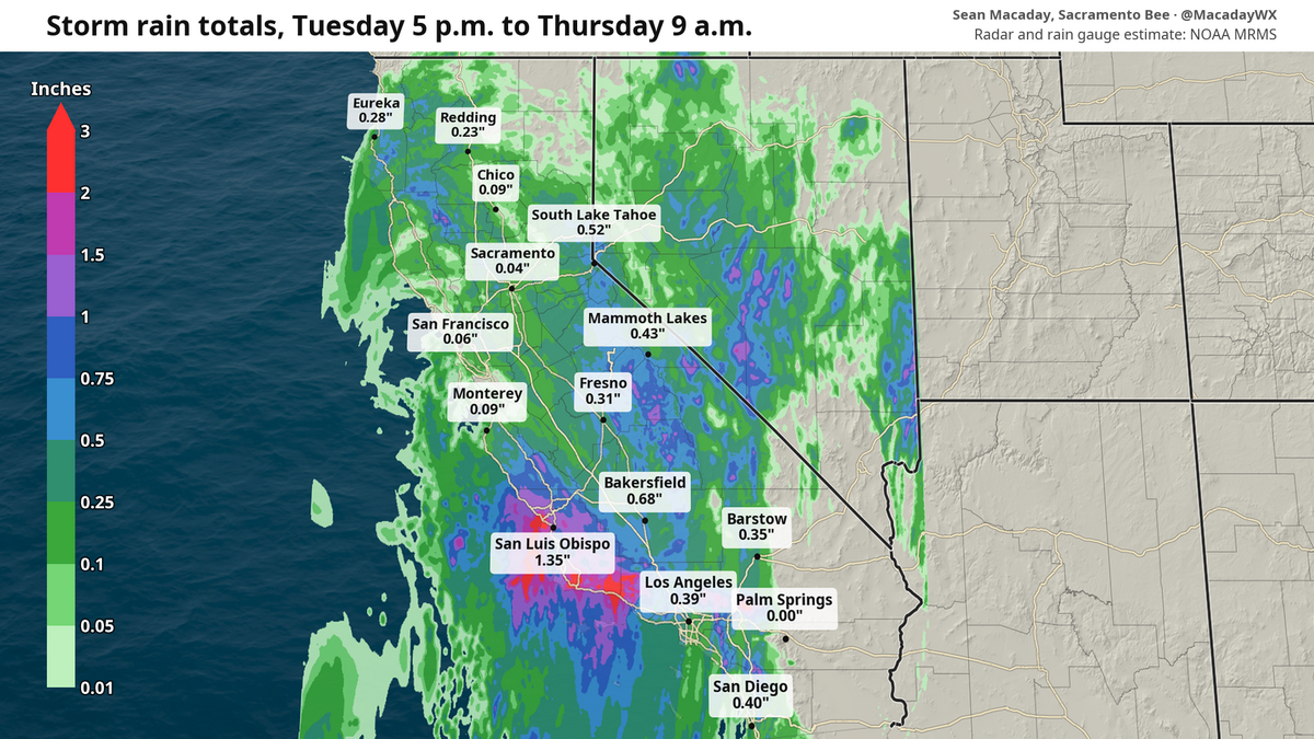
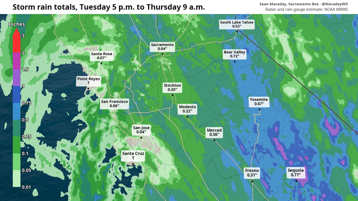
Precipitation was intense across the state. As of late Thursday morning, radar-estimated rainfall totaled more than half an inch in parts of the San Joaquin Valley and a quarter inch in the Sacramento Valley. By Friday morning, those totals will be slightly higher.
The official Sacramento International Airport total so far is 0.34 inches, which is notably higher than the downtown Sacramento estimate, and would make it the wettest two-day stretch for Sacramento since May 4-5. Meanwhile, Fresno officially recorded at 0.2 inches at the airport, the wettest two-day stretch since April 25-26.
 The Sacramento Bee
 The Sacramento Bee
The biggest rain totals came in Southern California and on the Central Coast. Thanks to a line of intense thunderstorms late Wednesday and into Thursday morning, Santa Barbara received more than two inches, with nearby San Luis Obispo clocking in about an inch and a half — its wettest days since Feb. 16-17.
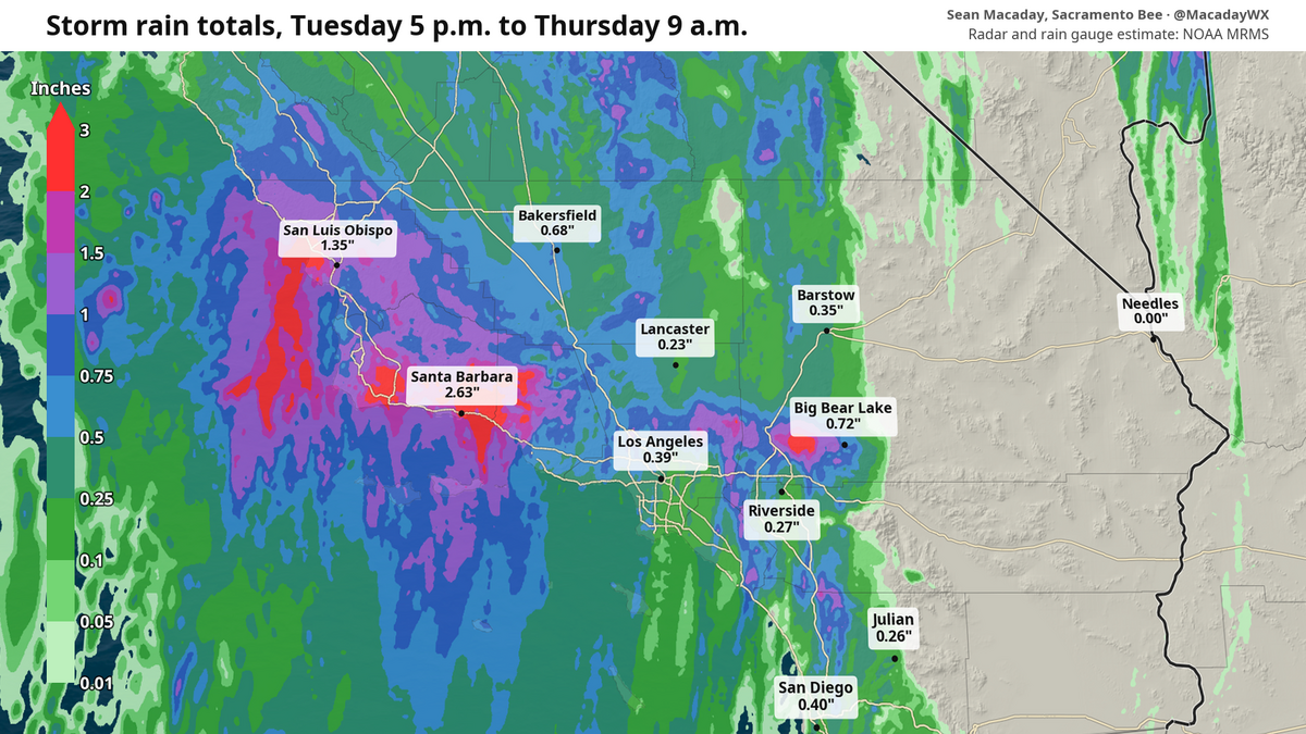 Radar estimated rainfall totals through Thursday morning. The Sacramento Bee
It’s a reminder that the wet season is at our doorstep, and it won’t be long before its taking a giant step into our living room. El Niño is expected to increase precipitation statewide this winter, with the biggest gains likely to arrive in December.
Settling into true fall for the weekend
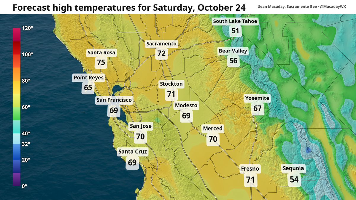
As the rain departs, with the trough of lower pressure pushing east into Arizona this weekend, temperatures will moderate back to normal by Saturday and Sunday, with typical late October weather lingering into next week with the occasional bout of clouds.
That means high temperatures for Sacramento in the mid-70s this weekend through next week, and similar temperatures everywhere else across the Central Valley and Southern California, including Fresno, Modesto, Merced, Bakersfield, San Luis Obispo and Santa Barbara. Low temperatures are set to hover around the low 50s and high 40s.
 The Sacramento Bee
 The Sacramento Bee
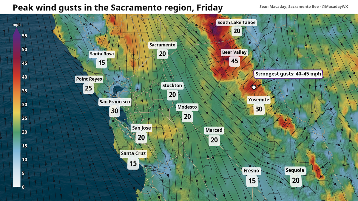
And as rain departs Friday, a rush of north wind will bring the temperatures back to normal as the atmosphere stabilizes. Winds gusting 30 mph or higher are expected Friday afternoon across the Central Valley, with the strongest gusts in the northern Sacramento Valley foothills and the Sierra. Skies will calm just in time for a beautiful sunny Saturday in the 70s.
If you have plans to head up the mountains and take advantage of the dwindling calm weather, know that there will be some snowfall to contend with. By Saturday morning, lingering snow is likely at high elevations in Yosemite National Park and near Mammoth Mountain. Much of this will melt between Saturday afternoon and Sunday, but the snow-dusted peaks will make for a nice day. High temperatures are expected to be in the 50s and 60s across most of the Sierra this weekend.
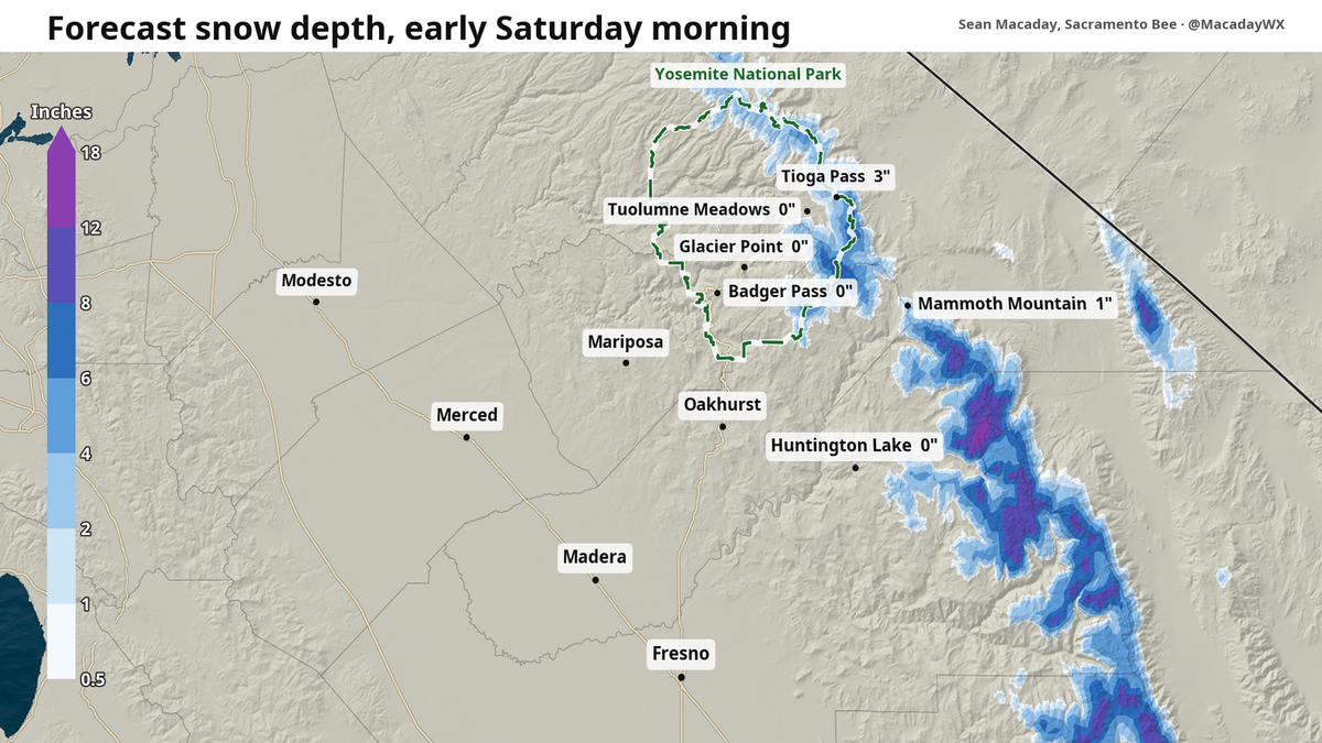 Forecast snow depth for Saturday morning, with higher amounts on mountain peaks south of Mammoth Mountain. The Sacramento Bee More windows for rain around Halloween
While the last full week of October is looking average, those conditions likely won’t stick around for long. As the atmosphere continues to entrench itself in El Niño’s pattern, the strengthened subtropical jet stream will continue to spur rain across the state.
This wet pattern could arrive in the days following Halloween. No exact days to deliver yet, but it’s notable enough to mention for now. The Climate Prediction Center expects above-average precipitation across California around this time in its latest outlook.
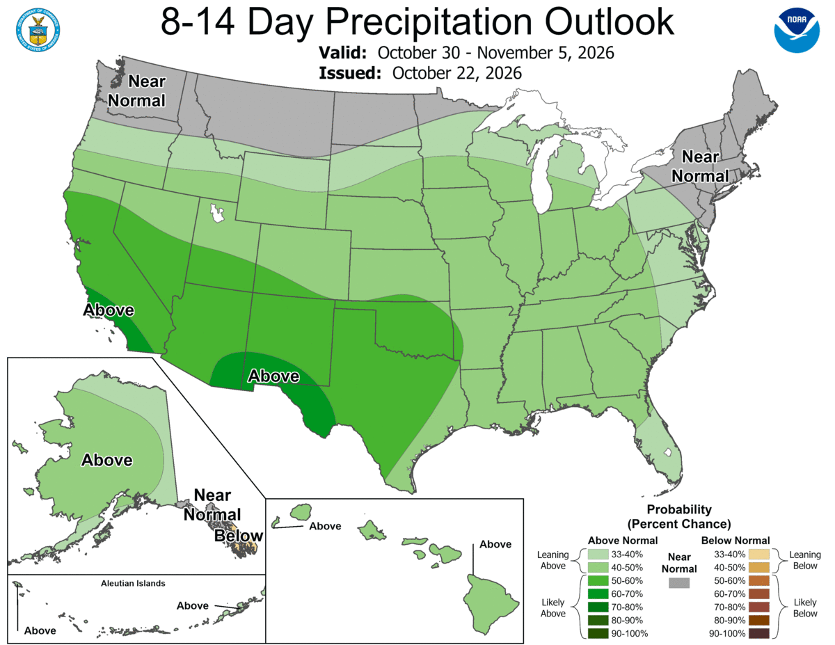 The precipitation outlook for Oct. 30 to Nov. 5 shows increased chances for above-average precipitation across California. The Sacramento Bee

The Sacramento Bee
Sean Macaday covers the weather for McClatchy Media in California. Originally from Chicago, Sean worked 6 years covering the weather on local television in Minnesota. He holds a bachelor’s degree in meteorology and marine science from the University of Miami.