
Ugh, we get it. You’ve spent the last decade driving the same soul-crushing commute, watching your sports car gather dust while you shuttle kids to soccer practice in a crossover that handles like a refrigerator on wheels. But California’s mountain roads? They’re the therapy your car and mind have been screaming for.
These 10 high-elevation drives will remind you why you bought that car with the manual transmission (yes, the one your spouse keeps threatening to trade for something “practical”). Each climb takes you past 5,000 feet, some flirting with 10,000, and all of them delivering the kind of driving that makes you remember why you fell in love with cars in the first place.
Pack your patience, check your brake fluid, and let’s go find some real roads.
Mountains Majesty, the Cali Way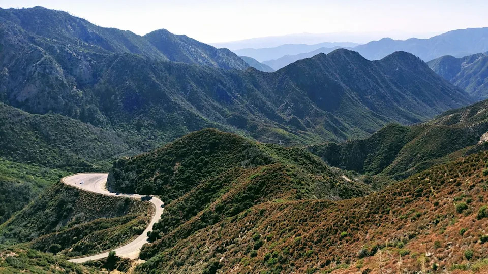
Image Credit: Shutterstock.
California didn’t just win the geographic lottery: it hit the jackpot and then bought more tickets. The state sits at the collision point of tectonic plates that have been playing geological bumper cars for millions of years, creating mountain ranges that rise from sea level to over 14,000 feet within a few hours’ drive. The Sierra Nevada alone stretches 400 miles north to south, while the San Gabriel, San Bernardino, and Cascade ranges add their own flavor of vertical entertainment.
What makes California’s mountains special isn’t just their height — it’s their accessibility. Unlike the Rockies or Appalachians, California’s peaks rise directly from populated areas. You can leave Los Angeles at 8 AM and be above the tree line by lunch. Try that in Denver and you’ll still be looking at strip malls.
The state’s Mediterranean climate means these roads stay open longer than their counterparts in Colorado or Montana. While other states are buried under snow for half the year, California’s passes typically offer 6-7 months of clear driving. When was the last time you heard someone complain about too much sunshine?
We picked these 10 mountain drives due to their challenging drives, accessibility, beautiful views, and the unique experience each one will bring to you. Some are for spirited driving that will put your car to the test, while others are for relaxing cruises with a breathtaking view. Each climb takes you past 6,000 feet, some flirting with 10,000, and all of them delivering the kind of driving that makes you remember why you fell in love with cars in the first place.
Tioga Pass Road Highway 120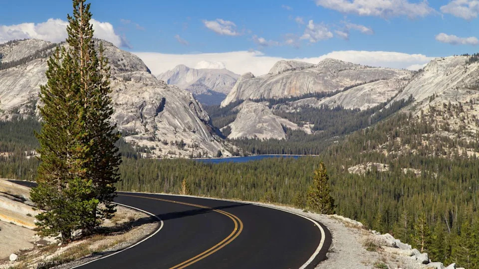
Image Credit: Shutterstock.
Elevation: 9,943 feet
Season: Late May through November (if we’re lucky)
Best for: Sports cars, sports sedans, anything that corners better than a shopping cart
Tioga Pass is what happens when road engineers decide to build a highway across the roof of Yosemite. At nearly 10,000 feet, this is the highest paved pass in California, and it shows. The 46-mile stretch from Crane Flat to the Eastern Sierra is pure driving poetry: smooth pavement, sweeping curves, and views that’ll make you pull over just to make sure your eyes aren’t playing tricks on you.
The road closes every winter (sometimes until June, because Mother Nature doesn’t care about your vacation plans), which keeps the crowds manageable and the experience exclusive. When it’s open, you’ll cruise past Tenaya Lake at 8,150 feet, where the water is so clear you can see your financial mistakes reflected in the surface.
Your naturally aspirated engine will wheeze like a chain smoker at this altitude. Turbocharged cars? They’re laughing all the way to the summit.
Mount Baldy Road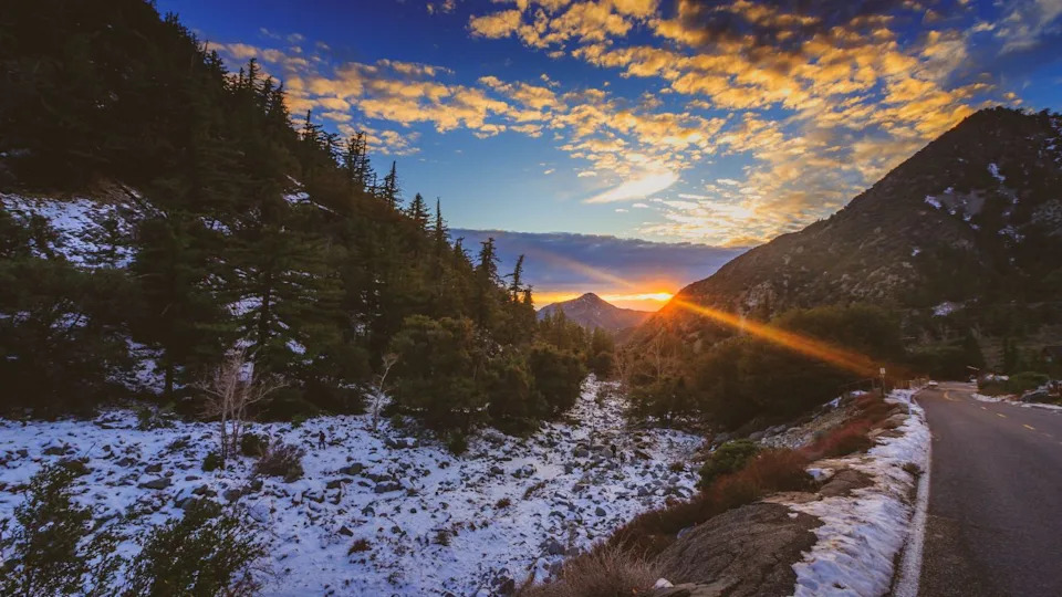
Image Credit: Shutterstock.
Elevation: 6,000 feet to Baldy Village
Season: Year-round (with winter closures above Mt. Baldy Notch)
Best for: Anything with decent brakes and a sense of humor
This 12-mile ribbon of asphalt launches you from the suburban sprawl of Southern California into the San Gabriel Mountains faster than you can say “HOA violation.” The road starts innocent enough, then immediately gets serious with 29 documented hairpin turns. Yes, someone counted. Probably the same person who counted your gray hairs after driving it the first time.
The switchbacks are tight enough to make a Miata owner giddy and technical enough to humble that guy in the BMW who thinks stability control makes him Senna. By the time you reach Mt. Baldy Village, you’ve climbed nearly 4,000 feet and earned the right to complain about the price of gas up there.
Those “Slow Vehicle Turnout” signs? They’re talking to you, Prius driver.
Ebbetts Pass Highway 4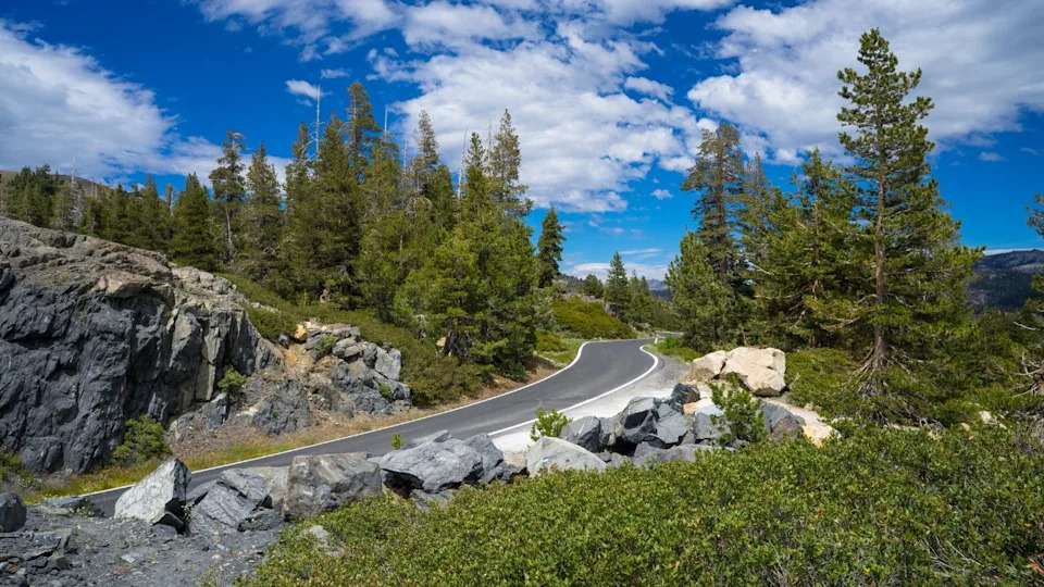
Image Credit: Shutterstock.
Elevation: 8,730 feet
Season: Usually June through October (weather permitting)
Best for: Drivers who like their roads narrow, winding, and slightly terrifying
Ebbetts Pass is California’s best-kept secret, mainly because it’s too scary for Instagram influencers. This 61-mile route from Angels Camp to Markleeville features some of the narrowest paved mountain passes in the state — we’re talking 18 feet wide in places, with no center line and drop-offs that’ll make your life insurance agent nervous.
Built in 1863 as a wagon road (and it still feels like one), Ebbetts Pass demands respect. The eastern approach is particularly brutal: 15% grades that’ll test your clutch, your brakes, and your relationship with whoever’s riding shotgun. But the payoff? Alpine Lake at 7,320 feet, surrounded by granite peaks that make you question why you ever thought a strip mall was acceptable scenery.
Warning: This isn’t the road to test your new summer tires. Or your marriage.
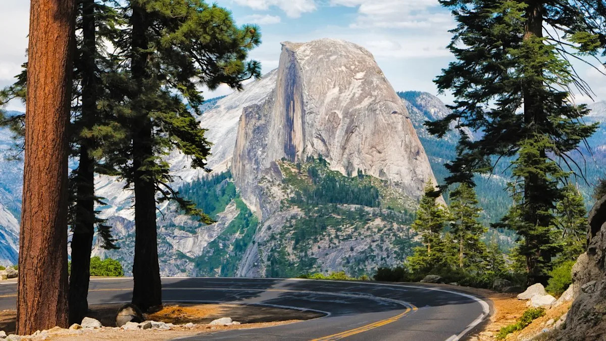
Glacier Point Road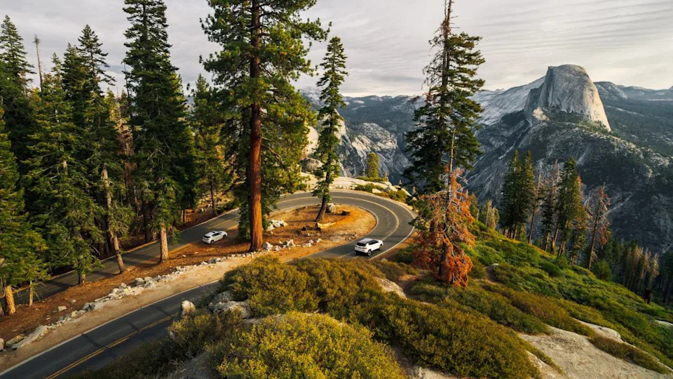
Image Credit: Shutterstock.
Elevation: 7,214 feet
Season: Usually May through November
Best for: Anyone who wants epic views without earning them the hard way
Starting from Wawona Road in Yosemite, Glacier Point Road is the park service’s gift to drivers who want spectacular views without the technical challenge of, say, not dying. The 16-mile route to Glacier Point is smooth, well-maintained, and features some of the most photographed overlooks in the country.
Half Dome looms 4,800 feet above the Merced River, and the view from Glacier Point makes every desktop wallpaper look like a cheap knockoff. The road itself is more scenic cruise than driving challenge, which means it’s packed with RVs driven by people who think blinkers are optional. Plan accordingly.
Show up at sunset if you want to understand why Ansel Adams spent so much time here. Show up at noon if you enjoy traffic jams at 7,000 feet.
Sonora Pass Highway 108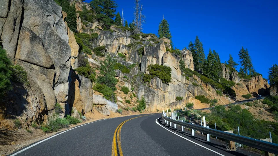
Image Credit: Shutterstock.
Elevation: 9,624 feet
Season: Late May through October (sometimes)
Best for: Experienced mountain drivers and masochists
Sonora Pass doesn’t mess around. The eastern approach from Bridgeport climbs 3,000 feet in 13 miles, with grades that peak at 26%. That’s not a typo — it’s steeper than most parking garages and twice as long. The western side is gentler but no less spectacular, winding through the Stanislaus National Forest past Kennedy Meadows.
This is the second-highest paved pass in California, and it acts like it. Weather changes fast, snow can stick around until July, and cell service is about as reliable as a Lucas electrical system. But when conditions align, few roads offer this combination of technical challenge and natural beauty.
Honestly, I’m just relieved to see guard rails. While driving down into Yosemite from Lake Tahoe a few years ago, my mom said that if we died, she’d want guard rails put up in her memory.
Palomar Mountain Road South Grade Road (S6)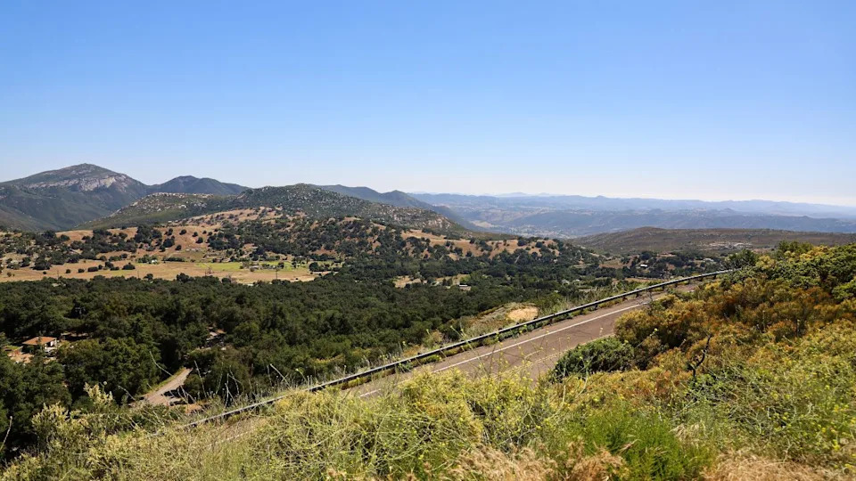
Image Credit: Shutterstock.
Elevation: 5,500 feet
Season: Year-round
Best for: Sports cars, motorcycles, and people who think 21 switchbacks sounds fun
Hidden in the backcountry of San Diego County, Palomar Mountain Road is what happens when engineers decide to connect the bottom of a mountain to the top using the most entertaining route possible. Seven miles, 21 documented switchbacks, and a 3,000-foot elevation gain that’ll leave your ears popping and your transmission fluid warm.
The Palomar Observatory sits at the summit like a white dome of scientific achievement, reminding you that while you’re having fun playing with cars, actual smart people are up here studying the universe. The road itself is tight, technical, and perfectly paved — a playground for anything with proper suspension and decent tires.
Early morning runs are best. By noon, the observatory tourists arrive in minivans driven like they’re still in the Costco parking lot.
Onion Valley Road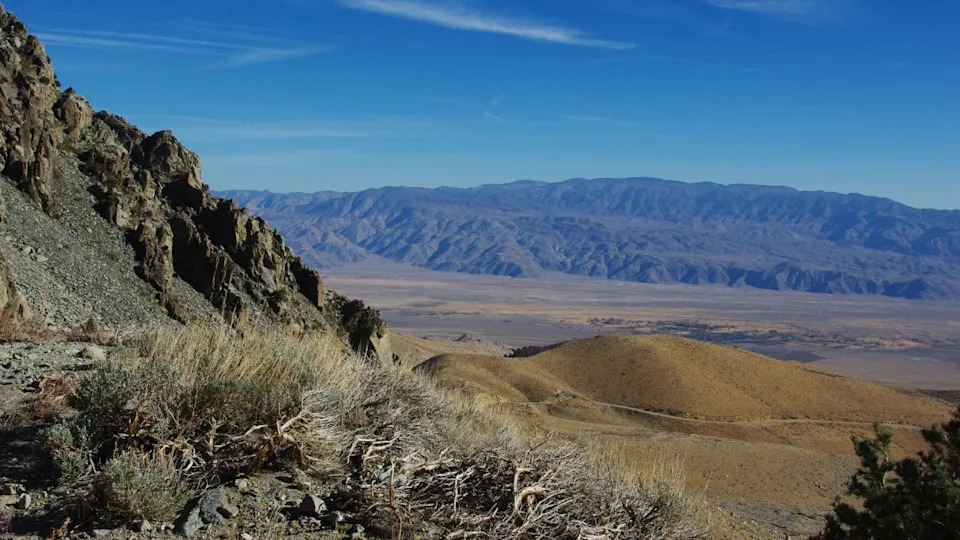
Image Credit: Shutterstock.
Elevation: 9,200 feet
Season: Usually May through October
Best for: Anyone who appreciates engineering efficiency over scenic meandering
Starting in the town of Independence (population: 669 and declining), Onion Valley Road takes the direct approach to high country. Thirteen miles of steady climbing, gaining over 5,000 feet of elevation without the fancy switchbacks or tourist-friendly overlooks. It’s the mountain driving equivalent of a sprint: intense, focused, and over before you know it. But you’ll still be out of breath.
The road terminates at the trailhead for Kearsarge Pass, where serious hikers begin their assault on the High Sierra. You’ll know you’ve reached the end when you’re surrounded by granite peaks and the only sounds are wind and the ticking of cooling engines.
Note to sea-level dwellers: Yes, that’s your engine complaining about the thin air. No, premium fuel won’t fix it.
Highway 2 Angeles Crest Scenic Byway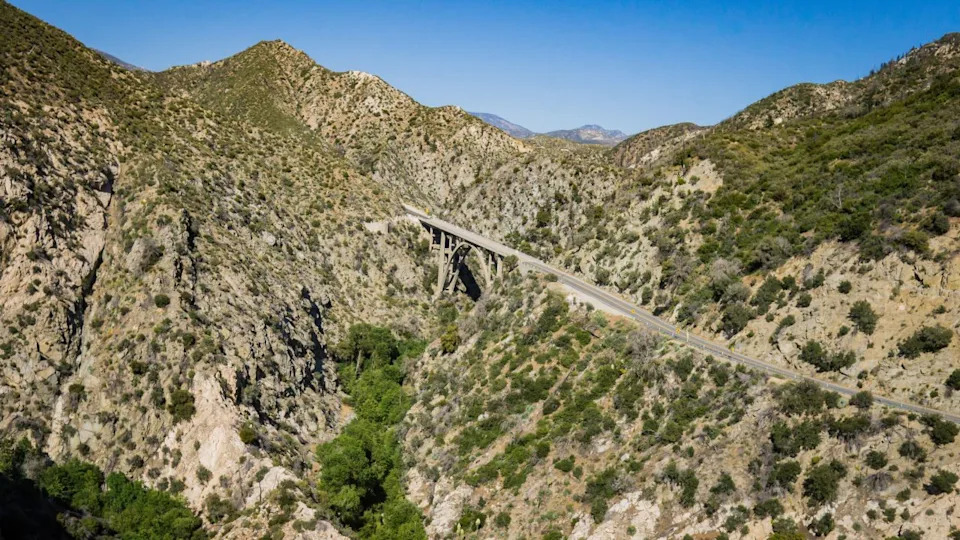
Image Credit: Shutterstock.
Elevation: 7,903 feet at Dawson Saddle
Season: Year-round (with occasional winter closures)
Best for: Anyone who needs to remember that Los Angeles is more than just freeways and strip malls
Angeles Crest Highway is LA’s backyard playground — 66 miles of mountain road that launches you from the smog-choked suburbs into the San Gabriel Mountains. Within 30 minutes of leaving La Cañada Flintridge, you’re surrounded by pine trees and wondering why you spent so much money living near the beach.
The road climbs steadily through Crystal Lake Recreation Area, past Mount Wilson Observatory, and eventually tops out at Dawson Saddle. It’s not the most technical drive on this list, but it’s accessible year-round and offers the best bang-for-your-buck ratio of any mountain road in Southern California. I’ve driven this mountain plenty of times, and my Miata and Elise are always begging for another weekend drive — just take some of the blind turns slow to avoid lost drivers who cut the mustard.
On weekends, this place is motorcycle and supercar central. Respect the locals: they know every corner better than you know your own driveway.
Sherman Pass Road
Image Credit: Shutterstock.
Elevation: 9,200 feet
Season: Usually May through October
Best for: People who think cell service is overrated
Sherman Pass Road connects Highway 395 to Highway 99 via the most remote, least traveled route possible. This 40-mile stretch through the Sequoia National Forest feels like driving through a Bob Ross painting: all tall pines, meadows, and the kind of silence that makes city folk nervous.
The road itself is well-maintained but narrow, with enough elevation changes to keep things interesting. What makes Sherman Pass special isn’t the technical challenge (though the 14% grades will get your attention), it’s the complete isolation. You can drive for hours without seeing another soul.
Bring a paper map. GPS satellites apparently haven’t discovered this place yet.
Whitney Portal Road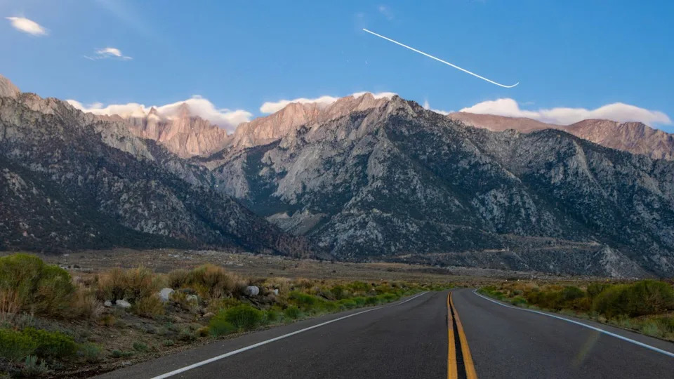
Image Credit: Shutterstock.
Elevation: 8,374 feet
Season: Year-round to Lone Pine Campground, weather permitting beyond
Best for: Drivers who like their mountain roads short, steep, and slightly intimidating
Starting in the desert town of Lone Pine, Whitney Portal Road climbs directly toward the highest peak in the contiguous United States. Thirteen miles, 4,000 feet of elevation gain, and grades that’ll make you grateful for engine braking. This isn’t a scenic cruise: it’s a purpose-built assault on Mount Whitney’s base camp.
The Alabama Hills provide a surreal foreground of rounded granite boulders, while the Sierra Nevada rises like a granite wall to the west. By the time you reach Whitney Portal, you’re at 8,374 feet and surrounded by some of the most dramatic mountain scenery in the country.
The parking lot fills up by dawn with hikers attempting Whitney. Show up early or prepare to turn around.
Where Altitude Meets Solitude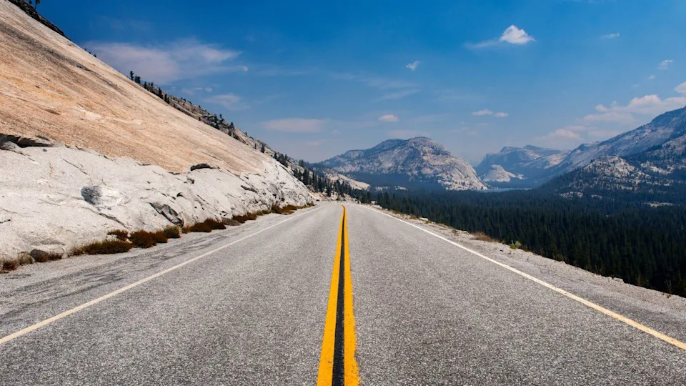
Image Credit: Shutterstock.
These roads represent California’s best answer to the question: “What if we built highways in places where only eagles should go?” Each climb offers something different — technical challenges, scenic rewards, or simple escape from the mundane reality of modern driving.
Your turbocharged German sedan will love the thin air. Your naturally aspirated V8 will struggle but sound amazing doing it. Your hybrid will question its life choices around 8,000 feet. And that manual transmission you insisted on? It’ll finally justify its existence.
So pick a road, check your tire pressure, and remember: these mountains have been here for millions of years. They’re not impressed by your lease payment or your LinkedIn profile. They just want to see if you can handle the climb.
Drive safe, drive smart, and drive like your car will leave you if you don’t push it just a little.