

Millions of people in California are going to weather the impacts of a new storm slated to hit the Golden State on Wednesday.
Why It Matters
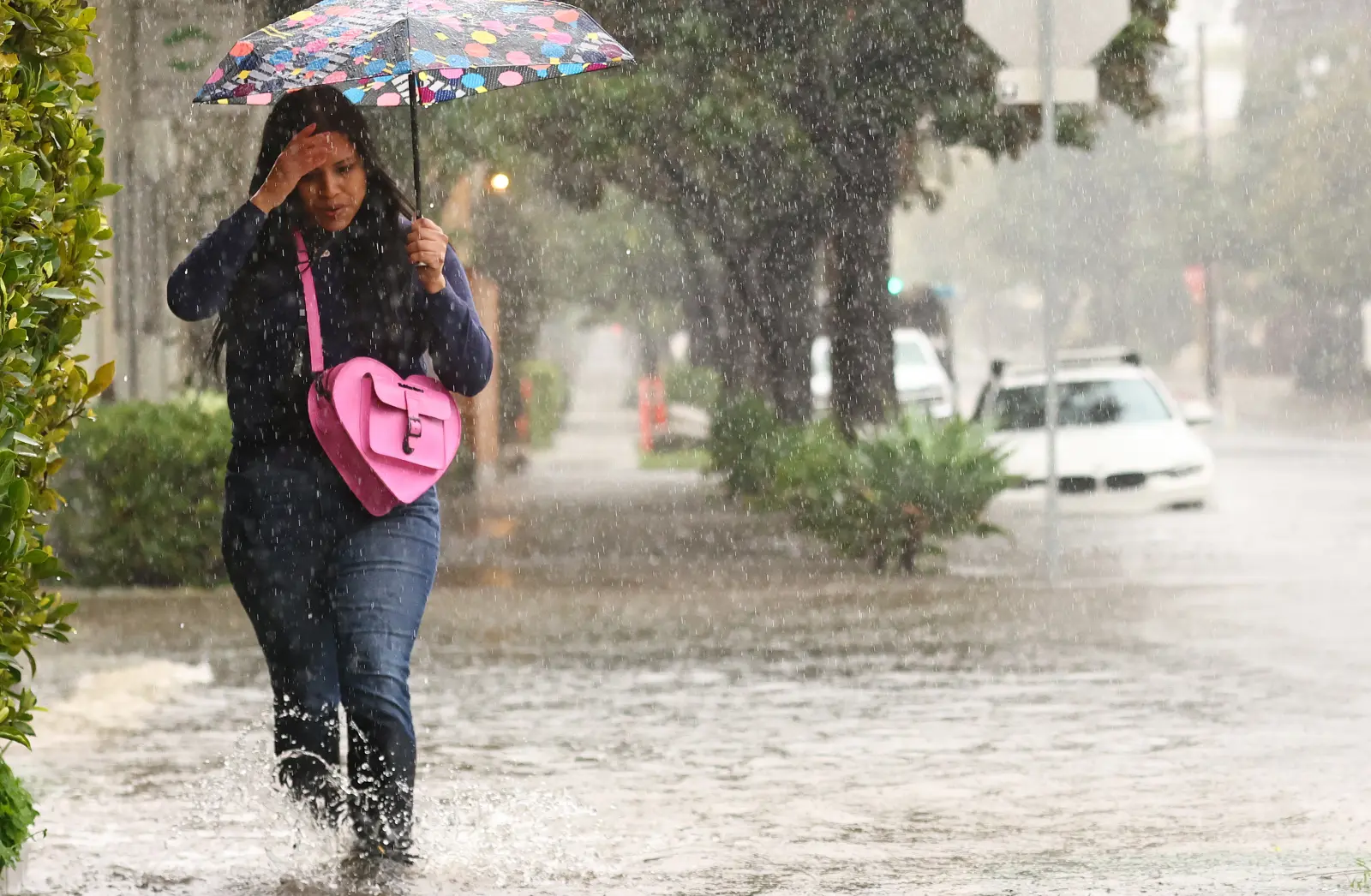
An atmospheric river recently slammed California, extending further south than is typical for this early in the season and bringing flooding rains to Los Angeles, prompting officials to issue evacuation orders amid concerns for mudslides and floods in recently burned areas.
Atmospheric rivers are long, narrow regions in the atmosphere—like a river in the sky—that transport water vapor outside of the tropics, according to the National Oceanic and Atmospheric Administration (NOAA). The storms brought by atmospheric rivers are known for heavy snow, heavy rain and strong winds. They are more commonly found on the West Coast, particularly during the winter months.
 What to Know
The incoming storm doesn’t have all the qualities of an atmospheric river, AccuWeather senior meteorologist Heather Zehr told Newsweek, primarily because the storm is coming from the northwest rather than originating in the tropics. However, it will bring heavy rain to parts of Southern California, adding to the flood issues the region experienced over the weekend.
The new moisture-laden storm will saturate nearly the entire state from Wednesday night through Thursday night according to a forecast from AccuWeather, bringing rainfall from the Oregon border in the north all the way south through San Diego. Mountain snow is expected for high-elevation areas.
A map from AccuWeather shows the storm progressing south as the week passes, bringing more showers and rain to Southern California on Friday and Saturday.
Some of the biggest impacts will be to traffic, with some travel delays likely.
“Snow at pass levels with the additional storm can bring travel delays through early week,” AccuWeather Meteorologist Alex Duffus said in the report.
The exact track of the storm is still unclear, forecasters said, but coastal California is likely to experience the highest rainfall amounts with the new storm. The additional moisture, so soon after the floods over the weekend, could trigger mudslides in vulnerable areas.
What People Are Saying
NWS in a Tuesday forecast: “Additionally, on Wednesday, another front will approach the West Coast, producing light rain over parts of the Pacific Northwest and Northern California by Wednesday afternoon and expanding into parts of Southern California by early Thursday morning.”
NWS Eureka in a post on X on Monday: “A dry Tuesday and beginning of Wednesday is forecast for NW California, but rain is likely return by Wednesday evening across the area. This quick moving system will bring periods of moderate to locally heavy rain to the area.”
What Happens Next
Most National Weather Service (NWS) alerts still in place for California are for the storm system that is currently moving through the region. Additional alerts could be issued as the incoming storm reaches the state, and people living in the area should monitor their local NWS offices and remain storm aware.