
It’s been an active few days of weather in California, as a powerful storm system traversed the state, bringing a wide range of impacts from severe weather at the coast to heavy snow inland.
But the script is about to flip, at least in the Bay Area, as calmer weather returns and temperatures start to rise, topping out with a return to 70s and 80s by the weekend.
The major storm system has cleared the Bay Area as of Wednesday and will quickly shift to the east of California by Wednesday evening.
In its wake, the atmosphere will slowly start to transition back to a less perturbed state. A weak area of high pressure will form just off the California coast, slowly edging its way towards the Bay Area through the end of the work week.
This will initialize a warming trend, starting on Wednesday, when temperatures will generally be in the 60s and 70s and peaking on Saturday, when temperatures will comfortably reach the mid-70s to low 80s region wide, about 5 to 10 degrees above average for this time of the year.
The temperature shift won’t quite reach the seasonal whiplash threshold, but it will certainly be a noticeable difference compared to the cool and wet conditions of Monday and Tuesday.
Don’t expect it to last though.
The return of stable, sunny and warm weather also appears to be temporary. By Sunday, the area of high pressure starts to break down, squeezed at its northern and southern edges by competing areas of low pressure.
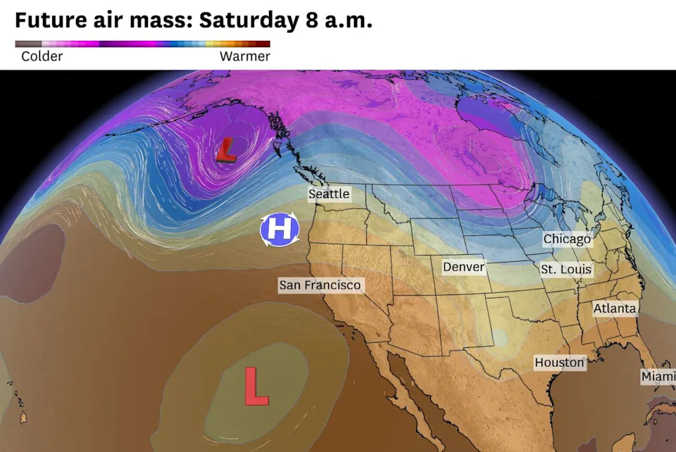
Two low pressure systems will eat away an area of high pressure by the end of the weekend. (Baron/Lynx )
It’s a somewhat bizarre weather pattern and an atmospheric configuration that we don’t see very often. Because of that, forecast models are struggling with the outlook beyond Sunday.
As of now, it looks like the region will return to more typical weather conditions next week, with morning and evening fog and temperatures generally back in the 60s and 70s.
We will be watching out for one stormier scenario though. Should those two areas of low pressure join forces, more rain will be in the forecast for Monday.
Wednesday breakdown
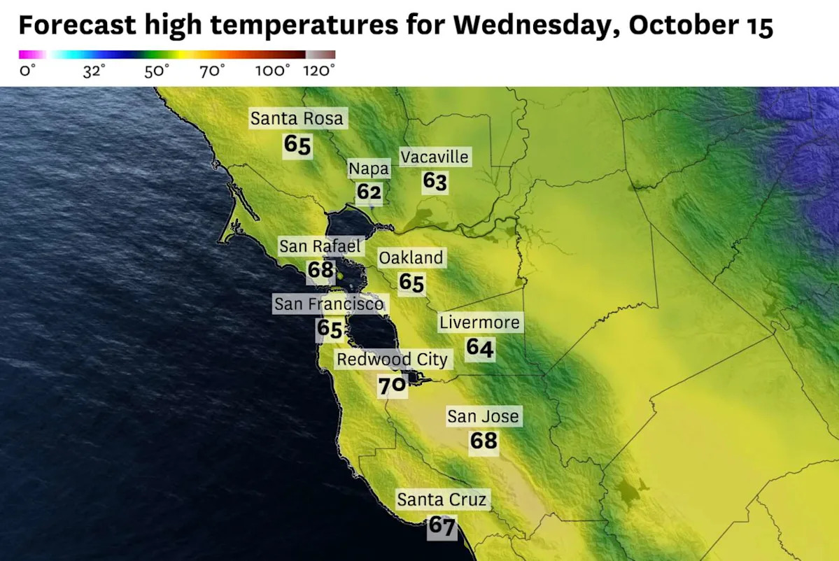
San Francisco: Clouds in the morning should slowly give way to partial sunshine by the afternoon. It’s a bit uncertain how quickly skies clear out and depends on the proximity of our departing storm system. It will be dry though, and temperatures will feel close to normal, with highs in the upper 50s at Ocean Beach and the mid-60s downtown. Skies will be mostly clear overnight with lows around 50 degrees.
North Bay: Clouds will certainly be around at the start of Wednesday in the North Bay. Unusually, sunshine may pop out closer to the coast before it does so across the inland valleys. But the day should end on a brighter note. Temperatures will stay in the mid- to upper 60s pretty much across the board, with maybe a 70 degree reading or two in Santa Rosa or Vacaville. Skies become mostly clear overnight and temperatures will drop into the upper 40s to low 50s.
East Bay: Much like the rest of the region, clouds will be in place across the East Bay on Wednesday morning. Sunshine will start to break through along the bayshore and across the interior by the afternoon, but the clouds won’t completely dissipate. Temperatures will be cool, with highs in the mid- to upper 60s region wide. Skies will become mostly clear overnight with temperatures dropping back into the upper 40s inland and the low 50s closer to the Bay.
Pacific Coast and Peninsula: Clouds will hug the coast and Peninsula on Wednesday morning. Cloud cover is likely to stay in place along the coast for much of the day, but partial sunshine will develop across the Peninsula by the afternoon. Temperatures will be in the upper 50s to around 60 degrees in Half Moon Bay and Pacifica and in the mid- to upper 60s in South San Francisco and Redwood City. Cloudy at the coast with clearer skies along the Bay overnight and lows around 50 degrees.
South Bay: The South Bay will probably end up with the most sunshine in the Bay Area on Wednesday as the cloud cover will break up earlier in the morning. Nevertheless, more sunshine won’t equate to more warmth as temperatures will range from the mid- to upper 60s in San Jose and Santa Clara. Mostly clear overnight with temperatures in the low 50s.
This article originally published at California’s weather rollercoaster continues with a quick warmup ahead.