
After a day spent inside cooking, eating, watching football, and hopefully not fighting with your family, you might long to get outside and take a good stroll. Or, if you’re like my kids, you might need to be forced to get outside, because otherwise your muscles will atrophy, your eyeballs will melt into your screen of choice, and your mother will take away all your toys.
Luckily, the Bay Area is basically the most beautiful place on Earth, filled with glorious trails that make a perfect post-prandial perambulation. (That’s the fancy term my fittest cousin uses for “post-meal walk.”)
Here we’ve compiled six of our personal favorite places to walk in San Francisco and the surrounding areas.
 The Golden Gate Bridge and the Coastal Trail viewed from the Lands End Trail parking lot. | Source: Wikimedia/Creative Commons
A favorite holiday walk for a reason, this trail in the northwest corner of the city has postcard views of the Golden Gate Bridge. The main path is a loop of just over three miles, but you can walk as much or as little as you want. The mostly coastal trail provides good variety: steps, shady areas, wide open beach, and the rocky Sutro Baths. There are wheelchair-accessible paths off the trailhead near the Lands End Lookout. Plus you can bring your dog! Sure, you might overhear tech bros bragging about their valuation as they walk, but the sound of the ocean and the smell of Monterey cypress trees will quickly drown them out.
Lands End Trail (opens in new tab)
680 Point Lobos Ave.
 Source: Emily Dreyfuss/The Standard
It’s hard to believe you are in the center of San Francisco when you walk the Mount Davidson path, a favorite for families, dog walkers, and anyone who wants to feel like they’ve escaped the city without, you know, having to leave the city. Once you step up into the dense forest, everything goes quiet. At the top, the highest point in San Francisco, you are rewarded with sweeping city views. The hike culminates at the Mount Davidson Memorial Cross, dedicated to the victims of the Armenian genocide.
Mount Davidson Park (opens in new tab)
Parking along Myra Way
 A view from the Bog and Saddle Loop trails in San Bruno. | Source: George Kelly
The Bog and Saddle Loop trails at San Bruno are guaranteed to fight food-coma fugue states. Start from the Crocker Gate trailhead on Crocker Avenue in Daly City to find your choice of easy- to moderate-paced loops along designated gravel footpaths, or hit the vehicle entrance off Guadalupe Canyon Parkway (technically in the city of Brisbane) to test your mettle against the Dairy-Ravine or Summit Loop trails. Leave your dogs and off-road vehicles at home, and use bicycles only on designated trails. From up top, the southern stretches of San Francisco, from Crocker-Amazon across to Sunnydale and Visitacion Valley, will look just like board-game landmarks. Best of all: The $6 vehicle entrance fee will be waived Nov. 28 for Green Friday (opens in new tab) at all county parks.
San Bruno Mountain State & County Park (opens in new tab)
555 Guadalupe Canyon Parkway, Brisbane
 The Rosie the Riveter WWII Home Front path in Richmond. | Source: George Kelly
This national historical park in Richmond offers gorgeous waterfront views and plenty of open stretches of Bay Trail pavement to burn off any caloric overage. (The visitors center is closed Thanksgiving Day.) Start at the Ford Assembly Plant near the Bay Area Ferry, and visit the memorial dedicated to women whose labors in local shipyards and factories turned the tide at home and abroad. Consider budgeting time for views of the nearby SS Red Oak Victory, and be sure to check out the “Changing Tide” sculpture, where thousands of solar cells power LED pixels illuminate the tide’s real-time height.
Rosie the Riveter WWII Home Front (opens in new tab)
1414 Harbour Way South
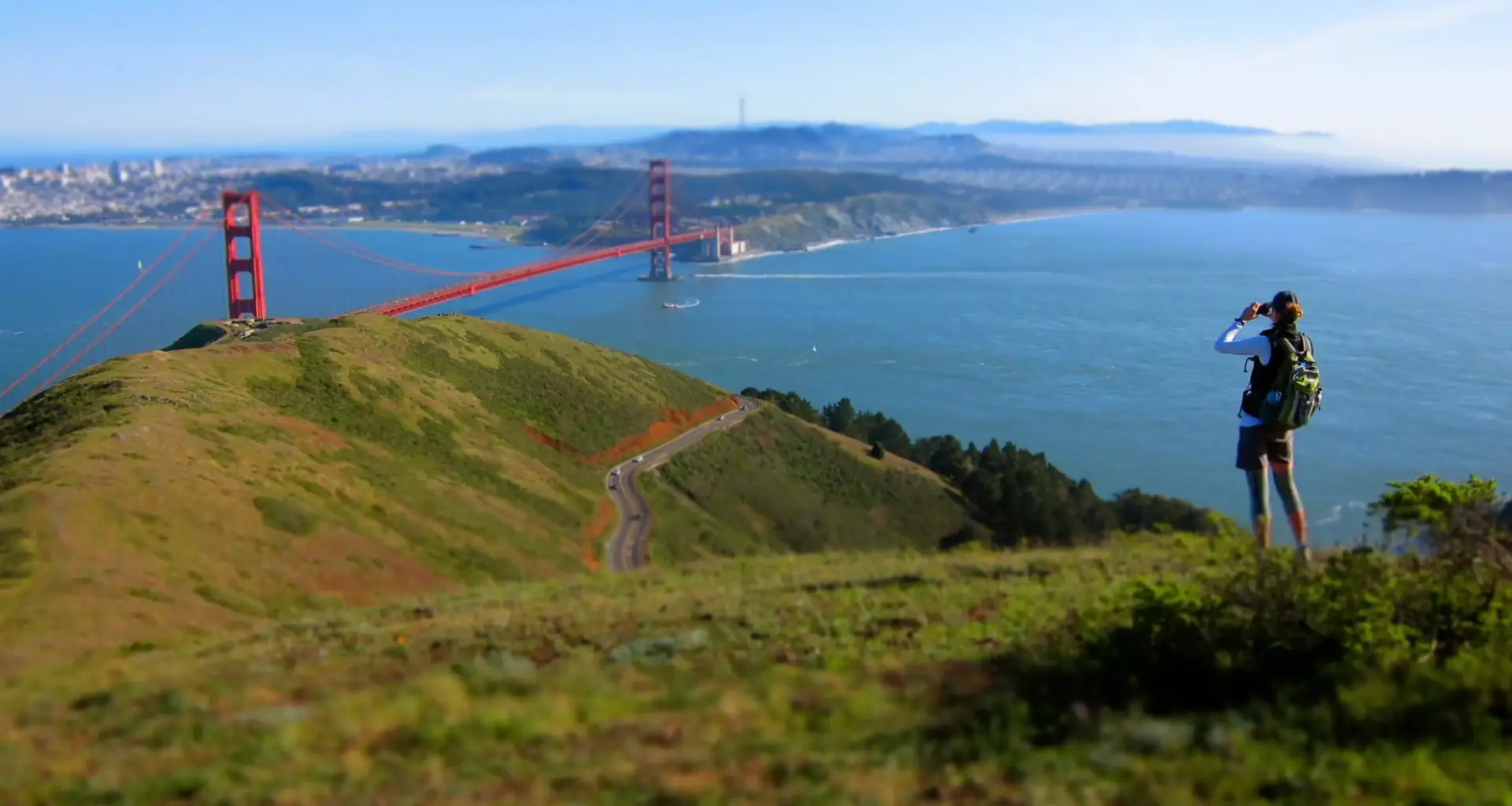
The Near North: Marin Headlands The Marin Headlands overlook San Francisco. | Source: Getty Images
If you want to go up north, the Rodeo Beach (opens in new tab) area delights locals and visitors. Just over the Golden Gate Bridge, where the Marin Headlands suddenly open up, the beach with its colored pebbles will be a hit among the slow-poke walkers and rockhounds in your party. From the Rodeo Beach/Fort Cronkite parking lot, take an easy stroll along the bluffs trail that loops Rodeo Lagoon, or tackle steeper, headlands trails if you’re feeling ambitious. Our favorite is the hike to Hill 88, (opens in new tab) a 5-mile loop. World War II history buffs will want to check out the Battery Townsley, (opens in new tab) too.
Rodeo Beach Ramble (opens in new tab)
Rodeo Beach/ Fort Cronkite trailhead, 11050 Mitchell Rd, Mill Valley
The butt burner: Straight up Twin Peaks Fans watch the Red Bull Sky Line skate contest at Twin Peaks. | Source: Jason Henry for The Standard
For a major calorie kill, go to Elizabeth Street in Noe Valley and head straight up Twin Peaks. The best part of this city walk is you get to start out in a cutesy neighborhood. Grab a pastry and coffee, then meander up the city’s central hill via an interconnected ladder of neighborhood stairways. The Pemberton Street steps once you cross Market Street are some of the prettiest. At the top, you’re rewarded with 360-degree views, and usually a bunch of skateboarders doing tricks. We suggest you follow the route described by the Wayfaring Architect (opens in new tab).
Elizabeth Street at Church