
Strengthening temperature inversion in our atmosphere means more gray days this week.The air above our clouds is unusually warm for this time of year. The closest upper-air station that launches radiosondes to collect atmospheric data is in Oakland, and Wednesday’s morning’s readings show that temperatures around 5,000 feet above sea level are among the highest recorded for this date.The 850-millibar temperature is about 63 degrees; this is much warmer than the record mean of about 45 degrees.Typically, on a day like Wednesday, upper-air temperatures at that height are a few degrees cooler than the ground.This reversed temperature profile is what we refer to as an “inversion.”The inversion is a primary cause of our Valley’s overcast weather this week. Warm air associated with the high-pressure system is sitting on top of, and compressing, the cooler and denser Valley air. The air near the surface is also moist, forming low clouds as it cools to saturation. With minimal wind to mix the layers, the low clouds remain trapped in our valley bowl. When they have nowhere to go and nothing to disperse them, we end up with extended periods of overcast, cool, and calm weather–just like what we’re experiencing now.This strong inversion is forecast to remain in place through the rest of the workweek, finally shifting east on Sunday. Expect gray and gloomy valley weather at least until then.See more coverage of top California stories here | Download our app | Subscribe to our morning newsletter | Find us on YouTube here and subscribe to our channel
SACRAMENTO, Calif. —
Strengthening temperature inversion in our atmosphere means more gray days this week.
The air above our clouds is unusually warm for this time of year. The closest upper-air station that launches radiosondes to collect atmospheric data is in Oakland, and Wednesday’s morning’s readings show that temperatures around 5,000 feet above sea level are among the highest recorded for this date.
The 850-millibar temperature is about 63 degrees; this is much warmer than the record mean of about 45 degrees.
Typically, on a day like Wednesday, upper-air temperatures at that height are a few degrees cooler than the ground.
This reversed temperature profile is what we refer to as an “inversion.”
The inversion is a primary cause of our Valley’s overcast weather this week. Warm air associated with the high-pressure system is sitting on top of, and compressing, the cooler and denser Valley air. The air near the surface is also moist, forming low clouds as it cools to saturation.
With minimal wind to mix the layers, the low clouds remain trapped in our valley bowl. When they have nowhere to go and nothing to disperse them, we end up with extended periods of overcast, cool, and calm weather–just like what we’re experiencing now.
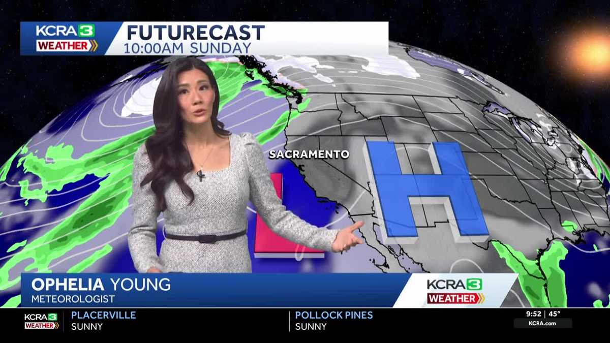
This strong inversion is forecast to remain in place through the rest of the workweek, finally shifting east on Sunday. Expect gray and gloomy valley weather at least until then.
See more coverage of top California stories here | Download our app | Subscribe to our morning newsletter | Find us on YouTube here and subscribe to our channel