
The Sacramento Valley and San Joaquin Valley — from Bakersfield to Redding — spent almost every morning since before Thanksgiving shrouded in fog and mist. That murky weather is challenging motorists’ visibility on Interstate 5 and other California highways.
Worst visibility this week was at the northern end of the Sacramento Valley — from Redding in Shasta County to Red Bluff in Tehama County — and in pockets along Interstate 80 east of Sacramento, according to the National Weather Service; but miles of mist this week made it harder to drive as far south as Kern County.
While winter often brings Tule fog and mist, this year’s holiday fog funk “never lasted this long in my 57 years here,” said Greg Clark of Redding.
Here’s why it’s so foggy: which highways have the worst visibility, and when NOAA forecasters say the weather will change.
Why so much of California is foggy or misty — and is there a difference?
It’s not unusual for the Sacramento and San Joaquin valleys to get fog and mist in late November and December, said Eric Kurth at the weather service’s Sacramento office; but this year a high-pressure system is pinning low-lying clouds to the ground.
The Central Valley is “basically a big bowl of mist,” he said, as is the Sacramento area to Tehama County.
That’s mist, not fog. That may sound like quibbling over semantics, but in mist, drivers can see 1-3 miles away compared to less than a mile in fog.
Low altitude areas from Bakersfield to southern Tehama County have been “filled” with mist, according to Kurth. While the Central Valley often gets Tule fog during late autumn and winter, this ongoing murk is mist in most places. It doesn’t always burn off during the day, so skies are overcast most of the time.
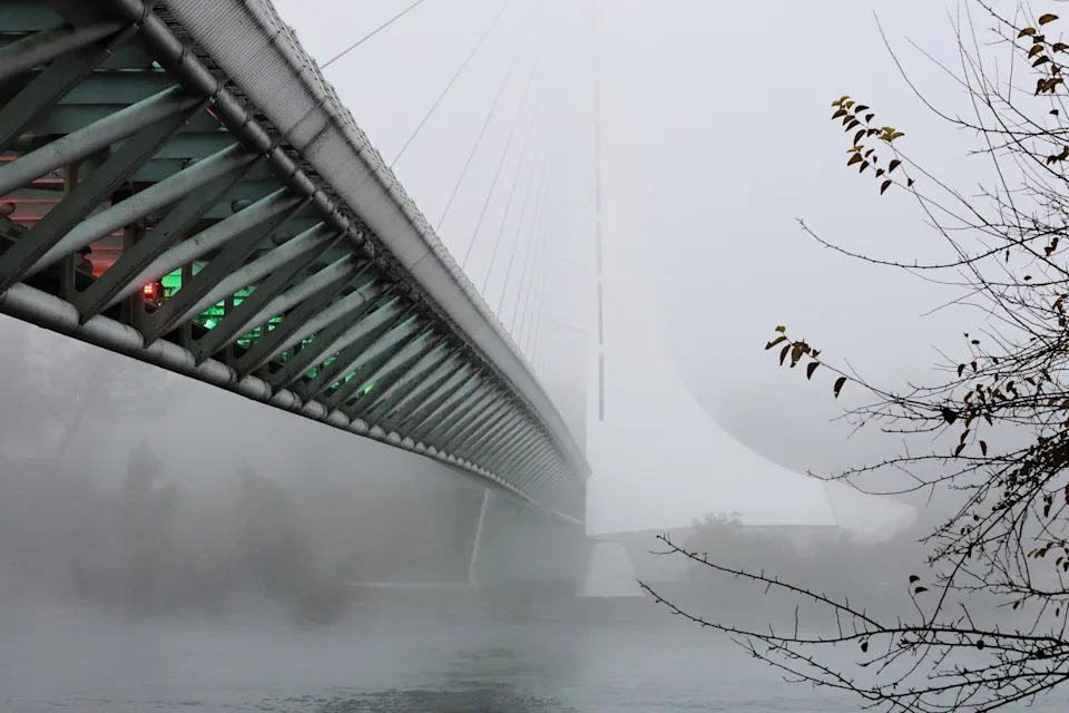
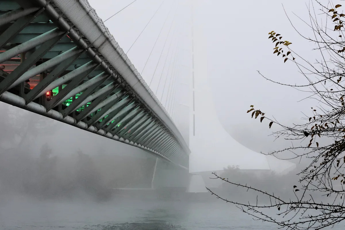
The Sundial Bridge in Redding is covered in fog on the morning of Thursday, Dec. 11, 2025.
That gloomy weather turns into thick fog north of the Tehama County line. It blanketed the northern Sacramento Valley most days from dusk to late-morning, dispersing most afternoons — giving motorists a clearer view of the road.
To have fog, you need low-level moisture. In the northern part of the Sacramento Valley, that fog is thin most days. The sun can warm the air enough to burn it off, giving motorists a taste of sunshine, Kurth said. When the sun goes down, temperatures drop to levels cold enough to make that dense fog, basically a low-lying cloud that fills part of the Interstate 5 corridor.
Where is worst visibility on Northern California highways?
Motorists should expect poor visibility at low altitudes east of Sacramento along parts of Interstate 80 from Reno, said Dakari Anderson at the weather service.
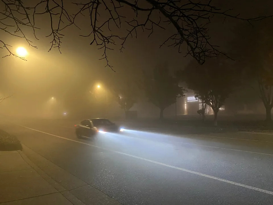
The fog was dense on Wednesday, Dec. 10, 2025 in north Redding,
Some of the worst visibility recorded by the weather service this week was along Interstate 5 in Shasta and Siskiyou counties. Drivers navigating through pea soup-thick fog early Thursday morning could see less than a quarter mile away, according to the weather service.
Other highways with the worst visibility this week included 299 and 44 around Redding, 36 at Red Bluff, the weather service cautioned.
For current highway information and slow traffic reports, go to the California Highway Patrol’s interactive map at quickmap.dot.ca.gov.
How long will California’s fog funk last?
That high pressure area pushing the clouds down on the North State will continue through the weekend, keeping the fog around at least through Saturday, according to Anderson and Kurth.
Rain expected to roll over the Coast next week will probably burn off the mist in the Central Valley by Dec. 18.
There’s a wee chance rain will clear the air in the Sacramento Valley, too, but it’s too early to tell, Kurth and Anderson said.
How to drive in foggy weather
It’s best to avoid driving in foggy weather, but if you have to do it, NOAA recommends motorists do the following:
Slow your speed. Leave early if you need to be somewhere at a certain time.
Keep your low-beam headlights on. That also keeps your taillights on, so don’t turn off the low beams. Never use high-beam lights in fog; these cause glare and make it more difficult to see what’s ahead. Use fog lights if you have them.
Keep extra space between your car and the vehicle in front of you.
Watch lane lines on the road to make sure you don’t wander out of your lane.
When visibility is too limited to drive safely, turn on your hazard lights and pull off the road into a parking lot, rest area, or other safe spot. If there’s no place to pull off, park on the side of the road as far as possible from the road itself, turn off all lights except flashing hazard lights, set the emergency brake, and remove your foot from the brake pedal to turn off the taillights. The latter is a precaution so the driver behind you doesn’t think you’re moving, NOAA said.
Jessica Skropanic is a features reporter for the Redding Record Searchlight/USA Today Network. She covers science, arts, social issues and news stories. Follow her on Twitter @RS_JSkropanic and on Facebook. Join Jessica on Record Searchlight Facebook groups Get Out! Nor Cal , Today in Shasta County and Shaping Redding’s Future.
This article originally appeared on Visalia Times-Delta: Where California is foggy and worst highway driving