

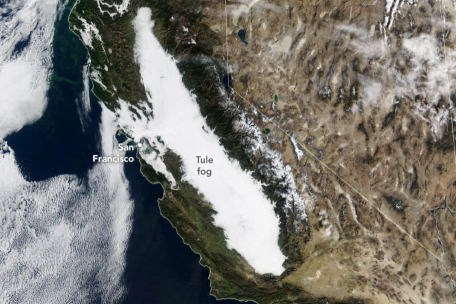
A vast sheet of fog a whopping 400-odd miles long has been reappearing over California for weeks, satellite images have revealed.
From late November to early December, the so-called “tule fog” formed along California’s Central Valley. Tule fog is caused by light winds and moist soil in the colder months of the year, according to NASA, who observed the fog using their “Terra” Earth observation satellite.
The white, low-hanging cloud is a form of persistent “radiation fog”—fortunately as in thermal radiation, not nuclear radiation!—a type of fog commonly seen across the United States in autumn and winter.
Radiation fog forms and deepens overnight on calm, clear nights, particularly in areas with little to no wind and near bodies of water, when the ground radiates away heat and cools the air above it to below the dew-point temperature.
In the light of day, meanwhile the fog is “burnt” off by evaporation. According to the National Weather Service, Central Valley’s tule fog can appear exceptionally thick from October through to February.
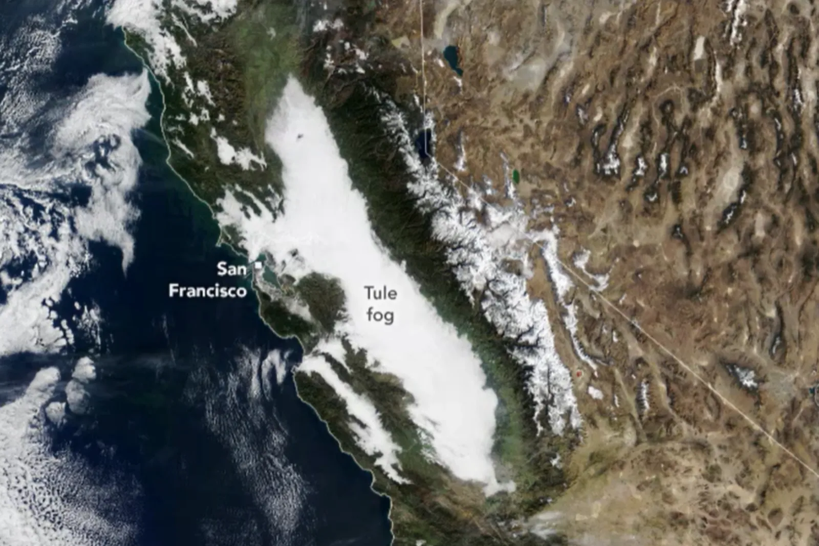
An animation of multiple images taken between November 24 and December 9 shows the thick white cloud filling the valley between Redding and Bakersfield, a stretch of around 437 miles.
At times, the fog spread towards San Francisco Bay as it spilled through the Carquinex Strait.
The images were taken using Terra’s Visible Infrared Imaging Radiometer Suite, using the Moderate Resolution Imaging Spectroradiometer instrument.
The thick fog was caused by a large amount of water in the soil following an especially wet autumn. Late November brought a stable high-pressure system, which NASA describes as acting as a lid over the fog, containing it to the valley, with no major storms disrupting the cloud.
A report from Daniel Swain, climate scientist at the California Institute for Water Resources, noted that precipitation totals in autumn were among the heaviest on record,.
However, he noted in his Weather West blog, ambient air mass was warmer overall, which may have caused the fog to linger at a higher level in certain areas.
In December, the San Francisco Chronicle reported that the driest place in North America, California’s Death Valley, was hit with more than 1.75 inches of rain. It made it the rainiest November on record for the area.
Do you have a tip on a science story that Newsweek should be covering? Do you have a question about weather? Let us know via science@newsweek.com.