
Northern California forecast: Gradually sunnier skies to start the week
We are looking forward to a shift away from the stagnant, gloomy weather pattern, but the change will be a slow one.
WE WANT TO CHECK IN NOW WITH METEOROLOGIST OPHELIA YOUNG. SO, OPHELIA, WE FINALLY SAW THE SUN AFTER WEEKS. ESSENTIALLY HERE IN THE VALLEY. YEAH, WE SPENT THE LARGE PART OF THE LAST THREE WEEKS UNDER THIS INVERSION LAYER, THESE LOW CLOUDS, AND FOR THE FIRST TIME IN TEN DAYS, WE SAW THE SUNSHINE. TODAY, IF YOU WERE OUT AROUND THREE, 4:00 THIS AFTERNOON, YOU MAY HAVE NOTICED THE LOW CLOUDS GETTING LATE, GETTING HAZY, THINNING OUT, AND YOU MAY HAVE NOTICED A BALL IN THE SKY. IF YOU’RE ANYTHING LIKE ME, YOU MIGHT HAVE WONDERED, IS THAT THE MOON? OR IS THAT THE SUN THAT HAPPENED TO BE THE SUN THAT YOU CAN SEE AS YOU LOOK SOUTH? THIS IS FROM OUR STATION, BEYOND OUR KCRA SIGN. IF YOU HAPPEN TO CATCH THAT ON YOUR CAMERA, SEND THE PICTURES TO KCRA.COM/UPLOAD. I’D LOVE TO SEE THEM. WELL, THAT LAYER OF LOW CLOUDS IS SETTLING TO THE GROUND ONCE AGAIN. TOMORROW WE’LL WAKE UP TO MORE FOG. BUT IT WAS NICE TODAY AS IT THINNED OUT. ALLOWED SOME OF THAT SUNSHINE TO FILTER DOWN. FINALLY HIT THE VALLEY GROUND AFTER TEN DAYS OF NOT AND DURING THAT TIME PERIOD, TEMPERATURES ACTUALLY DROPPED. YEAH, IT ALLOWED SOME OF OUR WARMTH TO ESCAPE OUT INTO THE ATMOSPHERE, AND WE DIPPED INTO THE 30S. SO FOR THE FIRST TIME IN NINE DAYS, WE ESCAPED THE 40S. MAYBE NOT IN THE WAY THAT WE WANT, BUT TEMPERATURES ARE OUT OF THE 40S AT LEAST, AND WE ACTUALLY HIT THAT LOW AT 530 THIS AFTERNOON. THAT IS, AFTER HITTING THE HIGH. ISN’T THAT A LITTLE CRAZY? WELL, HIGH PRESSURE IS MOVING OFF TO THE EAST. THAT’S WHAT WAS RESPONSIBLE FOR THIS GLOOMY WEATHER. WE DO HAVE ANOTHER HIGH THAT’S TRYING TO RIDGE IN TOMORROW, BUT THE JET STREAM IS FLATTENING AND THAT WILL ALLOW A SYSTEM TO MOVE DOWN AND PUSH THAT HIGH BACK DOWN SOUTH. IN ITS PLACE, WE’RE GOING TO HAVE SHOWERS INSTEAD. TUESDAY NIGHT INTO WEDNESDAY. LOOKS LIKE THURSDAY WILL BE A DRY DAY, THOUGH. WE WILL BE TRACKING A DISTURBANCE TO OUR NORTH. LOOKS LIKE WE HAVE ROUND TWO OF SHOWERS ON FRIDAY AND ANOTHER ROUND OF SHOWERS THAT WILL MOVE IN FOR THE BACK HALF OF NEXT WEEKEND. SO SOME BIG CHANGES ON THE WAY. AS FOR TOMORROW, WE’LL KEEP THINGS DRY AND MAYBE A LITTLE WARMER WITH A LITTLE MORE SUNSHINE IN THE AFTERNOON. TEMPERATURES AROUND 53 DEGREES IN THE FOOTHILLS. TEMPERATURES WILL BE A LITTLE WARMER IN THE MID TO UPPER 50S UNDER A LITTLE MORNING FOG, AND THEN SOME AFTERNOON SUNSHINE. AND IN THE SIERRA, PARTLY CLOUDY SKIES WITH TEMPERATURES CLOSE TO 60 DEGREES. ONCE AGAIN, TEMPERATURES ARE GOING TO CONTINUE TO GO DOWN IN THE SIERRA THANKS TO THE DISTURBANCES THAT ARE MOVING IN. THEY’LL BE IN THE 40S WITH SOME SHOWERS STARTING WEDNESDAY IN THE FOOTHILLS. TEMPERATURES WILL ALSO DROP A LITTLE BIT. THEY’LL BE BACK INTO THE LOW 50S, BUT THOSE SHOWERS MOVING INTO THE REGION WILL ACTUALLY BOOST OUR TEMPERATURES BECAUSE THE MOISTURE IS COMING FROM A WARMER SOURCE IN THE PACIFIC. SO ON WEDNESDAY WILL ACTUALLY BE CLOSE TO 60 DEGREES, AND WE’RE GOING TO STAY IN THE MID TO UPPER 50S ALL THE WAY THROUGH NEXT WEEKEND. ISN’T IT CRAZY HOW THE SAME WEATHER SYSTEM CAN HAVE DIFFERENT IMPACTS IN DIFFERENT REGIONS OF OUR LARGER REGION? IT’S GOING TO FEEL LIKE A NICE BIT OF RELIEF THOUGH. AFTER THE COOLER TEMPERATURES THAT WE’VE BEEN EXPERIENCING A COUP
Northern California forecast: Gradually sunnier skies to start the week
We are looking forward to a shift away from the stagnant, gloomy weather pattern, but the change will be a slow one.

Updated: 10:28 PM PST Dec 14, 2025
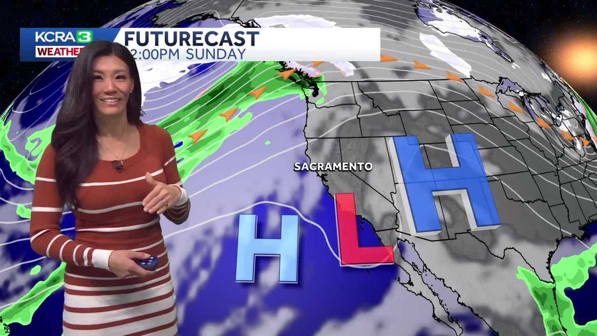
We are looking forward to a shift away from the stagnant, gloomy weather pattern, but the change will be a slow one.Monday will once again start with patchy dense fog. The layer will lift to overcast skies by midday, and we hope to enjoy some hazy sunshine by afternoon, with valley highs climbing into the 50s. In the foothills above the low clouds, highs will range from the mid-50s to near 60 degrees. Highs in the Sierra will be in the upper 50s under partly cloudy skies. Winds across the region will remain light.The stubborn layer of low clouds will reform overnight but is likely to continue thinning on Tuesday. The main pattern shift arrives Tuesday night as a Pacific storm system swings in from the Pacific Northwest. Our first chance of rain arrives Tuesday evening, with showers continuing overnight into early Wednesday morning. There is a small chance of thunder and lightning.As the jet stream sets up over Northern California, a second storm will pass to our north on Thursday, keeping our region mainly dry. However, a third wave may deliver a second round of valley rain on Friday, with another round of showers possible on Sunday. Forecast amounts for these back-to-back systems remain very uncertain, as guidance models continue to disagree on track and timing.Snow levels with these storms will remain relatively high–around 8,000 feet on Wednesday, dropping only to about 7,500 feet by Friday. This means precipitation in our region’s passes will mainly fall as rain, but those traveling early for the holidays should still prepare for potentially challenging commutes.
SACRAMENTO, Calif. —
We are looking forward to a shift away from the stagnant, gloomy weather pattern, but the change will be a slow one.
Monday will once again start with patchy dense fog. The layer will lift to overcast skies by midday, and we hope to enjoy some hazy sunshine by afternoon, with valley highs climbing into the 50s. In the foothills above the low clouds, highs will range from the mid-50s to near 60 degrees. Highs in the Sierra will be in the upper 50s under partly cloudy skies. Winds across the region will remain light.
The stubborn layer of low clouds will reform overnight but is likely to continue thinning on Tuesday. The main pattern shift arrives Tuesday night as a Pacific storm system swings in from the Pacific Northwest. Our first chance of rain arrives Tuesday evening, with showers continuing overnight into early Wednesday morning. There is a small chance of thunder and lightning.
As the jet stream sets up over Northern California, a second storm will pass to our north on Thursday, keeping our region mainly dry. However, a third wave may deliver a second round of valley rain on Friday, with another round of showers possible on Sunday. Forecast amounts for these back-to-back systems remain very uncertain, as guidance models continue to disagree on track and timing.
Snow levels with these storms will remain relatively high–around 8,000 feet on Wednesday, dropping only to about 7,500 feet by Friday. This means precipitation in our region’s passes will mainly fall as rain, but those traveling early for the holidays should still prepare for potentially challenging commutes.