
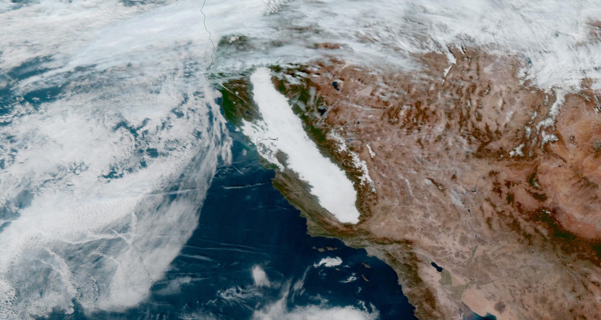
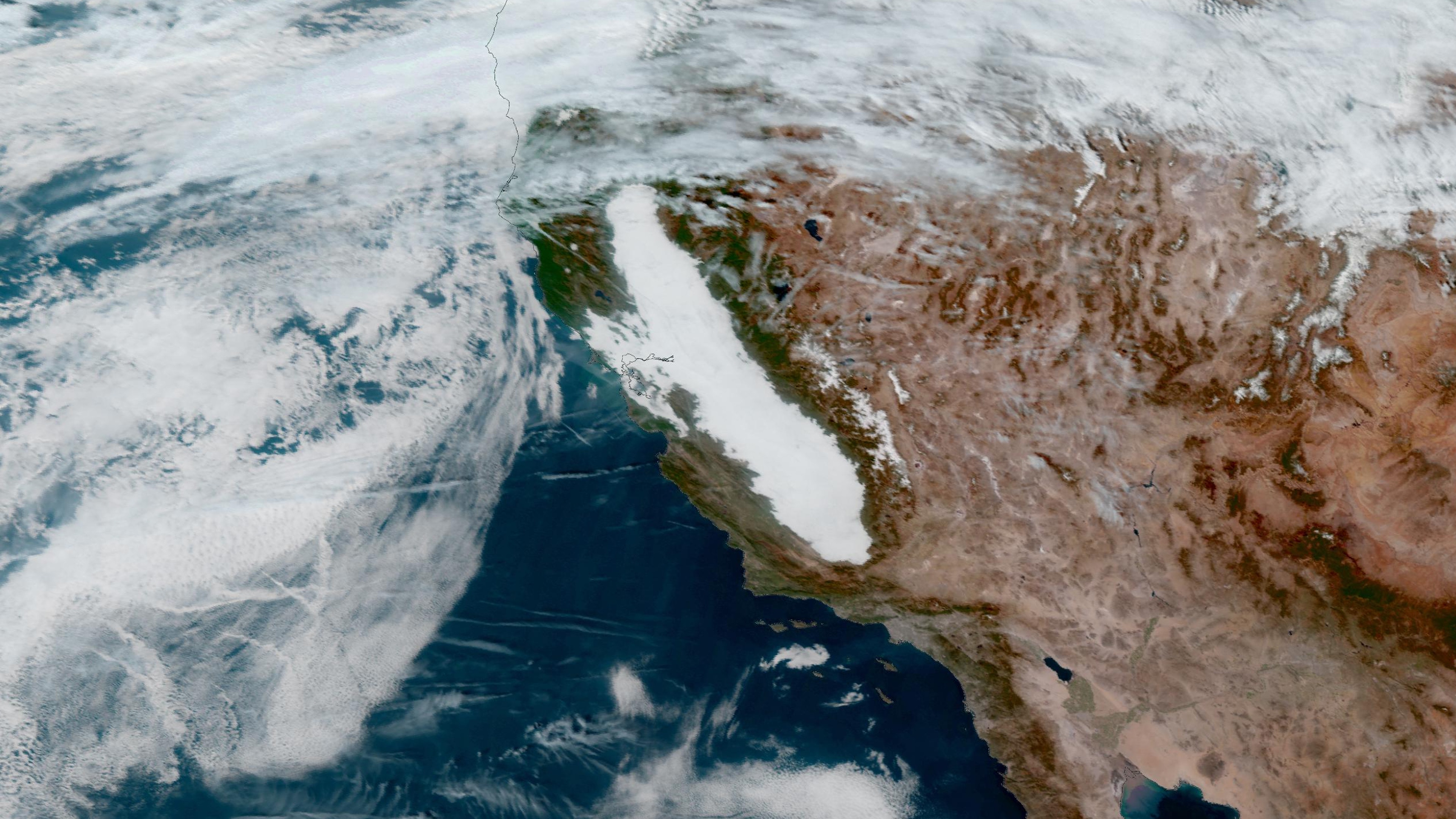
400 Miles Of Fog Blankets California
Pretty much everyone feels like they see endless gray skies in winter, but California’s Central Valley is taking things a step further with three weeks of foggy conditions from a phenomenon called “tule fog”.
Satellite imagery from NASA and CIRA has revealed how pervasive the fog has been for the region, with day-after-day and week-after-week fogginess never letting up.
The fog started to develop on November 22 and was firmly in place by November 24… and it’s pretty much been there ever since (though it has grown and shrunk a little on a day-to-day basis).
![]()
Weather in your inbox
By signing up you agree to the Terms & Privacy Policy. Unsubscribe at any time.
Here’s what’s happening:
Soil in the Central Valley has been nice and moist following a rainy autumn.
In fact, precipitation totals from September through November ranked among the top 10 percent wettest on record for most of central and southern California. Modesto and Hanford, California, each broke the record for the wettest meteorological fall since records began.
(MORE: What Is Tule Fog?)
So we have moist air for the equation.
In late November, a stable high pressure system developed over California, helping to trap all of that moisture.
The fog layer has kept things cool in the valley as the rest of the Southwest has been basking in above-average temperatures.
Now we have our temperature inversion.
Is the end coming soon? Until a storm comes in to clear out the moist air, there’s no anticipated end to the foggy conditions. The National Weather Service in Hanford, California, is warning of fog at least through Friday of this week.
Sara Tonks is a content meteorologist with weather.com and has a bachelor’s and a master’s degree from Georgia Tech in Earth and Atmospheric Sciences along with a master’s degree from Unity Environmental University in Marine Science.