
The heaviest part of a storm system that pummeled the Los Angeles area and other parts of the Southland subsided Thursday, but off-and-on showers and thunderstorm hit some areas, locally heavy at times, with persisting risks from flooding as well as mudslides in recent burn areas including from the Palisades and Eaton fires.
The forecast and heavy rains prompted L.A. Mayor Karen Bass to issue a declaration of emergency. A flood watch remained in effect for major portions of L.A. County through 6 p.m. on Friday.
The forecast for Thursday night was a 90% chance of showers and 70% during daylight hours on Friday. By Friday night, the rain is expected to peter out.
L.A. appears headed for a sunny, cool postcard weekend — with temperatures as high as 64 degrees.
“We will finally dry out once again Saturday afternoon,” said Kyle Wheeler, a meteorologist with the National Weather Service.
However, Wheeler also cautioned that the lighter rain on Friday poses risk because the ground is already saturated throughout much of the Southland.
The storms pounded a wide swath of California and left three people dead. A 64-year-old San Diego man died Wednesday after a tree fell on him. On Monday, a woman in her 70s was knocked off a rock and killed by a large wave during a fierce storm at a beach at MacKerricher State Park, according to the Mendocino County Sheriff’s Office. On Sunday, a person trapped inside a vehicle died in rising waters as flooding overwhelmed parts of Redding.
Firefighters rescued a woman after she was swept nine miles down San Jose Creek, the Los Angeles County Fire Department said Wednesday.
The rain also led to a sewage spill of about 10,000 gallons, county officials said, that created hazardous conditions three-quarters of a mile upstream and downstream from Cabrillo Beach in San Pedro, where visitors are advised to avoid contact with water and wet sand. The county Department of Public Health is conducting water sampling, and the closure will continue until bacterial levels meet health standards.
Families enjoying Disneyland on Christmas Day said rain would not have stopped them — and they enjoyed dry weather for at least part of the day.
Chris Solario and his wife, Jenny, drove in from Sacramento on Christmas Eve with their 7-month-old baby and a daughter who turned 5 on Christmas Day.
“Your birthday’s on Christmas? That must mean you’re a gift,” a talking Christmas tree at Downtown Disney told their daughter.
The rain hampered their drive especially through the Grapevine, Solario said.
Rain wasn’t going to deter Araceli Lima from having a good time.
“Even if it had rained, it wouldn’t have bothered us,” the Inglewood resident said. Her family was creating a new tradition to visit Downtown Disney on Christmas Day. “In Los Angeles, we need the rain.”
Flooding still a risk
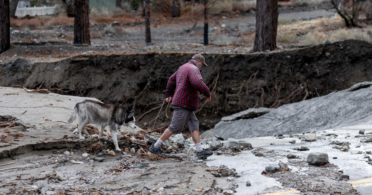
Areas that continued to be at risk include Eastern Malibu, Topanga State Park, Pacific Palisades, Topanga Canyon Road through the Santa Monica Mountains, Malibu Canyon and Los Virgenes Roads through the Santa Monica Mountains and Mandeville Canyon.
On Thursday morning, there were heavy thunderstorms throughout southern Ventura County, with radar tracking storm activity along a line extending from 6 miles south of La Conchita to near Point Mugu. Wind gusts were up to 50 miles per hour, according to the weather service: “While not immediately likely, Doppler Radar has indicated some weak rotation with this activity, and a brief, weak tornado cannot be ruled out.”
Through Wednesday, the storm system dumped 2 to 4 inches of rain across the region, with some areas receiving 4 to 8 inches and 10 inches in foothills and mountains, levels that Wheeler, the meteorologist called “crazy numbers” over a short span.
As of early Wednesday evening, the Los Angeles Fire Department had deployed teams to three river-rescue incidents. Additional information was not immediately available.
Meanwhile, the Los Angeles Police Department had responded to more than 100 traffic accidents. There have been no reported traffic-related injuries or deaths. The city transportation department was working restore five traffic signals and city crews were responding to “nearly 500 tree emergencies.”
Across the state, a winter storm warning remains in effect for Sierra Nevada above 7,000 feet above sea level from Yosemite to the Lake Isabella area through Friday, with 12 inches of snow per day anticipated. By the weekend, it’s possible that there will be snow on the ground in areas as low as 5,000 feet above sea level by the weekend.
The cities of Tehachapi, Frazier Park, Lebec, and Grapevine were under a high-wind warning until 4 p.m. on Friday, with south winds of 15 to 25 mph with gusts up to 45 mph — conditions likely to affect drivers heading north or south on the major route through the mountainous Grapevine pass.
“Damaging winds will blow down trees and power lines,” the National Weather Service said. “Widespread power outages are expected. Travel will be difficult, especially for high-profile vehicles.”
The NWS warned that those living in areas most affected should “remain in the lower levels of your home during the windstorm and avoid windows. Watch for falling debris and tree limbs. Use caution if you must drive.”
Mayor Bass said in a statement: “We are making every resource and tool available to help facilitate the city’s continued response effort… I am urging all Angelenos to stay safe and be extremely careful on the roads if you absolutely must travel. Please do not take this storm lightly — follow official guidance, plan ahead, and sign up for emergency alerts at NotifyLA.org.”