
IMPACTED. LET’S TURN OUR ATTENTION TO THE FORECAST NOW AS WE TAKE A LIVE LOOK HERE AT WHAT LOOKS LIKE A LITTLE BIT OF FOGGY SITUATION AT SUTTER HEALTH PARK. HERE’S METEOROLOGIST KELLY CURRAN. YEAH, IT IS CERTAINLY STARTING TO DEVELOP IN SACRAMENTO. WE’RE SEEING IT ALONG THE CAUSEWAY AS WELL. AND REPORTS OF DENSE FOG. OTHER PARTS OF THE VALLEY TOO. TEMPERATURES ARE ALSO COLD. SO IT’S A COLD AND DAMP THIS MORNING 37 DEGREES RIGHT NOW IN SACRAMENTO. TEMPERATURES THIS AFTERNOON WILL GRADUALLY CLIMB INTO THE MID AND UPPER 50S. BUT LET’S TAKE A LOOK AT THAT FOG FIRST. NOW TRUCKEE, YOU’RE DEALING WITH SOME AREAS OF FREEZING FOG AGAIN THIS MORNING. MARYSVILLE REPORTING HALF MILE VISIBILITY SACRAMENTO INTERNATIONAL AIRPORT REPORTING THREE QUARTERS OF A MILE. FAIRFIELD DOWN TO A QUARTER OF A MILE. STOCKTON AIRPORT IS REPORTING A QUARTER MILE VISIBILITY AND A MILE AND A HALF BEING REPORTED IN THE MODESTO AREA. AND THE FOG IS STILL BUILDING. WE’RE GOING TO CONTINUE TO SEE THAT THROUGH SUNRISE JUST A LITTLE AFTER SEVEN THIS MORNING. SATELLITE RADAR PICTURE NOT REALLY SHOWING MUCH OF ANYTHING. SO WHAT WE DO HAVE THAT LOW CLOUD COVER, THAT FOG AT THE MID AND HIGH LEVELS. WE’RE REALLY NOT SEEING ANYTHING. SO CLEAR SKIES. AS YOU’RE WAKING UP IN THE FOOTHILLS, YOU’RE GOING TO SEE A TON OF SUNSHINE. NOT JUST THIS MORNING, BUT ALL DAY LONG. NOW LET’S TAKE A LOOK AT FUTURECAST, BECAUSE THE HIGH PRESSURE CENTER IS STILL RIGHT OVERHEAD. THAT’S THE DOMINANT PLAYER. LIGHT WINDS, AREAS OF PATCHY FOG. AND FOR THE FOOTHILLS IN THE SIERRA, SUNSHINE AND WARMER TEMPERATURES. BUT WE’LL BE EXPECTING AS WE HEAD THROUGHOUT THE REST OF THE WORKWEEK. HEADING TOWARD THE WEEKEND, THE HIGH DOES START TO WEAKEN. IT MOVES A LITTLE FURTHER TO THE NORTH, THEN STARTS SLIDING BACK DOWN TO THE SOUTH AS A LOW PRESSURE CENTER STARTS TO MOVE ITS WAY TOWARD US THROUGH THE PACIFIC. NOW THIS IS EXPECTED TO OUR STAY TO OUR NORTH. POSSIBILITY FOR SOME BRIEF SNOW SHOWERS MIDDLE OF THE WEEK NEXT WEEK. THAT’S SOMETHING WE’RE GOING TO BE KEEPING A CLOSE EYE ON. WHILE IT IS NICE TO HAVE THE SUNSHINE THAT WE’RE GOING TO SEE IN THE FOOTHILLS, WE CERTAINLY NEED MORE RAIN AND MORE SNOW. SO TEMPERATURES TODAY IN THE FOOTHILLS WILL BE TOPPING OUT IN THE LOW 60S. WE’LL BE GETTING UP INTO THE MID 60S FOR THE MIDDLE OF THE WEEK, AND THE WEEKEND LOOKS FANTASTIC FOR THE SIERRA TODAY. SUNSHINE 51. LOOKING AT TEMPERATURES CLIMBING INTO THE MID 50S AS WE HEAD INTO THE BEGINNING OF NEXT WEEK. SO THAT DOES MEAN A LITTLE BIT OF MELTING SNOW. AND IN SACRAMENTO MORNING FOG CLEARING THIS AFTERNOON, A HIGH OF 57 TEMPERATURES ARE GOING TO BE PRETTY CLOSE TO NORMAL. NORMAL HIGH THIS TIME OF YEAR IS ABOUT 55. AS LONG AS WE GET SOME SUNSHINE IN THE AFTERNOON. I THINK THAT MAKES A WORLD OF DIFFERENCE. YEAH. NOT BAD. PRETTY KIND OF THE SAME OLD,
Northern California forecast: Foggy Tuesday morning ahead of afternoon sun

Updated: 7:16 AM PST Jan 13, 2026
Northern California could see another day with a cold, foggy morning ahead of slightly above-average temperatures Tuesday.Meteorologist Kelly Curran said Tuesday’s forecast high for downtown Sacramento is 57 degrees, similar to the 58 degrees recorded Monday. The average for this time of year is 55 degrees.Morning commuters in parts of the region could experience patchy fog, but Curran said it does appear the fog will be widespread or last all day. By the afternoon, sunshine is likely in the Valley and Foothills.Curran said the fog may return Wednesday, but the seven-day forecast indicates that conditions are expected to stay dry.REAL-TIME TRAFFIC MAPClick here to see our interactive traffic map.TRACK INTERACTIVE, DOPPLER RADARClick here to see our interactive radar.DOWNLOAD OUR APP FOR THE LATESTHere is where you can download our app.Follow our KCRA weather team on social mediaMeteorologist Tamara Berg on Facebook and X.Meteorologist Dirk Verdoorn on FacebookMeteorologist/Climate Reporter Heather Waldman on Facebook and X.Meteorologist Kelly Curran on X.Meteorologist Ophelia Young on Facebook and X.Watch our forecasts on TV or onlineHere’s where to find our latest video forecast. You can also watch a livestream of our latest newscast here. The banner on our website turns red when we’re live.We’re also streaming on the Very Local app for Roku, Apple TV or Amazon Fire TV.See more coverage of top California stories here | Download our app | Subscribe to our morning newsletter | Find us on YouTube here and subscribe to our channel
SACRAMENTO, Calif. —
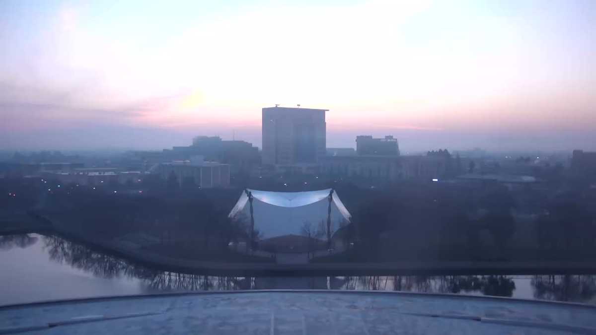
Northern California could see another day with a cold, foggy morning ahead of slightly above-average temperatures Tuesday.
Meteorologist Kelly Curran said Tuesday’s forecast high for downtown Sacramento is 57 degrees, similar to the 58 degrees recorded Monday. The average for this time of year is 55 degrees.
Morning commuters in parts of the region could experience patchy fog, but Curran said it does appear the fog will be widespread or last all day. By the afternoon, sunshine is likely in the Valley and Foothills.
Curran said the fog may return Wednesday, but the seven-day forecast indicates that conditions are expected to stay dry.
REAL-TIME TRAFFIC MAP
Click here to see our interactive traffic map.
TRACK INTERACTIVE, DOPPLER RADAR
Click here to see our interactive radar.
DOWNLOAD OUR APP FOR THE LATEST
Here is where you can download our app.
Follow our KCRA weather team on social media
Meteorologist Tamara Berg on Facebook and X.Meteorologist Dirk Verdoorn on FacebookMeteorologist/Climate Reporter Heather Waldman on Facebook and X.Meteorologist Kelly Curran on X.Meteorologist Ophelia Young on Facebook and X.
Watch our forecasts on TV or online
Here’s where to find our latest video forecast. You can also watch a livestream of our latest newscast here. The banner on our website turns red when we’re live.
We’re also streaming on the Very Local app for Roku, Apple TV or Amazon Fire TV.
See more coverage of top California stories here | Download our app | Subscribe to our morning newsletter | Find us on YouTube here and subscribe to our channel