
Northern California forecast: Clouds increase for the rest of the weekend
While dense morning fog will lift by noon on Sunday, skies will remain mostly cloudy as unsettled weather passes north of our region.
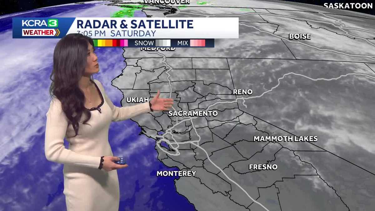
ON THIS SATURDAY EVENING. YOU’RE TAKING A LIVE LOOK IN STOCKTON. LET’S HEAD OVER TO OUR METEOROLOGIST, OPHELIA YOUNG, WHO’S TRACKING OUR CONDITIONS. IT WAS VERY, VERY COMFORTABLE. ACTUALLY HAD A JACKET AT THE FARMER’S MARKET THIS MORNING AND I HAD TO TAKE IT OFF. YOU HAD TO TAKE IT OFF BY AFTERNOON? YEAH, SURE. A LOT OF US WERE SWEATING. BUT YOU KNOW WHAT? IT WAS GREAT WEATHER, ESPECIALLY FOR SATURDAY IF YOU WANTED TO GO ON A RUN OR CLEAN THE YARD, WASH YOUR CAR. REALLY? YOU COULD HAVE DONE IT ALL TODAY WITH TEMPERATURES CLIMBING TO 63 DEGREES IN SACRAMENTO THAT IS FIVE DEGREES ABOVE THE NORMAL OF 58. FOR THE LAST DAY OF JANUARY, WE GOT DOWN TO 39 DEGREES. SO YES, CHILLY START, BUT QUITE A COMFORTABLE END TO THE DAY. AND THIS EVENING WE ARE COOLING DOWN. WE’RE IN THE 50S NOW, WILL BE DROPPING IN THE 40S AFTER 9:00 TONIGHT. SO HIGH PRESSURE STILL REMAINS THE MAIN INFLUENCE OVER THE WEST COAST. ABOVE US, THE JET STREAM AND THAT STEERING ALL UNSETTLED WEATHER INTO THE FAR PACIFIC NORTHWEST. BUT A LITTLE FURTHER SOUTH, ALL WE’RE GETTING ARE THESE CLOUDS THAT ARE STREAMING IN, AND WE’RE GOING TO GET MUCH MORE OF IT TOMORROW AS THIS WEATHER SYSTEM CONTINUES TO RIDE THAT RIDGE INLAND. SO EXPECT THE REST OF YOUR WEEKEND TO BE CLOUDY. NOW, ONCE THESE CLOUDS CLEAR BEHIND THAT SYSTEM ON MONDAY, MORE SUNSHINE RETURNS. BUT WE’LL ALSO NOTICE A LITTLE WIND. THAT WIND WILL BE THE MOST NOTICEABLE ALONG THE NORTHWESTERN EDGE OF THE VALLEY. I’M NOT TELLING YOU THIS BECAUSE IT’S GOING TO BE WINDY. I’M TELLING YOU THIS BECAUSE THIS MIGHT BE OUR LAST CHANCE TO SCOUR OUT THAT FOG FOR THE REST OF THE WEEK. SO YES, THAT WIND SHOULD HELP SET BACK THE FOG DEVELOPMENT, BUT IT’S STILL GOING TO BE WIDESPREAD AND DENSE IN THE MORNINGS. THAT FOG SHOULD LIFT AROUND NOON, AND THEN IN THE AFTERNOON WE CAN ENJOY A MIX OF SUN AND CLOUDS. IT WILL BE UNSEASONABLY WARM WITH EVEN WARMER WEATHER, UPHILL FOOTHILLS AND SIERRA VERY WARM FOR THE START OF FEBRUARY. SO LOW 60S ACROSS THE VALLEY ONCE AGAIN TOMORROW. 63 IN ROSEVILLE FOLSOM TOPPING OUT AT 64 DEGREES. A LITTLE WARMER IN THE SAN JOAQUIN VALLEY WITH TEMPERATURES IN THE LOW TO MID 60S OUT IN THE DELTA AND THE BAY AREA. SAN FRANCISCO DEALING WITH PATCHY FOG. TOMORROW 64 DEGREES MORE SUNSHINE IN SPOTS LIKE CONCORD AND SAN JOSE. THEY’LL TOP OUT IN THE MID TO UPPER 60S. BEAUTIFUL DAY IN THE FOOTHILLS. NOTICE A FEW CLOUDS SAILING BY WITH TEMPERATURES IN THE MID 60S AND IN THE SIERRA 52 DEGREES IN TRUCKEE AND SOUTH LAKE TAHOE. POLLOCK PINES AND ARNOLD. ABOUT TEN DEGREES WARMER IN THE LOW 60S. NOW, AFTER THE CLOUDS MOVE OUT, ANOTHER AREA OF HIGH PRESSURE MOVES IN. AND BOY DOES THIS ONE REALLY SETTLE DOWN OVER THE WEST COAST. THE TEMPERATURE INVERSION ASSOCIATED WITH IT WILL REALLY LOCK IN THAT MORNING FOG. SO EXPECT FOG TO BE MORE PRONOUNCED ALL THE WAY THROUGH THIS MORNING. THAT’S IMPORTANT TO KNOW FOR ALL YOU MORNING COMMUTERS. TEMPERATURES IN THE AFTERNOON, THOUGH SHOULD CLIMB WILL BE IN THE LOW TO MID 60S. 64 DEGREES IN THE VALLEY ON WEDNESDAY. THIS WEEKEND. I DO NOTICE THAT HIGH PRESSURE MAY COLLAPSE A LITTLE BIT. WILL IT WEAKEN ENOUGH FOR WEATHER SYSTEMS TO MOVE IN? MAYBE BRING THE MOUNTAINS A FEW SHOWERS? WE’LL SEE. IT’S NOT IN T
Northern California forecast: Clouds increase for the rest of the weekend
While dense morning fog will lift by noon on Sunday, skies will remain mostly cloudy as unsettled weather passes north of our region.

Updated: 7:05 PM PST Jan 31, 2026
While dense morning fog will lift by noon on Sunday, skies will remain mostly cloudy as unsettled weather passes north of our region.Valley highs will climb into the low 60s once again. Foothill temperatures will peak in the low to mid 60s, with the Sierra warming into the low 50s. Expect light winds out of the north.While a light north breeze should help scale back some morning fog development, fog will still remain dense and widespread this week as high pressure regains position over the West Coast.Weather will be stable and dry, with morning fog lifting to an afternoon mix of sun and clouds each day, along with light winds. We may notice a decline in air quality and increased haze. Valley temperatures will hover in the low to mid 60s all week.Forecast models suggest the ridge of high pressure may break down at the end of the week, allowing unsettled weather to return this weekend or early next week. While a light valley shower and a dusting in the mountains are possible, no major storms are expected in the foreseeable future.
SACRAMENTO, Calif. —
While dense morning fog will lift by noon on Sunday, skies will remain mostly cloudy as unsettled weather passes north of our region.
Valley highs will climb into the low 60s once again. Foothill temperatures will peak in the low to mid 60s, with the Sierra warming into the low 50s. Expect light winds out of the north.
While a light north breeze should help scale back some morning fog development, fog will still remain dense and widespread this week as high pressure regains position over the West Coast.
Weather will be stable and dry, with morning fog lifting to an afternoon mix of sun and clouds each day, along with light winds. We may notice a decline in air quality and increased haze. Valley temperatures will hover in the low to mid 60s all week.
Forecast models suggest the ridge of high pressure may break down at the end of the week, allowing unsettled weather to return this weekend or early next week. While a light valley shower and a dusting in the mountains are possible, no major storms are expected in the foreseeable future.