
Southern California is poised to feel a distinct shift in weather starting mid-week and possibly more rain and thunderstorms, though it won’t be as intense as last week’s storm.
“This storm is less dynamic with less moisture to work with,” Robert Munroe, a meteorologist with the National Weather Service, told Patch.
However, these types of systems are “hard to predict,” Munroe added.
Find out what’s happening in Los Angelesfor free with the latest updates from Patch.
While Northern California is bracing for a powerful atmospheric river storm this week, the low-pressure system moving to the Southland will bring cooler temperatures, deepening marine clouds, thunder and a chance of rain in some areas on Tuesday and Wednesday, according to the NWS.
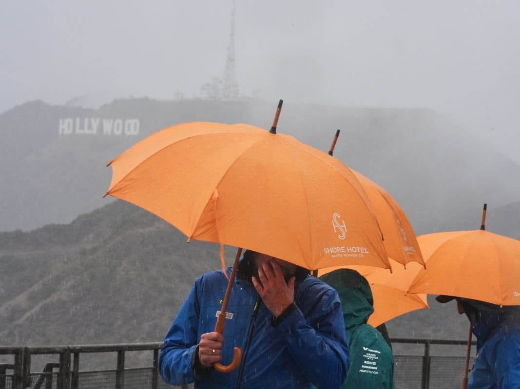
Los Angeles, Ventura, Santa Barbara and San Luis Obispo Counties will see the largest chance for thunderstorms, but “the drizzle potential will extend further south into far [Southern California]”, Munroe said.
Find out what’s happening in Los Angelesfor free with the latest updates from Patch.
It remains to be seen exactly which areas will get more or less rain, but according to Munroe, there are “almost equal chances across the area.”
“Although thunderstorm chances are generally a bit higher (15-20%) for the mountains and deserts,” Munroe told Patch. “Coastal areas have the potential for measurable rain from either marine layer cloud drizzle or thunderstorms.”
Beginning Tuesday, cooler air will start to push inland from the coast, with more significant drops in temperatures expected Wednesday and Thursday. Forecasters in San Diego notes highs falling by as much as 12 to 18 degrees in the mountains and far inland valleys.
“Expect temperatures to undulate around average over the next week, much like a gentle ocean swell, falling a few degrees below into Wednesday, rising back above average Friday, dipping again this weekend, then cresting once again above average next week,” forecasters in San Diego wrote on X.
Expect temperatures to undulate around average over the next week, much like a gentle ocean swell, falling a few degrees below into Wednesday, rising back above average Friday, dipping again this weekend, then cresting once again above average next week. pic.twitter.com/NLTBiJ9r7d
— NWS San Diego (@NWSSanDiego) October 21, 2025
A similar forecast was expected in Los Angeles and Orange counties, with weather experts saying temperatures will dip 8 to 12 degrees below normal for much of the inland areas by Wednesday, thanks to a looping upper low and a deepening marine layer.
“The marine layer will deepen tonight and Wednesday as a low pressure system moves over the area leading to much cooler temperatures and possible drizzle or light rain in some places,” NWS officials in Los Angeles said Tuesday. “Dry and much warmer conditions are expected for the end of the week.”
While for now, a slight chance of rain is expected just in some parts of Southland, forecasters noted that outlook could change as clouds knit together this week.
“A deeper marine layer is likely and there is a [10 to 20 percent] chance of showers and thunderstorms just about anywhere,” forecasters wrote Tuesday.
Gusty winds are expected to blow through LA and Orange counties, but they aren’t forecast to reach “advisory” or worrisome levels. Meanwhile, in San Diego County, there could be periods of stronger southwest to west winds along and below the east slopes of the mountains with gusts to 35 to 45 mph possible.
As for more lightning, forecasters aren’t expecting any major thunderstorms, though lightning is possible.
“The trajectory seems to be favoring more southeast CA but there have been some lightning strikes and it’s not likely to have much rain with it,” forecasters in LA wrote.
In Riverside County, residents should expect a noticeable cool-down midweek as a weak low-pressure system moves inland, according to the NWS. Temperatures are forecast to drop by 10 to 15 degrees across the inland valleys and foothills Wednesday and Thursday, with highs in the 70s and lows dipping into the 50s.
While the chance of rain remains low, forecasters say light drizzle or isolated showers could develop over higher terrain, particularly in the San Jacinto Mountains. Gusty winds, especially near the Banning Pass and desert slopes, could reach up to 50 mph Wednesday afternoon and evening. Conditions are expected to warm slightly by Friday before another trough brings cooler, breezier weather over the weekend, the NWS said.
Rain is less likely in Riverside County this week, but there is a “slight chance of light showers” late Saturday night into Sunday morning from the coast to the mountains, the service said.
Last week, the first hard-hitting storm of the season arrived early, delivering a month’s worth of rain in one morning to some parts of the Southland. Along with the rain, came hazards in the wildfire-scarred communities, where those living in high-risk areas were forced to evacuate amid the threat of mudslides and dangerous flooding.
READ MORE: Here’s How Much Rain Fell In Major LA Storm So Far
As La Niña has officially returned to the Pacific Coast, Californians can expect a cold and unpredictable winter in Northern California and a hot and dry winter for the Southland.
“It’s challenging to attribute La Nina to a single storm or week,” Munroe told Patch. “La Nina has a tendency for winter storms to target further north than the climatological winter (a “normal” winter). However, outside of this relatively weak system, it does seem likely the more impactful storm systems will continue to target areas well to the north of Southern California for at least the next week.”
If the La Niña patterns of the last decade with her swing from historic drought conditions to a rare Southern California blizzard, have taught us anything, it’s that this little girl can be unpredictable.
La Niña, which means “Little Girl” in Spanish, is a climatic pattern event that brings increasing upwelling and cold, nutrient-rich water to the surface of the Pacific Ocean to the west of the United States, according to the National Oceanic and Atmospheric Administration (NOAA).
La Niña is a cold event. The cold waters it brings to the surface of the ocean lead to droughts in the Southern part of the United States and heavy rain and flooding in the Pacific Northwest, according to weather officials.
The National Oceanic and Atmospheric Administration on Thursday that La Niña conditions emerged in September and are likely to remain though February, according to NOAA.
READ MORE: La Niña Has Officially Arrived: Here’s What That Means For Fall And Winter In CA
Get more local news delivered straight to your inbox. Sign up for free Patch newsletters and alerts.