
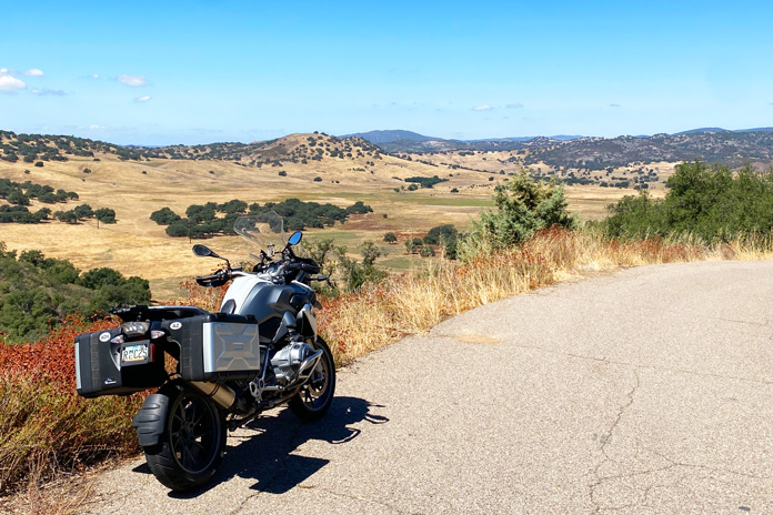
 Spectacular views, like this one near Julian, abound on this Southern California motorcycle ride. (Photos by the author)
The August 2019 issue of Rider included my tour story, “Palms to Pines to the Pacific,” about a Southern California motorcycle ride west on State Route 74. The mountain and canyon roads on that route are some of the best in the state, so I decided to return to SR-74 and extend my route.
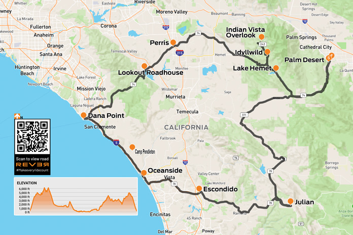
Scan QR code above or click here to view the route on REVER
The mountainous transition zone between the Mojave Desert and the Pacific Ocean is a motorcycling wonderland. One can ride from the fringe of the sweltering desert to the cool coastline easily in a single day, but it takes at least a couple of days to get a full sampling of the fun contained in that green zone sandwiched between brown and blue on the map.
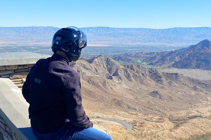 Coachella Valley Vista Point on the Palms to Pines Highway.
The September morning sun outside my hotel in Palm Desert had me sweating inside my gear as I did pre-ride checks on my BMW R 1200 GS. Over the next several hours I would transition from the heat of the Coachella Valley to the crisp, cool air of the mountains and then to the sea mist of the California coastline.
The fun started immediately when I turned onto State Route 74 – the beginning of the Palms to Pine Highway – at the base of the Santa Rosa Mountains. The smoothly paved ribbon of tarmac coils into increasingly tight, banked turns during the ascent into that rocky range.
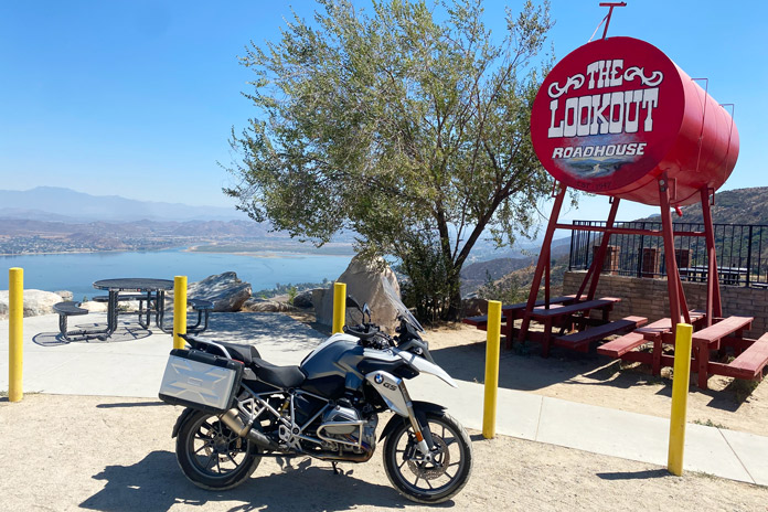
 The climb up from Lake Elsinore on SR-74 is curvaceous and scenic. It leads to the legendary Lookout Roadhouse, a favorite stop for motorcyclists for decades.
After a few miles, I pulled into the parking area of the Coachella Valley Vista Point. I sat in silence on the stone wall and looked down at the road I had just experienced. The view of the valley is impressive on a grand scale: the winding road in the foreground, the green splashes of the various Coachella Valley golf courses beyond that, and the grand Mojave Desert in the distance.
Back on the bike, I continued climbing into the mountains. Taller trees, rocky crags, and sheer cliffs define the terrain. Having climbed from 220 feet above sea level to 4,400 feet in less than 20 miles, SR-74 continues west across a broad plateau. At Mountain Center, I turned right (north) onto State Route 243, climbing higher into the San Jacinto Mountains. There’s an alpine feel with taller trees and the funky-cool mountain town of Idyllwild. At the Indian Vista Scenic Overlook, I stopped to stretch my legs and snack on a granola bar while admiring the impressive western views.
 Lookout Roadhouse
After backtracking to Mountain Center, I continued my westward trek on SR-74. The descent begins with another thrilling series of twists, turns, and views before straightening out near Hemet. Deviating around the city on the Ramona Expressway, I returned to the Pines to Palms Highway near Perris.
SR-74 took me west to Lake Elsinore, which triggered memories from my youth in the ’70s and the glory of the Honda Elsinore motocross bikes of that era. They were inspired by the legendary Elsinore GP dirtbike race featured in the film On Any Sunday. Immediately west of Elsinore, I began another fun, winding climb on a stretch of SR-74 known as Ortega Highway. At the first crest of this climb, I pulled into the dirt parking lot of the iconic Lookout Roadhouse, which serves up food, drinks, and great views.
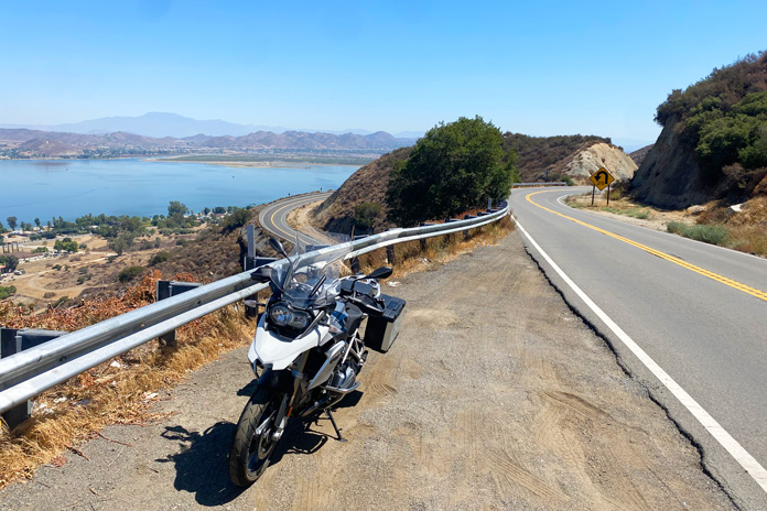
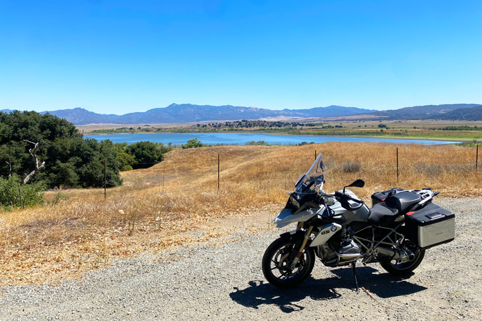 Nestled in the San Jacinto Mountains off SR-74, Lake Hemet is a scenic side jaunt.
Continuing west on SR-74, it’s a glorious 42 miles to the ocean: winding through pines and oaks, leaning deeply into endless curves, and carving along the rock wall of a deep canyon. This is a fantastic stretch of road that demands attention. I wrapped up the riding day in Dana Point, a cool California coastal town where I enjoyed fresh seafood and a relaxing walk along the marina and sandy beach.
The next morning, my ride back to Palm Desert began with a coastal cruise south on Interstate 5, which includes 17 miles of undeveloped land that’s part of Marine Corps Base Camp Pendleton. At Carlsbad, I took the exit for State Route 78 and rode inland (east). After crossing I-15, I began climbing again in a subtle repeat of the trip down SR-74: curves, trees, and views.
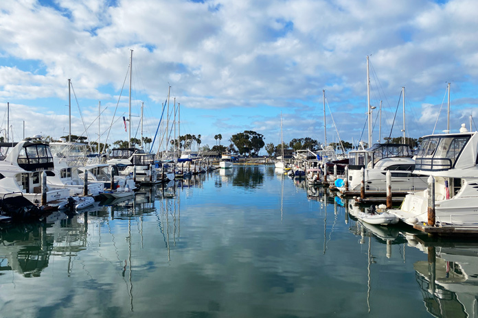 Dana Point makes for a picturesque stop-over on this ride.
At Santa Ysabel, I took a short spur on State Route 79 to Julian, another charming mountain town that’s famous for apple pie. After some touristing, I backtracked and continued north on SR-79, turned right (east) on State Route 371, and then reconnected with SR-74 for the glorious descent back to Palm Desert.
This great loop with peaks, valleys, and coastline gets a big thumbs up.
See all of Rider’s touring stories here.
California Motorcycle Ride Resources
Tim Kessel, a former English teacher, makes his home in the mountains of north-central Arizona. He has been a Rider contributor for nearly two decades. Exploring great roads and intriguing destinations has been a lifelong passion.