
Officials with the National Weather Service are forecasting heavy rains, possible thunderstorms and strong winds as a powerful storm system that’s expected to last well into the week makes its way into Southern California.
A winter storm warning has already been issued for the Eastern San Gabriel Mountains and Northern Ventura County Mountains as much as two feet of snow could blanket higher elevations.
At lower elevations in the valleys and coastal regions, forecasters say residents might see as much as two and a half inches of rain on Monday and as much as four inches throughout the week.
Residents in mountain and foothill communities may get as much as five inches of rain tomorrow with totals as high as eight inches as the weather system moves out of the region on Thursday.

(National Weather Service)
The strongest part of the storm, according to NWS, is expected Monday, with San Luis Obispo, Santa Barbara, Ventura and L.A. counties all in the path of two low pressure systems that are forecast to merge overnight and produce rain throughout the day.
Widespread winds, with gusts of up to 60 miles per hour, are expected, as well as 20% to 40% chance of thunderstorms and possible tornados.
Weather officials are urging residents in low lying or vulnerable areas, such as recent burn scars, to start taking precautions now and be prepared to evacuate.
An evacuation warning will take effect from 9 p.m. Sunday through 9 a.m. Tuesday for the Palisades, Sunset and Hurst burn scar areas due to the risk of mud and debris flows during the storm.

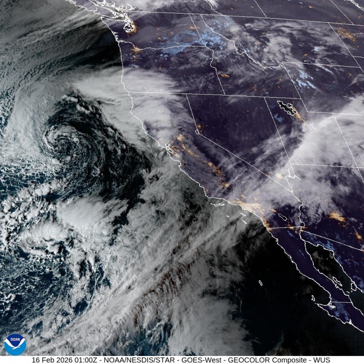
A powerful storm system moving into Southern California is expected to hit hardest on Monday Feb. 16, 2026. (NOAA)
Los Angeles officials said preparations are already underway ahead of the storm. Mayor Karen Bass said first responders, Public Works crews and other city personnel are coordinating resources in anticipation of heavy rain and potential impacts.
Motorists should be cautious of treacherous conditions and possible flooding on roadways. Low elevation snow could impact commuters on Interstate 5 and Highway 33, as well as other low-lying passes through Wednesday.
NWS officials suggest adjusting travel plans if possible and being prepared for significant delays due to possible flooding and closed roads.
Residents are urged to monitor forecasts, sign up for alerts through NotifyLA.org, and avoid unnecessary mountain travel during hazardous conditions.
Click here to view the most up-to-date forecast for your Southern California community.
Copyright 2026 Nexstar Media, Inc. All rights reserved. This material may not be published, broadcast, rewritten, or redistributed.
For the latest news, weather, sports, and streaming video, head to KTLA.