
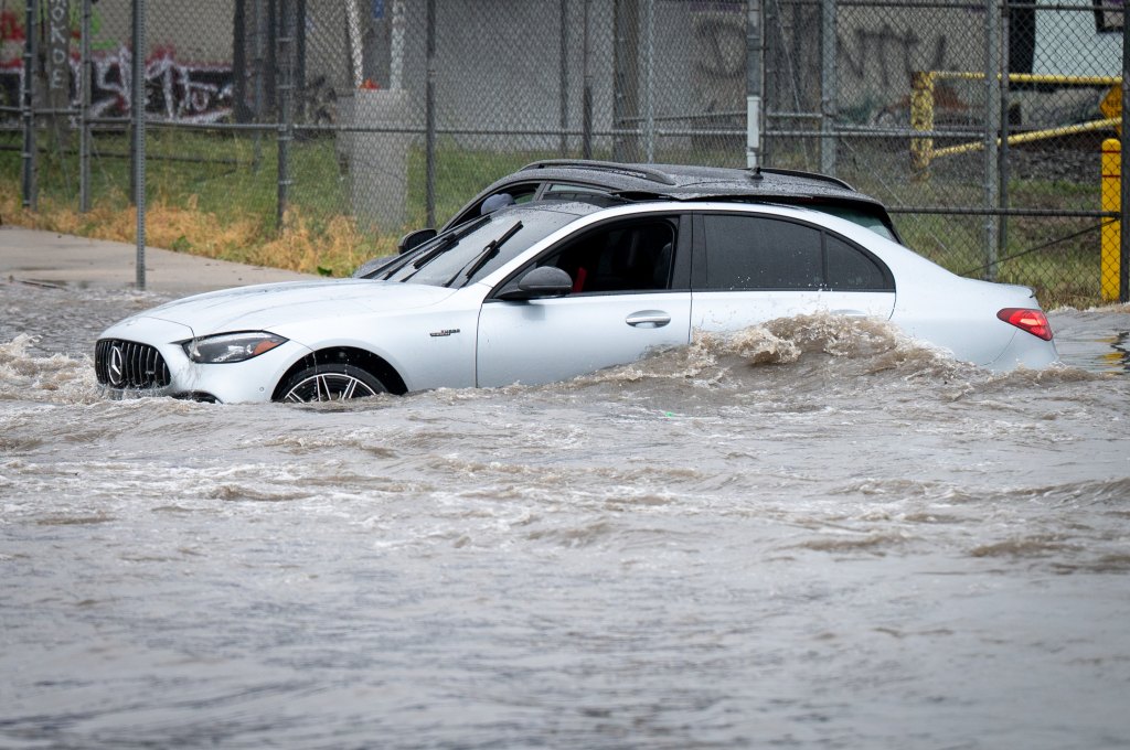
An intense Presidents Day storm arrived over parts of Southern California on Monday morning, Feb. 16, leading to heavy rains, strong winds, and flash-flood and evacuation warnings.
It is the first of three storms expected to land over Southern California this week.
“We’ve seen some very impressive rainfall rates,” said David Gomberg, a meteorologist with the National Weather Service. “When you get that intense rainfall, that increases your chance of urban flooding.”
Parts of western Los Angeles, near UCLA and Venice, received over an inch of rain in an hour.
Evacuation warnings were in effect for burn scars of the Palisades, Eaton, Hurst, and Sunset fires and will last until 9 a.m. Tuesday.
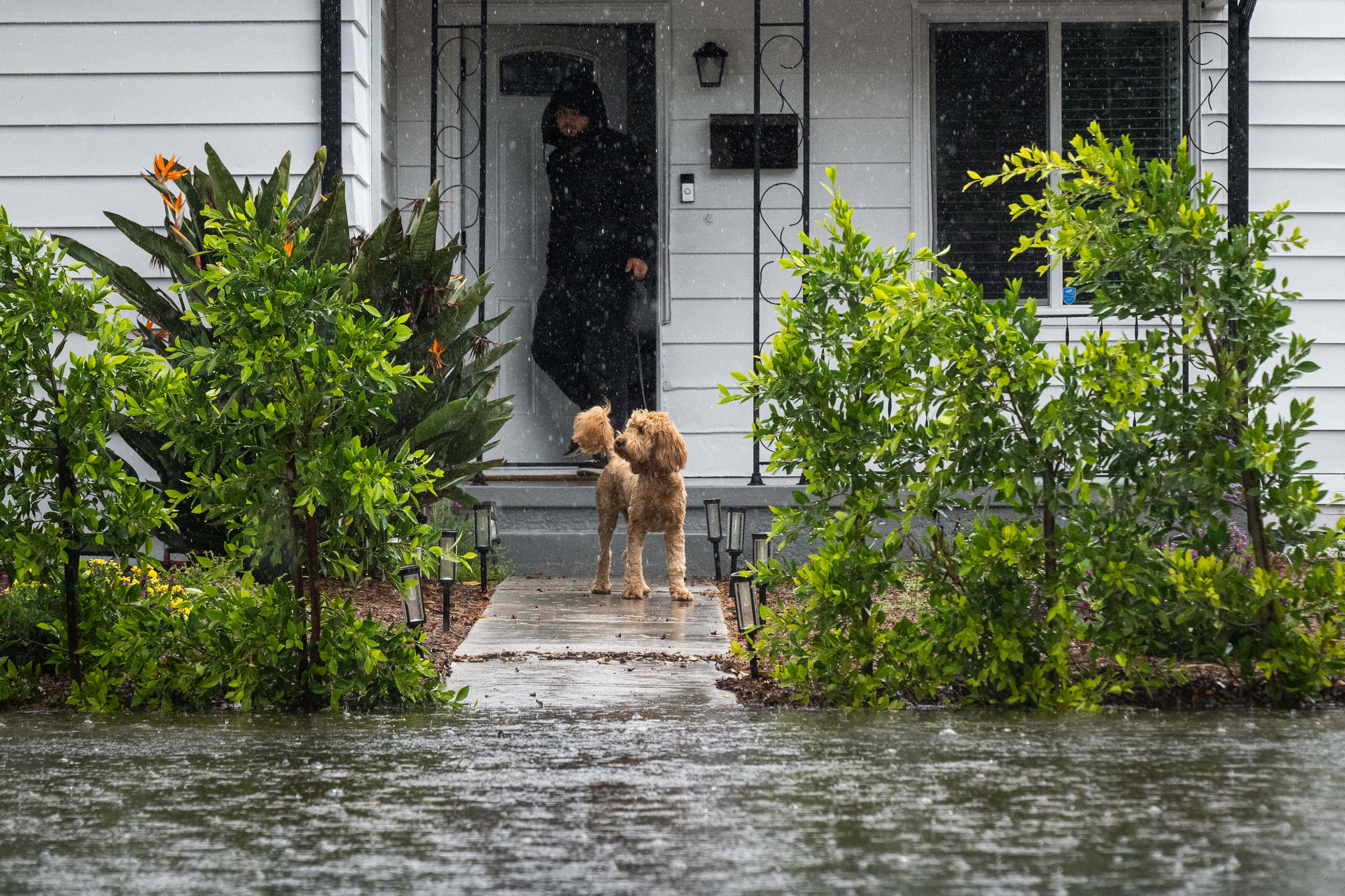
Water rises into the yard of a home along Vanowen Street in Reseda where a dog is let out during a winter storm on Monday, February 16, 2026. (Photo by Sarah Reingewirtz, Los Angeles Daily News/SCNG)

A Mini Cooper drives along Vanowen Street while crossing flooded Gloria Avenue in Van Nuys during a winter storm on Monday, February 16, 2026. (Photo by Sarah Reingewirtz, Los Angeles Daily News/SCNG)
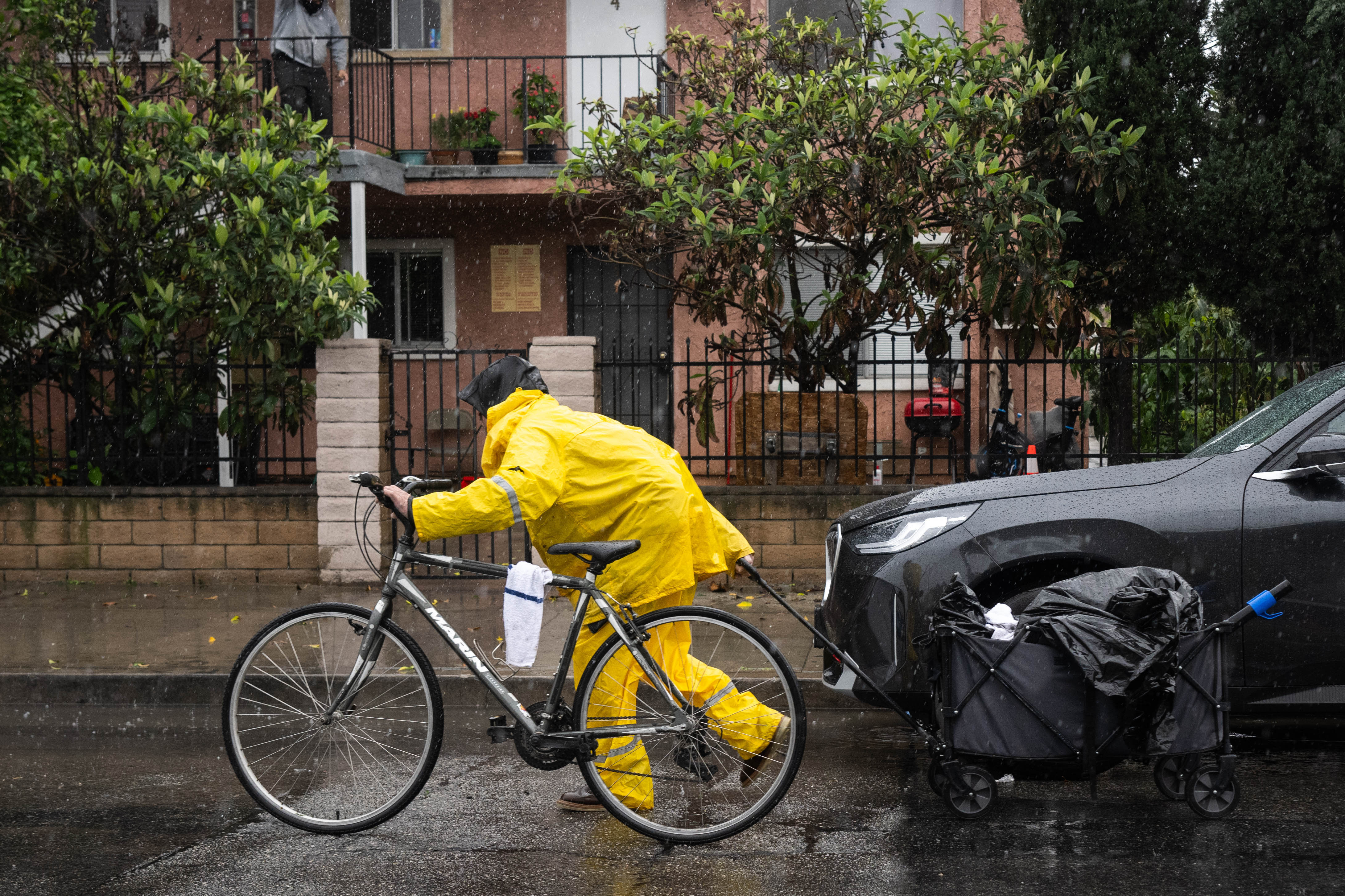
A man makes his way through North Hollywood during a winter storm on Monday, February 16, 2026. (Photo by Sarah Reingewirtz, Los Angeles Daily News/SCNG)
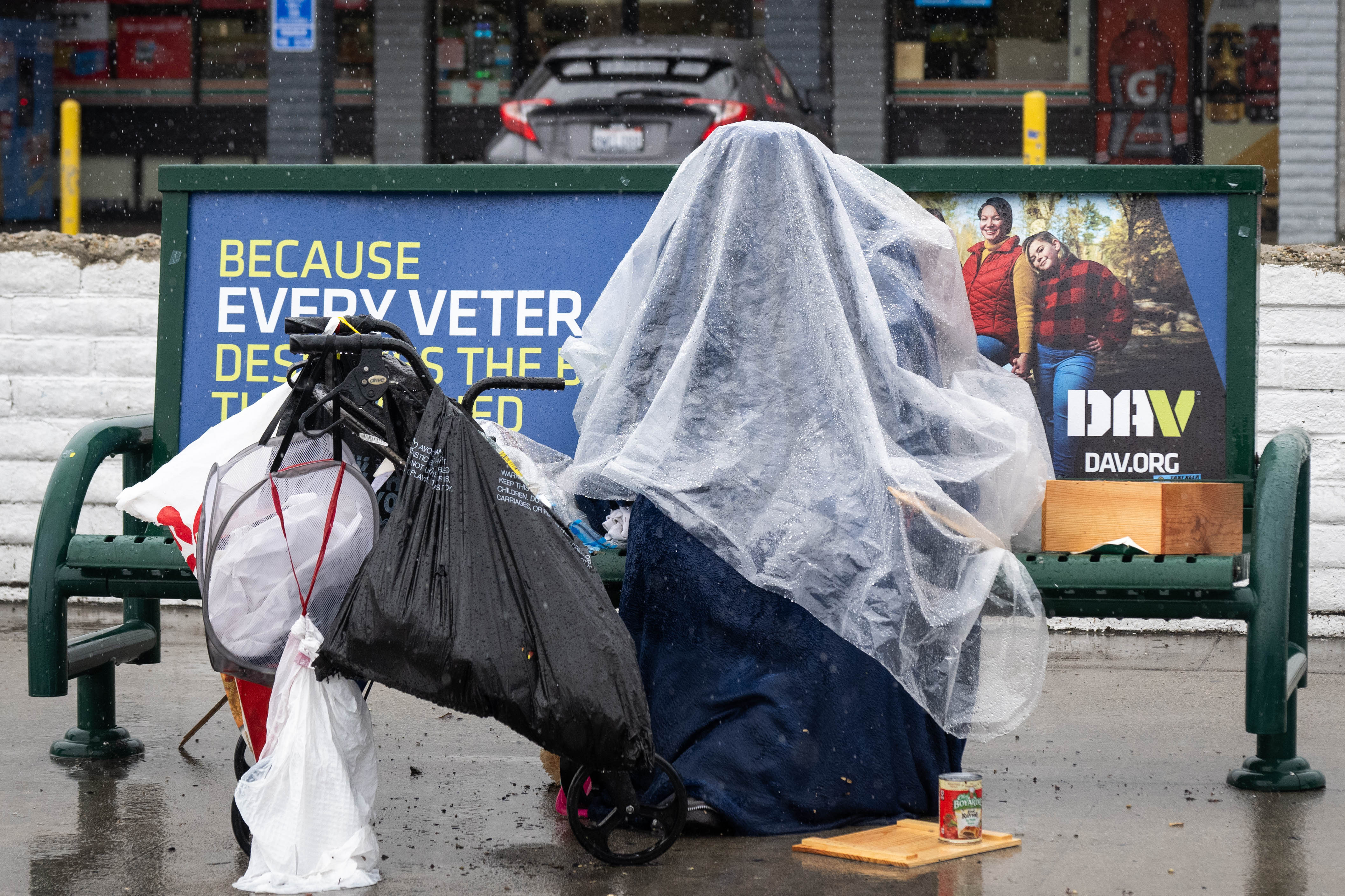
A person shelters from the rain in North Hollywood during a winter storm on Monday, February 16, 2026. (Photo by Sarah Reingewirtz, Los Angeles Daily News/SCNG)
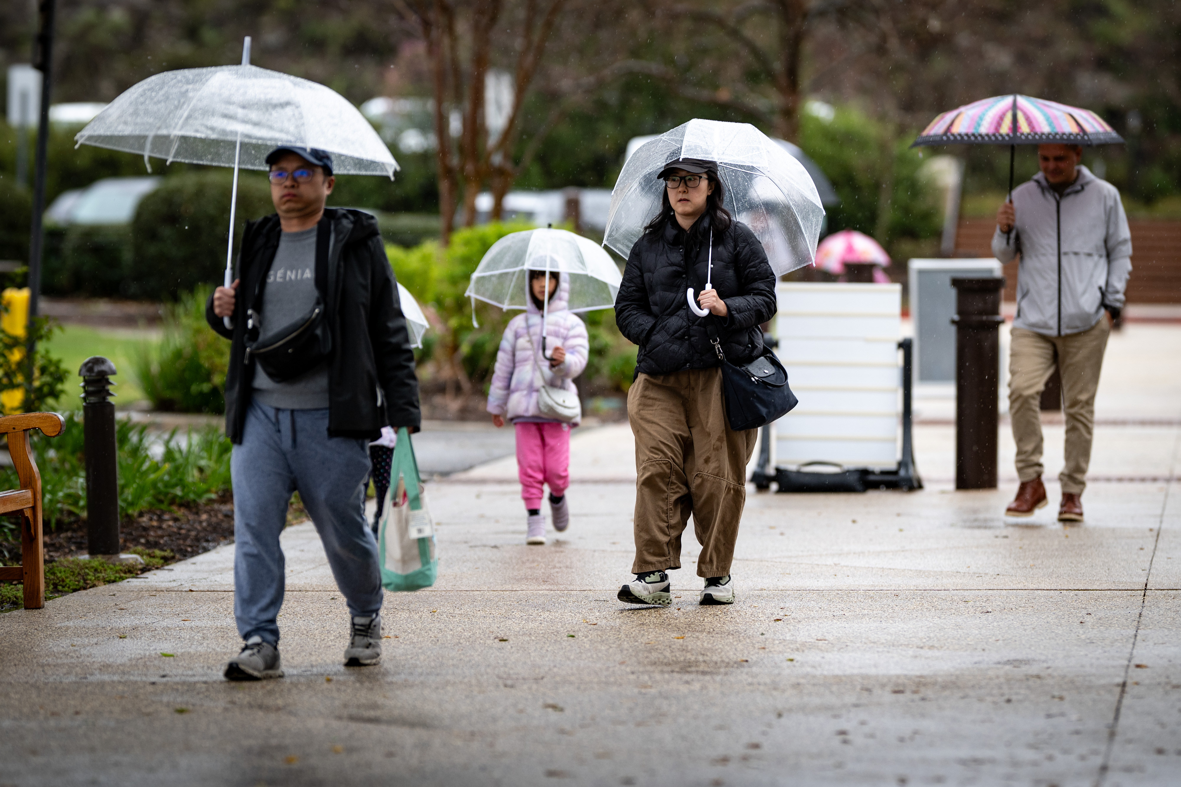
Visitors don umbrellas during a downpour at the Ronald Reagan Library on Monday, February 16, 2026. Rain is expected to continue through much of the week. (Photo by David Crane, Los Angeles Daily News/SCNG)
Show Caption
1 of 5
Water rises into the yard of a home along Vanowen Street in Reseda where a dog is let out during a winter storm on Monday, February 16, 2026. (Photo by Sarah Reingewirtz, Los Angeles Daily News/SCNG)
Authorities remained on standby for any weather-related issues or emergencies.
Los Angeles International Airport had issued a ground stop for departing flights Monday morning, according to ABC7, with this first storm offering the risk of thunderstorms and reduced visibility. The stop was later lifted.
The rainy end to Presidents Day weekend prompted Six Flags Magic Mountain to close its gates due to the forecast of heavy downpours and a threat of high winds in the Santa Clarita area. A sister park, Knott’s Berry Farm, said it would close early Monday because of the weather.
Los Angeles County health officials warned people to stay away from ocean water this week, especially near storm drains, creeks, and rivers that could hold higher bacteria levels because of storm runoff. An advisory is in place until 8 a.m. Saturday and could be extended.
The OC Health Agency also issued a rain advisory for Orange County beaches advising residents to avoid creeks and rivers, and coastal waters near storm drains until at least Thursday.
Winds of 45 mph to 65 mph whipped near the Palisades burn scar and in the foothills of the San Gabriel mountains on Monday morning.
Here’s how much rain parts of SoCal had received as of Monday afternoon:
Downtown LA: 1.82 inches
Santa Monica Mountains: 2.5 to 2.96 inches
San Gabriel Mountains: 1.8 to 2.4 inches
Coastal Orange County: 0.2 to 1.04 inches
Riverside County: 0.2 to 0.79 inches
San Bernardino County: 0.04 to 1.34 inches
This storm was expected to taper off Monday evening, though showers might return in the overnight hours, with a 10% to 15% chance of isolated thunderstorms.
In Orange County and the Inland Empire, strong winds were possible at times until 8 a.m. Wednesday.
As of early Monday afternoon, no debris flows or weather-related injuries had been reported.
The second storm was expected to arrive over parts of the region Tuesday night, Feb. 17, and last into Wednesday.
“We are expecting a potential for snow over the Interstate 5 (Freeway) Grapevine area by Tuesday night and Wednesday,” said Mike Lofford, another Weather Service meteorologist. “So there could be some delays or closures on the highway.”
The third storm, on Thursday, is expected to be fast-moving, rolling though the area in the day and going into late afternoon.
“It’s probably going to be, you know, like three to six hours of moderate to locally heavy rain,” Lofford said.
Reporter Brady MacDonald contributed to this story.