
Northern California forecast: A shower or two possible Monday
As a slow-moving storm system moves across Northern California overnight, a couple of sprinkles are possible during the morning commute, with a few drops of rain peppering the mountains and foothills through the afternoon.

Updated: 6:13 PM PST Mar 1, 2026
As a slow-moving storm system moves across Northern California overnight, a couple of sprinkles are possible during the morning commute, with a few drops of rain peppering the mountains and foothills through the afternoon. Temperatures will remain mild, with highs reaching the mid to upper 60s in the Valley, the low 60s in the foothills, and the mid 40s in the Sierra.The region will be dry by evening and will look forward to a quiet, slightly warmer Tuesday with mostly sunny skies.Another storm system arrives from the Pacific on Wednesday and brings back a few showers late morning and afternoon, again mainly in the foothills and Sierra. Light snow can be expected down to 6,000 feet.While the low exits east quickly, it will sink into the Intermountain West before retrograding west to Southern California. As a trailing Pacific high moves north of the low, a blocking pattern may form, bringing breezy north winds to the Valley for the rest of the week and into the weekend. Those north winds will usher in a warming trend, with highs returning to the 70s next weekend.
SACRAMENTO, Calif. —
As a slow-moving storm system moves across Northern California overnight, a couple of sprinkles are possible during the morning commute, with a few drops of rain peppering the mountains and foothills through the afternoon.
Temperatures will remain mild, with highs reaching the mid to upper 60s in the Valley, the low 60s in the foothills, and the mid 40s in the Sierra.
The region will be dry by evening and will look forward to a quiet, slightly warmer Tuesday with mostly sunny skies.
Another storm system arrives from the Pacific on Wednesday and brings back a few showers late morning and afternoon, again mainly in the foothills and Sierra. Light snow can be expected down to 6,000 feet.
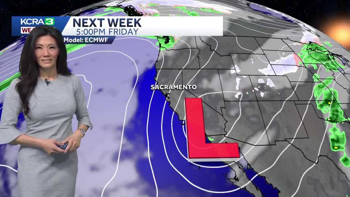
While the low exits east quickly, it will sink into the Intermountain West before retrograding west to Southern California. As a trailing Pacific high moves north of the low, a blocking pattern may form, bringing breezy north winds to the Valley for the rest of the week and into the weekend. Those north winds will usher in a warming trend, with highs returning to the 70s next weekend.