
Current climate models may be underestimating carbon emissions from soil fires, according to research published by UC Berkeley postdoc Johan Eckdahl in affiliation with Lund University.
While studying wildfires in Sweden, Eckdahl and his colleagues found that current methods don’t completely account for emissions from deep, flammable soil layers. In response, they developed a new method for estimating emission rates.

Johan Eckdahl | Courtesy
“Instead of just above ground, where you can see it … you can have fire happening below ground … and that can release a lot of carbon as well,” Eckdahl said. “I think what the (research) paper brings, in terms of novelty, is mostly being able to estimate with high spatial precision where the carbon is coming from, which is something that was previously very hard to do.”
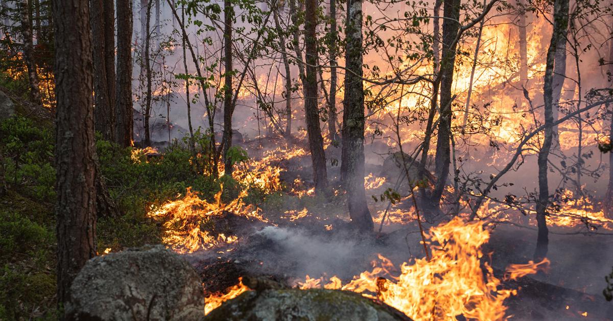
Fires in the boreal region of Sweden differ considerably from the vegetation fires typically associated with forest fires, according to Eckdahl. Boreal forests account for 27% of the world’s total forest area, and are primarily composed of pines, spruces and other similar tree species.
Belowground fires from carbon-rich soils drive carbon dioxide emissions, a greenhouse gas that accounts for 74% of climate change emissions. As a result, current models that prioritize large, visible fires underestimate soil emissions, which are less apparent.
“A lot of specialists know that the methods we use aren’t really well calibrated for the boreal region,” Eckdahl said. “If we still try to use them, it’s because it’s hard to do anything else … This (paper) is quantifying how these current monitoring methods can be off … while proposing a few new ways to improve our ability to monitor the emissions.”
To measure carbon emissions that emerge from soil layers, Eckdahl and his co-authors Lars Nieradzik and Louise Rütting collected samples from 50 field sites, comparing burned and unburned soil. The difference in carbon content between these samples was used to determine how much carbon dioxide was released into the atmosphere.
The research team compared their findings to six global emissions models, accounting for variation in carbon content. Some of the emission rates they calculated were four times higher than previous estimates, particularly in areas with deep organic soil layers such as Dalarna, a county in Sweden.
Eckdahl’s research suggests the benefit of combining satellite data with field studies from land managers and researchers. Integrating different perspectives would provide a more holistic understanding of carbon storage in “a changing boreal landscape.”
“Our development of knowledge is kind of going back and forth between ideas and numbers until we stabilize some certainty around it,” Eckdahl said. “The scientific process is not separate from that.”
According to Xu Feng, a postdoc researcher of wildfire behavior at UCLA’s Fielding School of Public Health, Eckdahl’s research linking environmental conditions and field observations to carbon emissions can be applied to other fire-prone areas and to management decisions.
“Future research could focus on applying this approach across different boreal regions and integrating more satellite and field observations,” Feng said in an email. “Even though the fire regimes and fire types in the western U.S. differ from those in Sweden, linking fine-scale environmental conditions and detailed field observations to fire emissions is very helpful.”