
BAKERSFIELD, Calif.(KBAK/KBFX) — As the part of the Pacific Ocean closest to our area continues to be a high-pressure factory, there is and has been no sign of storminess for close to a month. Instead, quiet weather has been the rule across southcentral California, only interrupted a few times by a few clouds, sprinkles and occasionally windy conditions. It’s hard to believe that we’re still in what is considered the “rainy season” for this part of the world.
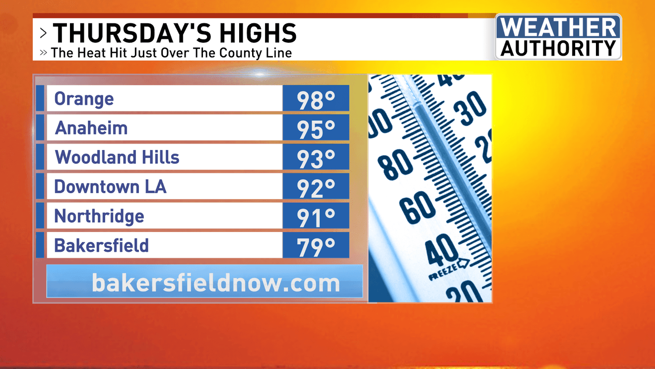
Summer-like heat has hit SoCal already, with widespread 90s blanketing millions of residents just over the county line, as a rare and long-lasting hot spell for this time of year has begun.
Friday saw afternoon temps back into the 90s for many of the same areas as the first upper-level ridge of high pressure, along with a surface high to the north, form enough offshore flow to further heat up the air on the coastal-facing sides of the mountain ranges.
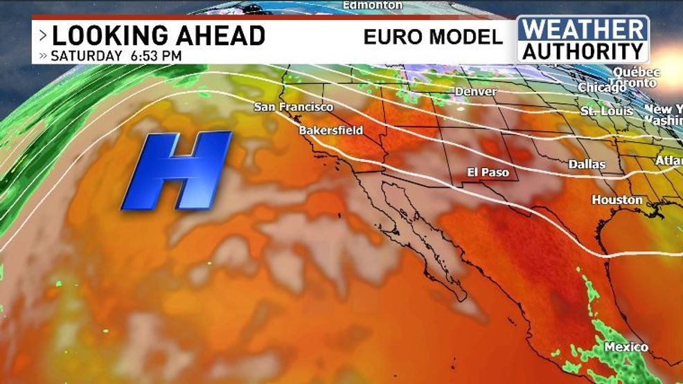
Saturday may see a “slight” reprieve in temps over the Southland and even a tiny dip in highs over Kern County as the first ridge slides away.
Waiting in the wings will be a second upper-level high that is currently progged to build in from the tail-end of the weekend on into next week. It’s this high that will be part of the atmospheric equation to send Kern County temperatures real high. Stay tuned…
Comment with Bubbles
BE THE FIRST TO COMMENT
Chief Meteorologist Ilya Neyman