
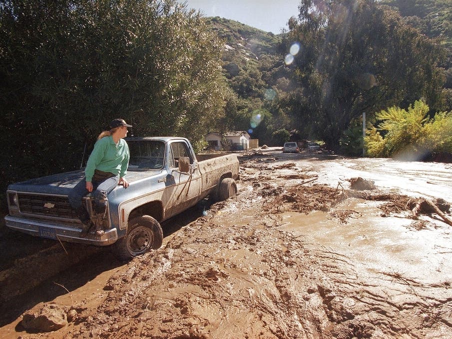
SAN DIEGO, CA — Scientists have proclaimed El Niño is coming back, and this time, it’s returning with a vengeance. The seasonal weather anomaly is being dubbed Super El Niño, and in some cases, Godzilla El Niño, which could trigger weather-related disasters and monstrous heatwaves in California during the 2026-2027 weather season beginning late summer or fall. Strong El Niño years have historically seen torrential winter storms, flooding and coastal erosion in the Golden State.
Over the past two decades, the name El Niño has become synonymous with extreme weather. El Niño occurs when there is a change in the Pacific Ocean’s typical pattern of water movement, temperatures and air flow, which happens about every two to seven years.
Already, scientists are seeing elevated surface sea water temperatures in the Pacific Ocean, a sign that El Niño conditions are building.
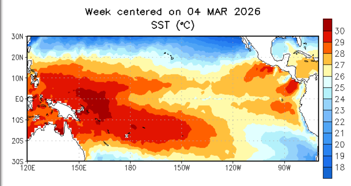 The National Weather Service Climate Prediction Center charts rising temperatures in the Pacific Ocean.
In California,El Niño’s winter impact is usually strongest, bringing high tides, flooding and powerful snow and rain storms.
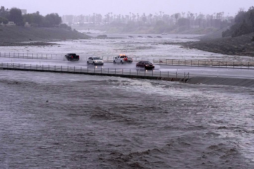 Vehicles cross over a flood control basin that has almost reached the street, Sunday, Aug. 20, 2023, in Palm Desert, Calif. Scientists figure a natural El Nino, human-caused climate change, a stubborn heat dome over the nation’s midsection and other factors cooked up Tropical Storm Hilary’s record-breaking slosh into California and Nevada.(AP Photo/Mark J. Terrill, File)
El Niño doesn’t usually lead to higher temperatures in the summer, but this year it could lead to record global temperatures.
One of the leading weather forecast models recently calculated a 62 percent chance that a strong El Niño could develop in the summer. Some other models predict the chances of a moderate El Niño occurring in the late summer or fall are about 98 percent likely.
Forecasters have been surprised how quickly the weather models have changed within just a few weeks.
Shang-Ping Xie, a climate science professor at University of California at San Diego, and climate scientist at the Scripps Institution of Oceanography, has tracked and documented El Niño and La Niña for years. About a month ago, he noted that forecast models showed several possible outcomes which have since changed, the San Francisco Chronicle reported.
There is a larger consensus that a moderate to strong El Niño will develop by the end of the summer.
Both Northern and Southern California are already getting a taste of unusually hot weather, which could break records between Thursday and Tuesday, forecasters said.
“Many high temperature records are likely to be tied or broken on Thursday and Friday,” the National Weather Service said in a statement Wednesday forecasting Southern California temperatures. “There will also be some record warm overnight temperatures on Thursday, mainly for the mountains and inland valleys, with many more on Friday.”
“High temperatures on Tuesday will be as much as 25 to 30 degrees above average for the mountains, inland valleys and high desert, with high temperatures ranging from around 80 near the coast to the mid 90s to 102 for the inland valleys, with the lower deserts reaching 102 to 106,” according to the Weather Service. “Some locations in the lower deserts could exceed their all-time record high temperatures for March.”
El Niño Summer And Fire Danger
The National Weather Service has not issued any fire weather alerts yet, but Cal Fire/Riverside County Fire Department, for example, says it is continuously monitoring weather patterns and seasonal outlooks.
National Weather Service forecaster Paul Stewart said more offshore flow is possible later this year, leading to higher temperatures. That drier weather does mean a higher risk of wildfires. However, the region has experienced generous rainfall that may reduce fire risk if a stronger El Niño comes to fruition later this year.
Southern California’s current heat wave is abnormally high for this time of the year, according to data from the National Weather Service. By comparison, during the same time last year, the area highs peaked in the upper 50s to low 60s, according to temperature charts.
In Northern California, A heat wave caused by a strong ridge of high pressure could bring temperatures as high as 90 degrees in some areas by next week — possible record highs. Highs over the weekend and early next week are expected to be 20 to 30 degrees above seasonal averages, according to the National Weather Service.
While fire danger is a year-round threat, especially in the summer and late fall, fire officials say residents can help reduce wildfire danger by taking the following steps:
Create and maintain 100 feet of defensible space around homes by clearing dry vegetation and debris.Ensure roofs and gutters are free of leaves and pine needles.
Use fire-resistant landscaping and building materials whenever possible.Prepare a family evacuation plan and stay aware of local emergency alerts.Be mindful of activities that could spark a fire, especially during periods of hot, dry, or windy weather
City News Service and Patch Staffer Michael Wittner contributed to this report.