
BAKERSFIELD, Calif. (KBAK/KBFX) — A MARATHON OF HEAT
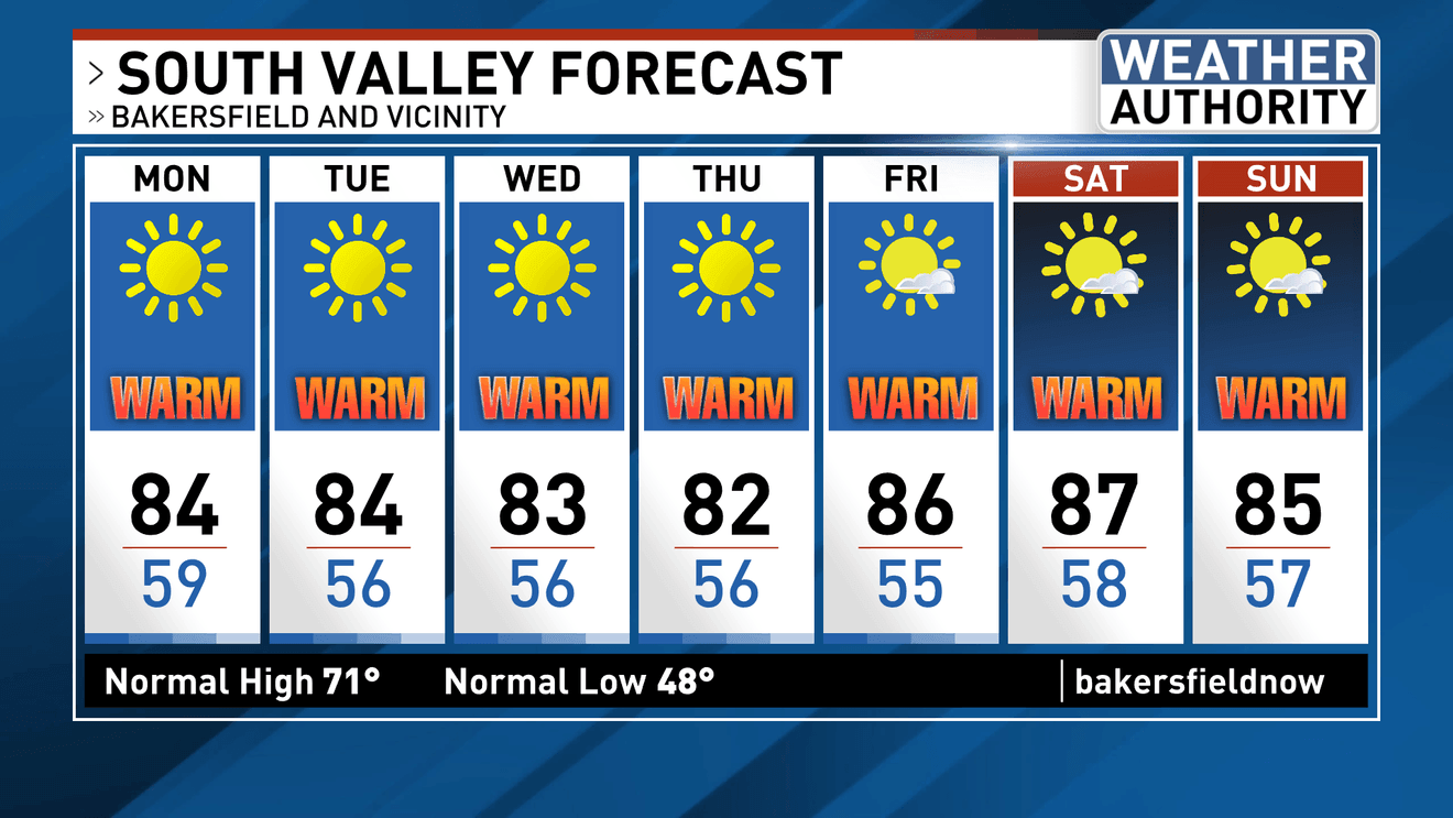
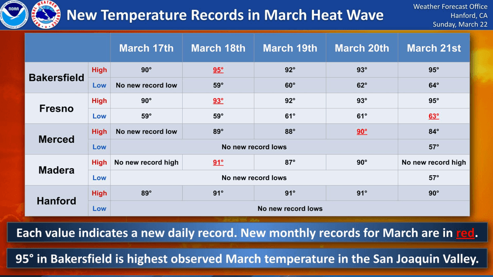
Spring is just 3 days old, but SUMMER-LIKE HEAT began in earnest last week. Old records fell, being replaced by new ones day after day beginning last Tuesday. 95 degrees in Bakersfield, a reading that wasn’t observed in 133 years of continuous record keeping during March was felt not once but TWICE 3 days apart on Wednesday and then again on Saturday! Sunday topped off at 88, beating the old record for the day of 86 by 2 degrees.
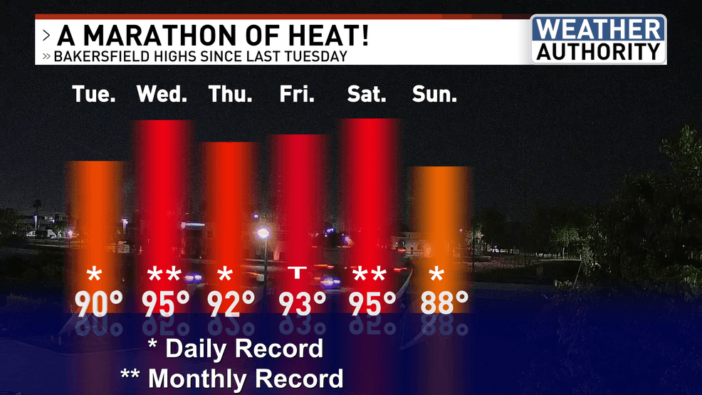
The airmass was so uncharacteristically warm for this time of year that thermometers were recording highly anomalous warmth even before the sun even came over the horizon during the early morning hours with record max minimums (record high low temperatures) registering every night/morning since Wednesday!
It has truly been exceptional.
THE WARMTH PREVAILS IN THIS WEEK’S FORECAST
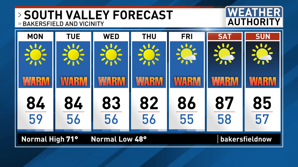
Little change in the overall weather pattern as we head into this new week means another ridge of high pressure and more opportunities for warmth with one major exception: this time the heat may be JUST under historical records. A week of 80s is in the forecast and while this would still be up to 15 degrees higher than “average”, it’ll be cooler than the last several days of winter were around here (last week).
SO FAR SO DRY
With a week and a half to go until April it’s looking increasingly likely that March 2026 could go do down with NO MEASURABLE RAINFALL WHATSOVER in Bakersfield’s official rain gauge. A pattern change is looking more likely heading into early April which could lead to a different atmospheric scenario at that point, but until that timeframe our forecast continues to be: high and dry with very few clouds in the sky.
Comment with Bubbles
BE THE FIRST TO COMMENT
Chief Meteorologist Ilya Neyman