
On April 25, dozens of bike riders will meet in West Oakland to ride together for the annual Trails Day ride, which highlights the East Bay’s abundant trails in nature reserves and along local roads.
This year, Bike East Bay and the event’s other organizers are focusing the day’s advocacy efforts on pushing forward a potentially game-changing project that would transform bike and pedestrian access to San Francisco: the Bay Skyway.
The biggest goal of the ride, the organizers told The Oaklandside, is to jumpstart momentum for the project among state, regional, and local legislators so that it gets the hundreds of millions of dollars needed to complete it — before they all get too old to ride.
For now, John Goodwin, the communications director for the Metropolitan Transportation Commission, told The Oaklandside, the West span path part of the project is “effectively paused” in the early planning stage. He said the soonest work on the project can advance is 2027.
“Future stages would include development and submission of Environmental Impact reports; submission of a Project Report; detailed design work; and right-of-way acquisition. All of these steps — to say nothing of securing money! — must be completed before construction can begin,” Goodwin said by email.
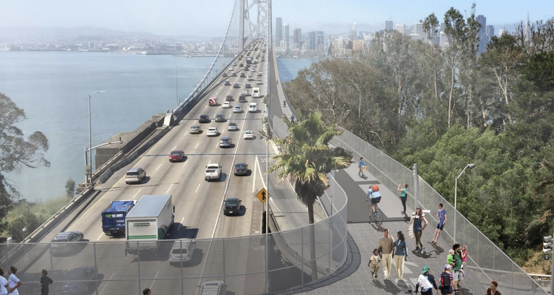
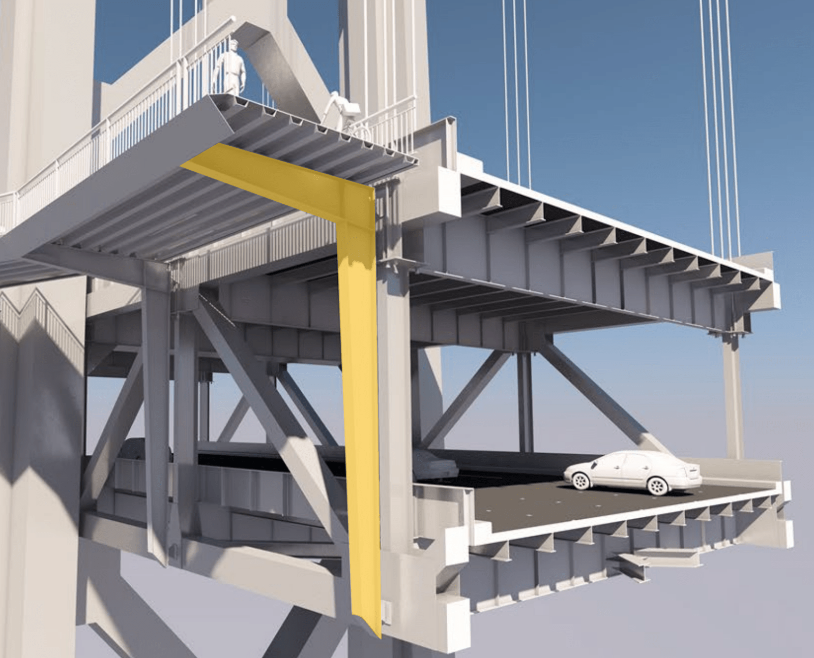
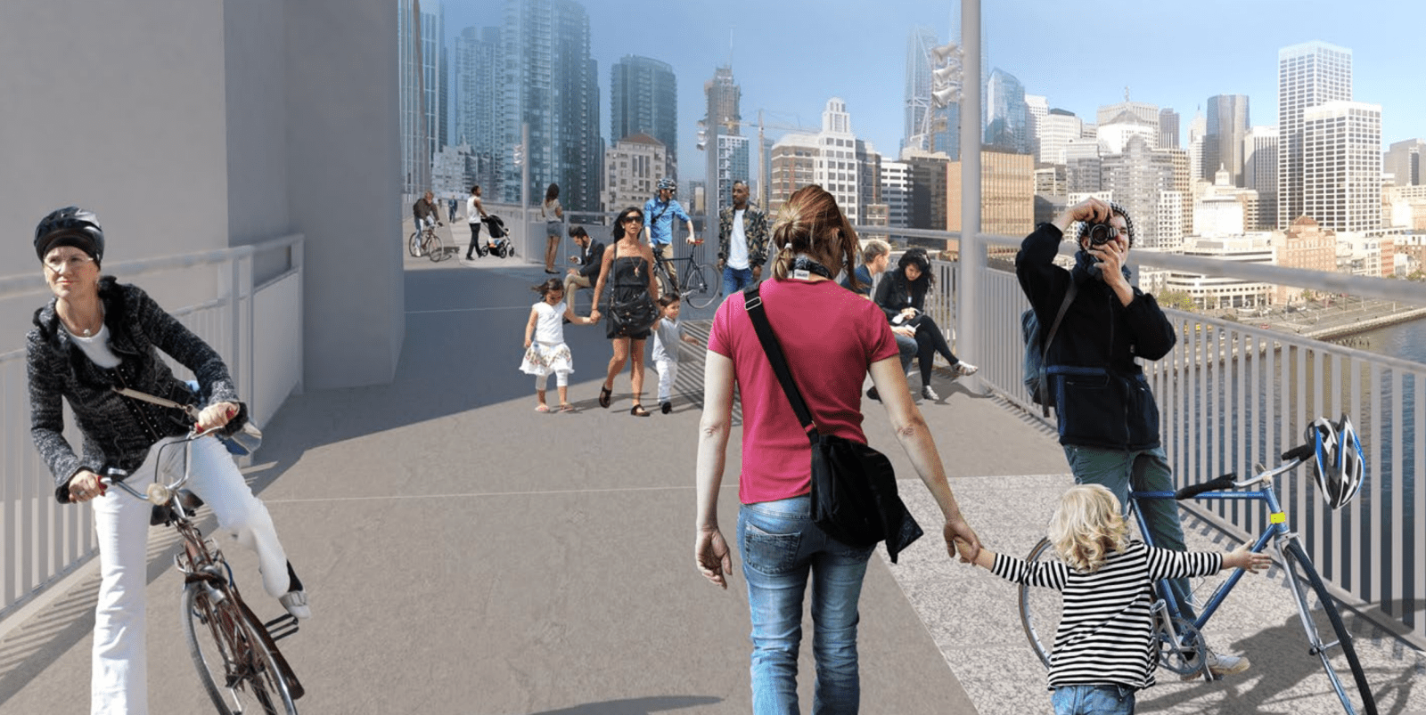
 The design, by the Arun firm, shows a 15-foot path right next to the road on the Bay Bridge, rather than an elevated walkway above it. Source: Arup Design and Engineering
According to Robert Prinz, Bike East Bay’s advocacy director, legislators “get surprisingly little direct correspondence from constituents on most issues, so anything we can do to activate folks and encourage them to get more engaged makes a big difference.”
Prinz said a recent Emeryville City Council vote to approve a 40th Street cycle and walking track was a good example of such advocacy. Most people who showed up at the March 17 council session in-person opposed the project — but council members voted in favor because, Prinz said, most people who reached them in advance supported the project, giving them “more confidence to approve the construction.”
“Some of those comments were ones that we helped encourage, by sharing out info about the project and info on how individuals can get involved,” he said.
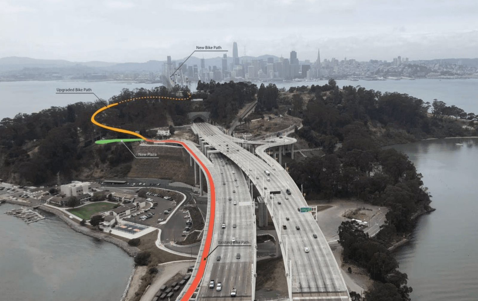
 The path in the upper left, as shown in a design rendering, would drop people off at Essex Street in San Francisco, according to an early design. Source: Arup Design and Engineering
Plans for Bay Skyway show a 15-foot-wide path that is separated from the main vehicle lanes on the Bay Bridge. It will connect to the eastern span of the Bay Bridge, whose bike lane opened in September 2013, via paths on Yerba Buena Island — with spur paths onto Treasure Island as well. Bike East Bay held an inaugural ride that year to celebrate the Oakland to Treasure Island path, which is why the Trails Day ride has been called an “anniversary ride” in the years since.
The path of this April’s ride will take the cyclists onto the Bay Bridge and back, then to the Bay Trail next to Berkeley and Emeryville, continue onto the Albany Bulb, and end at Berkeley’s Sports Basement.
The latest design for the western span, completed by the Arup, an engineering and design firm in 2018, was originally estimated to cost up to $400 million, including full design and construction. But the estimate has gone up to $500 million for the western span and up to $700 million for the whole project that includes other paths. The price jump, Goodwin, the MTC spokesperson, and Gavin Lohry, an MTC staffer who is the bikeway project’s program coordinator, told The Oaklandside, is due to inflation and rising material and construction costs.
That $700 million includes the costs of the entire Multimodal Bay Skyway project: the western bridge span, called the Yerba Buena Island Multi-Use Pathway Project, and the West Oakland Link, which will connect the bridge path into West Oakland along West Grand Avenue and beyond. Goodwin said that $200 million is secured, with $500 million left to go.
“Money almost always is the biggest question about major transportation projects, and the funding pie for virtually all such projects includes a mix of local, regional, state, and even federal slices,” Goodwin said. “We recognize the huge gap between conception and construction. But there is not yet a plan for how to fill this gap and it’s way too early to speculate about specific fund sources. An eventual funding plan may include private support as well as public dollars.”
Goodwin further noted that, given funding availability for all projects, the top priority for bridge projects is simply to keep them in good repair.
 The path would drop people off at Essex Street in San Francisco, according to an early design. Source: Arup Design and Engineering
According to a summary document of the project presented to the Oakland BPAC by the Bay Trails Collaborative, which manages the Bay Skyway and the entire pathway connections network, securing funding involves “advocacy with elected officials, and identification of new and diversified streams of funding (grants, foundations, corporate giving).”
The collaborative includes the city of Oakland, the SFMTA, the Metropolitan Transportation Commission, the Bay Area Toll Authority, Caltrans, the Alameda County Transportation Commission, and the Bay Area Air Quality Management District.
The ride is also a chance to convince the Bay Trails Collaborative to open the eastern span of the Bay Bridge pathway 24/7, as it currently closes at 9 p.m. each day. Bike East Bay has invited a representative from the Metropolitan Transportation Commission to answer cyclists’ questions about any of these projects before and after the ride.
Possible pollution risks
 The Skyway, as reflected in a design rendering, would offer great views of San Francisco, but would also place people right next to thousands of cars. Source: Arup Design and Engineering
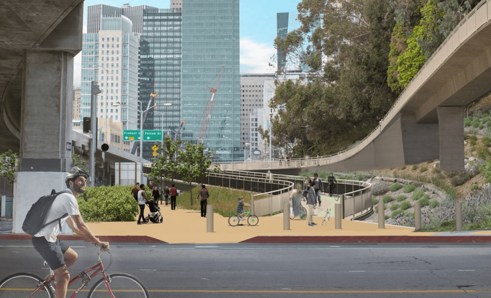
The Bay Skyway’s westbound bridge section is the cornerstone of a larger project that will further extend bike and pedestrian connections through the West Oakland Link, an elevated pathway that will lead into the Oakland Port, then into West Oakland to West Grand Avenue.
The West Grand Avenue project, scheduled to begin construction later this year, will renovate the old arterial road, replacing paving and adding bike lanes from Mandela Parkway to Maritime Road. According to Prinz, the city is currently preparing a grant application to the state’s Active Transportation Program that proposes a fully protected bikeway from Telegraph Avenue to Mandela Parkway and potentially from Mandela to Broadway as well. That stretch could someday connect to the Grand Avenue project, which the city is also in the process of securing funding, would add car-slowing infrastructure, such as pedestrian islands, as well as new protected bike lanes, north of Lake Merritt.
Prinz told us another goal of the April trail ride is to inform people about other major bike-and-pedestrian connectivity projects in the offing, as part of its Bridging the Bay campaign. These include an elevated pathway on 7th Street being built by the Port of Oakland and Emeryville’s 40th Street Multimodal Project, which will include a protected bikeway that will run west of the city border from Adeline Street to the Bay Bridge trail entrance.
All these projects are expected to link up, to allow cyclists to travel easily from the lake to the bridge and into the city.
Even with years of advocacy work ahead, the potential to someday ride from Oakland’s famous jewel lake all the way to San Francisco’s Embarcadero makes some of Oakland’s most hard core cyclists giddy.
Getting there may be a bumpy road. The Yerba Buena Island Multi-Use Pathway, for one, still needs to be completed. The San Francisco County Transit Authority says that should happen in summer 2028.
An environmental review is also needed to assess the potential effects of pollution on people walking or biking over the bridge right next to heavy car traffic. A brisk walk on the eastern span of the bridge today takes about 35 to 45 minutes one way; once the Yerba Buena path and the Western Path are completed, it might take close to 90 minutes or more to cross the whole bridge.
Former West Oakland Environmental Indicators Project co-director Brian Beveridge had previously said that his group had raised questions to the collaborative about human exposure to vehicle emissions, especially particulate matter that has deleterious effects when it enters the lungs. In 2022, the WOEIP was working on adding signs to the current Eastern span to warn people about their potential exposure levels. The WOEIP told the Oaklandside today that those signs are still not up on the Eastern span.
Last month, the Oaklandside reported on another project, the Prescott Greening Project, that seeks to reduce particulate matter exposure for West Oakland residents. That project is adding shrubs and trees between the freeway and residential neighborhoods to capture much of that pollution.
Horticulturist Tom Ogren told us that the areas closest to freeways, which he calls “dead zones,” are the “least healthy places to live.” Previous academic work has found that living within 500 feet of a freeway poses the greatest risk, especially for older folks, but few studies have examined the risks of temporarily biking or walking next to one. The bike-and-foot pathway on the Bay Skyway will be right next to the exhaust from up to 100,000 daily drivers.
“*” indicates required fields