
The Brief
The main source of California’s water supply is not looking good. The Sierra snowpack measurements are at the second-lowest amount of snow ever recorded.
The recorded levels at Phillips Station trail only 2015.
One water agency spokesperson said if this continues, this could be the beginning of a drought.
SAN JOSE, Calif. – California’s primary water source is facing a dire outlook following official snowpack measurements taken Wednesday in the Sierra Nevada. The survey revealed the second-lowest snow levels ever recorded, sparking warnings of a potential return to drought conditions.
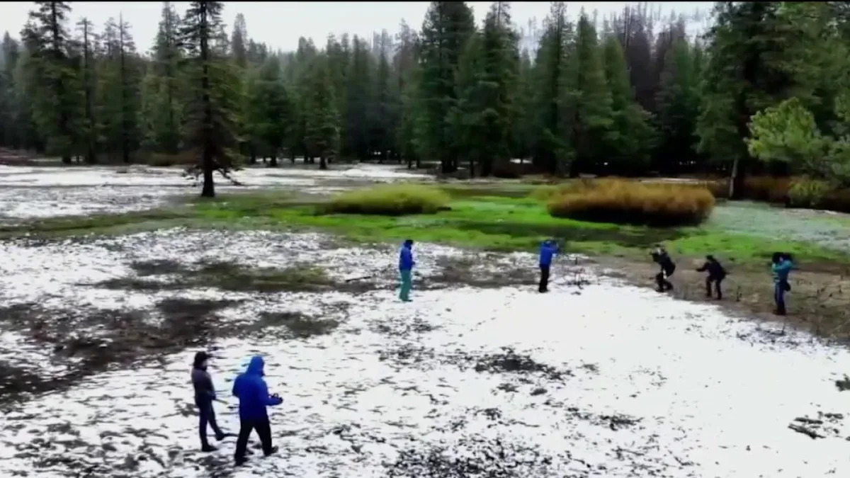
Concerning snow totals
At Phillips Station in El Dorado County, officials from the California Department of Water Resources (DWR) conducted their critical April snow survey only to find a total absence of snow. The official measurement recorded zero snow and zero water content.
“We measured today, but there was actually no measurable snow,” said Andy Reising, manager of DWR’s Snow Surveys and Water Forecasting Unit. “Our instruments aren’t able to pick up any snow, so we are calling today’s measurements zero.”
The recorded levels at Phillips Station trail only 2015 for the lowest in state history. Officials noted that 2026 only avoided the bottom spot because of a visible trace of snow that was too thin to formally measure.
“This was obviously a below-average year,” Reising said.
Dependency on Sierra Nevada runoff
The implications stretch across the Bay Area, where regional water supplies depend heavily on Sierra Nevada runoff. While San Francisco and parts of the Peninsula utilize the Hetch Hetchy system, much of the East and South Bay rely on a network of federal and state reservoirs, including Lake Shasta and Lake Oroville.
Local officials are characterizing the results as a wake-up call.
“At this particular moment, I will call it a warning sign,” said Aaron Baker, chief operating officer for Valley Water. Baker’s agency is the wholesale water retailer serving approximately 2 million residents in Santa Clara County.
‘This is how drought begins’
Baker noted that while several previous wet years allowed the agency to fill reservoirs and replenish groundwater supplies, the current trend is concerning.
“This is a year where we are doing fine, but if this continues, this is how droughts begin,” Baker said.
Statewide, the snowpack currently stands at just 18% of average for this date. Furthermore, water officials expressed concern that the existing snowmelt is occurring more than a month earlier than normal.
DWR Director Karla Nemeth attributed the shortage to unseasonably warm weather.
“Most of our precipitation, which is just below average, came as rain,” Nemeth said. “It is the combination of rain, limited snow and warmer temperatures in March which are setting us up for what will be a challenging year for water management.”
According to state data, the average low temperatures from October through February — the peak window for snow accumulation — were the highest recorded since 1896.