

Stephen Leonardi / Pexels
![]()
![]()
–
Senior Staff Writer
·
April 6, 2026
The California Coastal Trail (CCT) is an ambitious public project dating back to 1975, aiming to create a network of public trails stretching from the Mexican border in the south to the Oregon border in the north.
Numerous California agencies have worked steadily for decades to develop the 1,230-mile CCT, which is currently about 70% complete, with sections including paved sidewalks, hiking paths, bike lanes, and occasional road shoulders.
While construction is ongoing, much of the trail is already hikeable. Here’s a closer look.
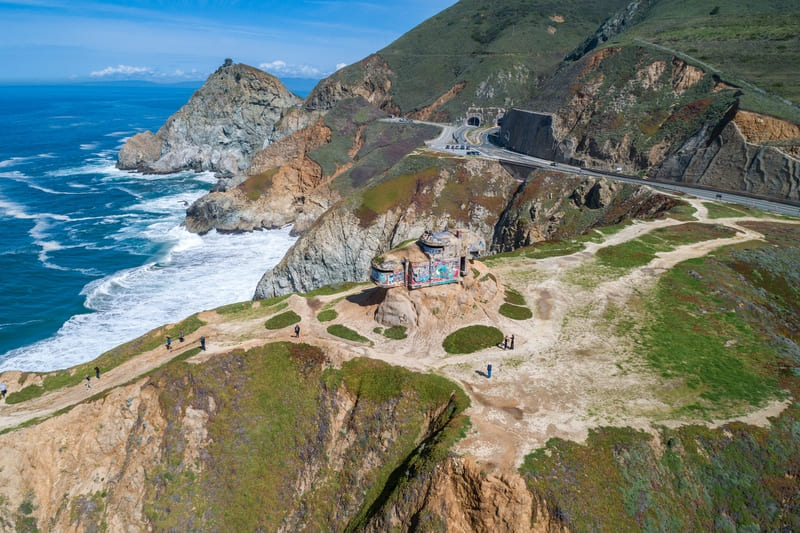 Devil’s Slide, California. Photo by Photosounds via Shutterstock
California Coastal Trail project overview
The 1975 California Coastal Plan first introduced the idea of a continuous trail along the California coast. However, it wasn’t until 1999 that Governor Gray Davis officially designated the trail as California’s “Millennium Legacy Trail,” prompting more significant efforts and legislation.
The California Coastal Trail Association has collaborated with key agencies, including the California Coastal Conservancy, California Coastal Commission, California State Parks, and Caltrans, to make the trail a reality. Their shared mission is to ensure public access along the full coastline, promote environmental awareness and stewardship, and encourage outdoor recreation.
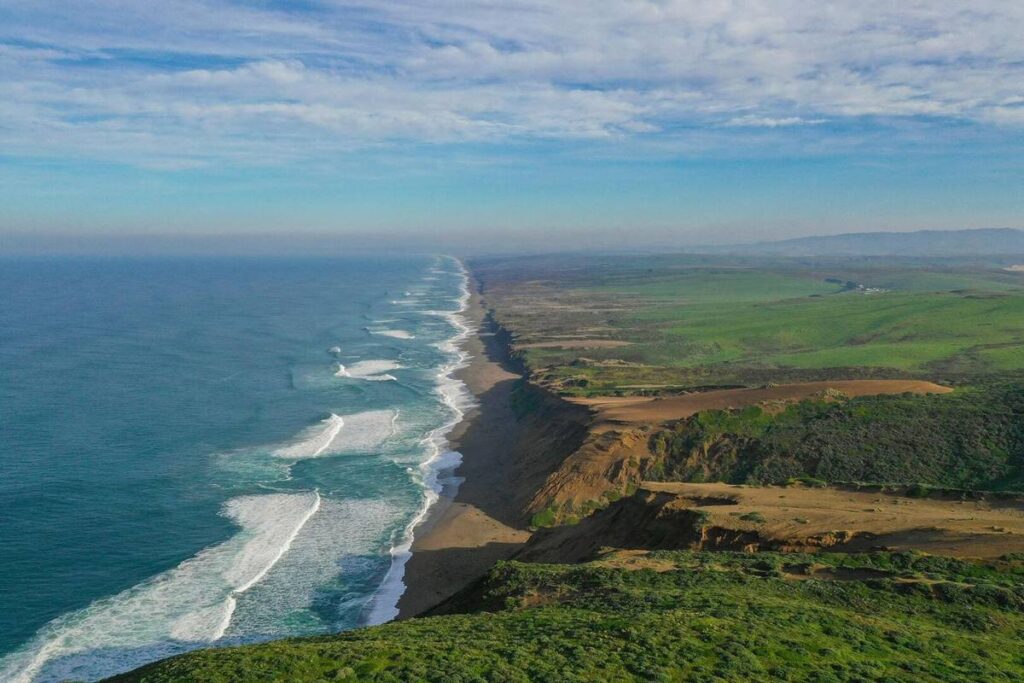
Rather than a single route, the “trail” is a network of connected paths that can serve a range of travelers, including cyclists, hikers, and people with mobility limitations. Terrain varies from challenging hiking trails to smooth, accessible sidewalks, through iconic scenic points including Point Reyes, the Presidio, Devil’s Slide, and Piedras Blancas.
About 875 of the CCT’s planned 1,230 miles are now complete, which is approximately 70%. There is no official or estimated completion date for the full length of the trail, which faces funding constraints and disputes over private and public land.
 Torrey Pines, San Diego, CA. Photo by Patrick Fore via Unsplash
Hiking the CCT today
If you’re interested in hiking the CCT, remember that it’s still a work in progress and requires extensive planning. Bring a GPS or a detailed map to navigate incomplete sections and remote areas. Some segments require permits to pass through or timing with the tides.
Think you’re up for the challenge? Be sure to consult these essential planning resources before setting out on your CCT adventure!
CaliforniaCoastalTrail.org – The nonprofit Coastwalk/California Coastal Trail Association manages this dedicated website with detailed route descriptions, videos, photos, hiker-written guides, and more.
California State Coastal Conservancy – The State of California offers an interactive California Coastal Trail map, which is useful for trip planning and finding accessible sections.
Local and regional park websites – Your journey along the CCT will likely pass through state and local parks. Visit their official websites for updates on trail conditions and closures.