
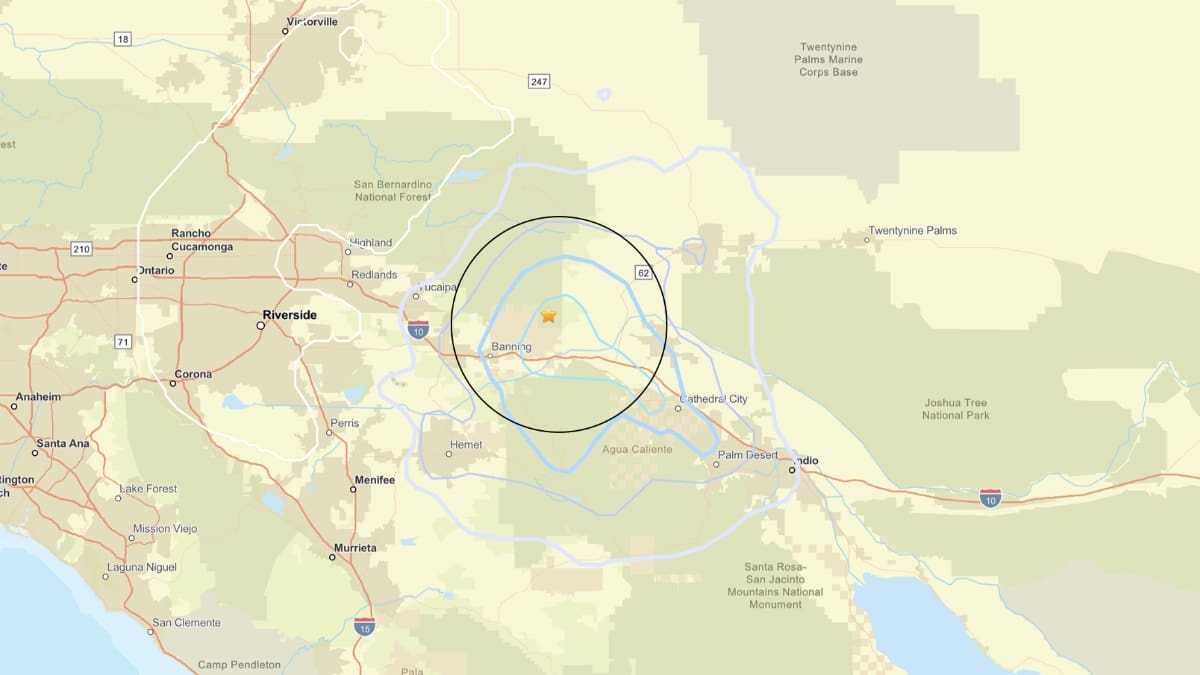
At least four earthquakes rattled California on April 27, 2026.
While some of the quakes were minor, the largest struck near Cabazon in Riverside County.
The 3.4-magnitude earthquake at 8:44 a.m. on Sunday, around 10 kilometers north-northeast of Cabazon, according to the U.S. Geological Survey (USGS). The tremor struck at a depth of around 12.8 kilometers.
The seismic event led to significant shaking, with more than 360 people reporting having felt the earthquake on the USGS’s ‘Did You Feel It?’ reporting tool.
People reported experiencing the tremor from as far as South Pasadena, which was roughly 129 kilometers from the epicenter, and Escondido (nearly 105 kilometers from the epicenter).
The quake was felt in more cities and towns close to the epicenter, including Banning (14.3 kilometers), Morongo Valley (16.5 kilometers), Garnet (21.9 kilometers), and Palm Springs (28.3 kilometers).
More than 100 ‘Did You Feel It?’ responses were submitted from Palm Springs, where the quake was categorized as Level III on ShakeMap.
Overall, the earthquake was categorized as Level IV on USGS’s ShakeMap, which indicates light shaking and no damage.
ShakeMap provides more information about an earthquake, beyond its magnitude and location. It is useful in understanding the extent of the areas affected and portrays the severity and distribution of shaking.
A few seconds after the 3.4-magnitude earthquake, Cabazon was rattled by another minor quake.
A 1.9-magnitude quake struck near 10 kilometers north-northwest of Cabazon at 8:45 a.m. The quake occurred at a depth of 12.7 kilometers.
Two persons reported experiencing the shaking on USGS’s ‘Did You Feel It?’ reporting tool. The responses were recorded near Palm Springs and Cathedral City.
The seismic event was categorized as Level II on ShakeMap, which indicates weak shaking and no damage.
No damages were reported from either of the events.
The earthquake was caused likely due to the San Andreas Fault, which runs from the Gulf of California north to the region of Cape Mendocino, according to the USGS.
The 2003 Working Group for California Earthquake Probability assigned a 21% chance of the San Andreas Fault producing a magnitude 6.7 or larger quake in the next 30 years.
More Minor Earthquakes on Sunday
A 2.6-magnitude earthquake was recorded at 8:19 p.m. 42 kilometers west-northwest of Trinidad in Humboldt County. The quake struck at a depth of 0.7 kilometers.
The tremor was also felt in Westhaven-Moonstone (45.4 kilometers from the epicenter), McKinleyville (50.8 kilometers), and Arcata (57.4 kilometers).
No responses were submitted about people feeling the shake on the ‘Did You Feel It?’ reporting system.
A 2.3-magnitude quake struck 16 kilometers north of Borrego Springs in San Diego County. Occurring at a depth of 4.5 kilometers, the seismic event took place at 10:49 a.m. on Sunday.
The epicenter sits close to other cities, including Warner Springs (25.3 kilometers), Oasis (28.9 kilometers), La Quinta (30.7 kilometers), and Anza (30.9 kilometers).
No damages were reported from any of the earthquakes.