
Northern California forecast: Temperatures march upward through the weekend
The region is set for another warm day today, with high temperatures expected to climb higher than yesterday.
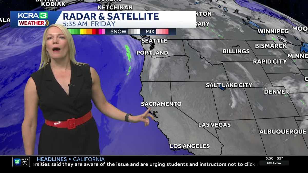
IT IS 549. BOY, IT IS GOING TO BE WARM. I THINK BORDERLINE HOT THIS WEEKEND. YEAH. AND YOU KNOW WHAT’S INTERESTING? USUALLY IN EARLY MAY IS TYPICALLY WHEN WE SEE OUR FIRST 90 DEGREE DAY OF THE YEAR, AROUND MAY 8TH TO BE EXACT. SO IT’S COMING IN RIGHT ON CUE, CONSIDERING THAT TODAY, OF COURSE, IS THE EIGHTH. THIS IS A LIVE LOOK OUTSIDE RIGHT NOW AS I TAKE YOU INTO RANCHO CORDOVA, A LITTLE BIT OF LOW CLOUD DECK OUT THERE. AND WE WILL SEE SOME OF THOSE LOW CLOUDS AROUND THE VALLEY FIRST THING IN THE MORNING AND THEN CLEARING BY LATE MORNING TEMPERATURES UNDERNEATH THAT LITTLE BIT OF A DELTA BREEZE AND SOME LOW CLOUDS, LOWER 50S IN SACRAMENTO AND STOCKTON. IT’S 55 RIGHT NOW. MODESTO 31 CURRENTLY IN LAKE TAHOE. AND THERE’S A NICE AND SHARP, STEADY DELTA BREEZE COMING ACROSS FAIRFIELD HERE AT TRAVIS AIR FORCE BASE. SUSTAINED WINDS 24MPH. FREQUENT GUSTS UP TO OVER 30. A LITTLE BIT OF A TASTE OF THAT SOUTH BREEZE IS COMING INTO SACRAMENTO, AND WE HAVE A LITTLE BIT OF A SOUTH WIND AS WELL, FLOATING ACROSS STOCKTON. IT IS GOING TO BE A BRIGHT AND VERY WARM WEEKEND, SO BRACE FOR THE HEAT AND THEN SPRING HEAT IS REALLY GOING TO PEAK EARLY NEXT WEEK. AND THAT’S WHEN WE COULD SEE POTENTIAL FOR SOME RECORDS TO FALL MONDAY, POSSIBLY INTO TUESDAY. LET ME TALK ABOUT THE WEATHER SET UP HERE. MOST OF YOUR ACTIVE WEATHER, YOU CAN SEE EXPANDING HERE ALONG THE PACIFIC NORTHWEST AND ALONG THE VANCOUVER COAST. WHILE OUR FORECAST HERE IS QUIET, BUT THAT BUDDING MARINE AIR IS CERTAINLY THERE. IF YOU’RE GOING TO SPEND TIME IN THE BAY AREA, ESPECIALLY TODAY, AS IT’S GOING TO BE STUBBORN TO BREAK UP A BIT, WE HEAD INTO SATURDAY HIGH PRESSURE, PRETTY MUCH THE DOMINANT FEATURE TAKING CENTER STAGE AS IT STARTS TO ENHANCE THE WARMING. IT IS GOING TO EXPAND MUCH LIKE YOU WOULD FILL AIR INTO A BALLOON. IT’S EXPANDING HERE AS WE LOOK OFF INTO THE DESERT SOUTHWEST, ESPECIALLY MONDAY AND TUESDAY. AND THOSE WILL BE THE HOTTEST DAYS. LOOKING AHEAD TO THE EXTENDED FORECAST, THIS SYSTEM, THOUGH, OFF THE COAST BY TUESDAY AFTERNOON, GETS READY TO PREP AND APPROACH OUR AREA AS WE GO THROUGH WEDNESDAY. THAT WILL ENHANCE THE DELTA BREEZE AND ALLOW THOSE TEMPERATURES TO DROP OFF. SO EVEN THOUGH WE ARE HEADING INTO SOME BUILDING HEAT, ESPECIALLY THROUGH THE WEEKEND AND BEYOND, IT’S NOT GOING TO LAST ALL THAT LONG INTO NEXT WEEK. SO IN THE FOOTHILLS, UPPER 70S TODAY WILL JUMP INTO THE LOW 80S SATURDAY AND SUNDAY 90 EXPECTED ON MONDAY. WE’RE STILL PRETTY TOASTY AT 88 TUESDAY AND IN THE SIERRA. SHOULD BE A BEAUTIFUL WEEKEND, ESPECIALLY IF MOM SAYS, I’D LIKE TO GO OUT ON THE BOAT ON LAKE TAHOE LOOKING GOOD FOR THAT. WE’RE LOOKING AT LOWER 80S IN THE SIERRA THROUGH THE WEEKEND AND FOR THE VALLEY. HERE WE GO. FIRST 90 OF THIS YEAR FOR SACRAMENTO, SLATED FOR SUNDAY AND MONDAY AND TUESDAY. THOSE ARE TOUGH TO LOOK AT. OUCH. UPPER 90S
Northern California forecast: Temperatures march upward through the weekend
The region is set for another warm day today, with high temperatures expected to climb higher than yesterday.

Updated: 6:12 AM PDT May 8, 2026
The region is set for another warm day Friday, with high temperatures expected to climb higher than yesterday.
As unseasonable heat continues to grow this weekend and next week, so will the heat risk.
Friday forecast
The morning will start off pleasant, with some low clouds and possible mist in parts of the valley.
Those clouds are expected to clear by late morning, giving way to full sunshine for the rest of the day.
Temperatures will run a bit warmer this afternoon, with highs peaking in the mid 80s.
More heat each day
The warming trend will continue through the weekend, when highs are expected to rise into the upper 80s and low 90s.
Expect a light and refreshing Delta breeze to return in the afternoons.
This early summer heat will last into the start of next week.
Warm Mother’s Day
Mother’s Day will be a warm one across the region, with 90s forecast for the first time this season in Sacramento.
The weather for morning brunch, however, will be very comfortable.
Growing heat risk
The hottest part of this stretch is expected to arrive Monday and Tuesday. Temperatures are forecast to run about 20 degrees above normal.
Monday, in particular, could push into record heat territory as highs approach the upper 90s.
With our first 90-degree days in the forecast, moderate heat risk will return to the Valley with a few areas of major heat risk.
It is important that we remember to drink plenty of water and try to rearrange outdoor activities for cooler parts of the day, in the morning and evening.
Foothills & Sierra 7-day forecast
In the Sierra, high temperatures will climb into the 80s, likely setting new daily record highs.
Valley 7-day forecast
Relief does appear to be on the horizon, with cooling expected to begin by late next week.
A disturbance will arrive mid-week to drop temperatures a few degrees.