
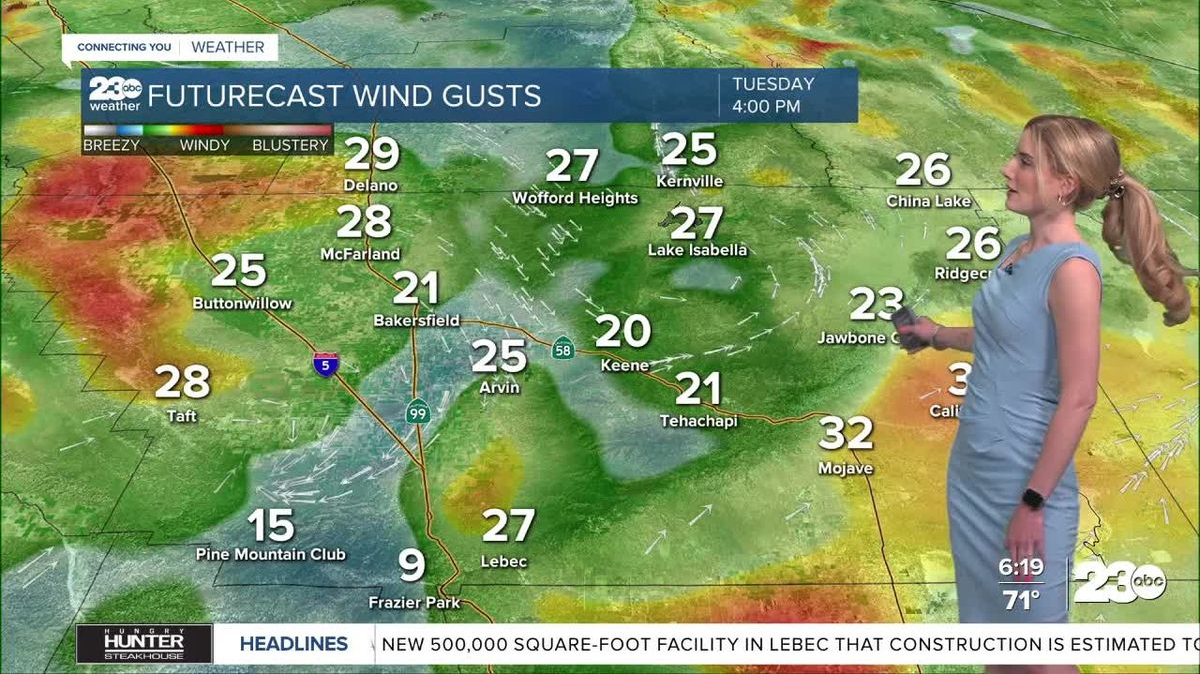
Bakersfield and the Kern River Valley face a dual threat of triple-digit temperatures and high-velocity winds on Tuesday, May 12, 2026, as a Heat Advisory remains in effect until 8 p.m. local time. Meteorologists from 23ABC report that a shifting weather system will introduce 35 mph gusts by early evening, significantly elevating regional fire risks.
High temperatures are projected to reach 101 degrees in Bakersfield, while desert areas are expected to surpass the 100-degree mark. Mountain communities will experience slightly lower but still unseasonable heat with afternoon temperatures nearing 90 degrees according to 23ABC forecasts.
A Wind Advisory has been issued for the I-5 corridor in Buttonwillow and the town of Taft starting at 5 p.m. Tuesday through early Wednesday morning. The onset of these winds is tied to a weak atmospheric system pushing cooler marine air toward the region, which is expected to lower temperatures by Wednesday.

The National Weather Service previously identified specific hazards for local reservoirs through a separate alert for the Eastern Sierra and Lassen regions. That agency highlighted the risk to recreation areas like Eagle Lake and Stampede Reservoir during the transition.
“Southwest winds 10 to 20 mph with gusts up to 35 mph for Stampede Reservoir, Lake Davis, Antelope Lake, and Eagle Lake,” informs the NWS.
Authorities warn that the combination of sustained heat and increasing wind speeds creates favorable conditions for the rapid spread of wildfires if a spark occurs. Residents are advised to maintain hydration and exercise caution during the peak heat hours on Tuesday afternoon.

Relief from the extreme heat is anticipated to arrive on Wednesday. Forecasts show Bakersfield dropping to a high of 88 degrees, marking an end to the current streak of triple-digit temperatures as the marine air settles into the valley.