
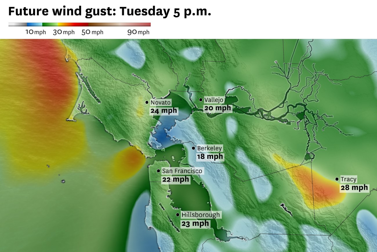
Winds will be gusty across the Bay Area on Tuesday afternoon.
Baron/Lynx
The Bay Area will turn cooler and cloudier this week as the marine layer thickens and a weak low-pressure system passes north of the region.
Early Tuesday observations showed low clouds concentrated along the coast, San Francisco, the Peninsula and parts of the bayshore, while inland valleys were still positioned for some afternoon clearing. That keeps the main forecast split intact with cooler and cloudier conditions near the water, milder inland and breezier conditions by late day as onshore flow strengthens.
On Tuesday, clouds will be hard to clear in the city and along the bayshore. Inland areas should still see some afternoon sunshine, but temperatures will step down from Monday’s brief warmup. Most inland neighborhoods will fall back into the 70s and lower 80s, while San Francisco, Oakland and the coast stay in the 60s to lower 70s.
Winds will become more of a factor as the day progresses. By Tuesday afternoon, most neighborhoods will see west or northwest winds around 10 to 25 mph, with stronger gusts along the coast and through gaps and passes.
Article continues below this ad
The bigger cooldown arrives Wednesday as the low moves inland across Oregon and Northern California. The system’s northern track now makes widespread rain less likely in the Bay Area, but it should still reinforce the marine layer and keep a chance of drizzle or very light rain in the forecast, especially along the coast and coastal ranges.
The midweek shift will look less like a rain event and more like a classic marine-layer surge: low clouds will spread inland, temperatures will fall closer to seasonal levels and onshore winds will strengthen each afternoon. A few coastal spots may wake up to mist, drizzle or very light rain Wednesday, but most neighborhoods should see clouds and wind rather than measurable rainfall.
San Francisco Chronicle Logo
Make us a Preferred Source to get more of our news when you search.
Add Preferred Source
Winds will become more noticeable. Breezy to gusty onshore flow is expected each afternoon and evening through late week, with gusts reaching 25 to 40 mph along the coast, through gaps and passes, and over ridgetops.
Article continues below this ad
By Thursday and Friday, drier west-to-east flow should return, with temperatures gradually moderating into next weekend.
Tuesday breakdown
San Francisco: Low clouds will return overnight and linger into Tuesday afternoon, especially in the Outer Sunset, Richmond, Twin Peaks and near the Presidio. Some afternoon clearing is likely east of Twin Peaks, but the marine layer will keep temperatures cooler than Monday. Highs will range from the upper 50s near Ocean Beach to the low and mid-60s downtown, in SoMa and in the Mission. West winds will increase to 10 to 25 mph during the afternoon, with stronger gusts near the coast and through the Golden Gate. Low clouds return Tuesday night, with patchy mist possible and lows in the low to mid-50s.
North Bay: Low clouds will fill in the the Marin and Sonoma valleys on Tuesday morning. Skies will be slow to clear as the day progresses, with partially sunny conditions in developing in the afternoon. Santa Rosa should reach the mid- to upper 70s, while Napa, Sonoma, Petaluma and San Rafael settle in the low to mid-70s. Farther inland, Vacaville should still be one of the warmer North Bay-adjacent spots, likely reaching the low 80s. Coastal Marin and Point Reyes will stay cooler, mostly in the upper 50s and 60s. Clouds return overnight with lows in the 50s.
East Bay: Tuesday will be cooler than Monday, but still mild inland. Oakland, Berkeley, Alameda and Richmond will be hard pressed to shake the cloud cover on Tuesday, with temperatures topping out in the mid- to upper 60s. Hayward and Fremont should reach the low to mid-70s. Inland, Walnut Creek and Pleasanton should reach the upper 70s to around 80, while Concord, Livermore and Antioch climb into the low 80s. West winds will increase during the afternoon, with gusts up to 25 mph near the bay, through the Altamont Pass and toward the delta. Mostly cloud again overnight with lows in the low to mid-50s.
Article continues below this ad
Pacific Coast and Peninsula: The coast will stay locked into the marine layer for much of Tuesday with Daly City, Pacifica and Half Moon Bay mostly in the upper 50s to low 60s. Mist or light drizzle is possible near the immediate coast early Tuesday. Farther inland, South San Francisco and San Mateo should reach the mid-60s to low 70s under partial afternoon clearing, while Redwood City and Palo Alto warm into the mid-70s if clouds clear quickly. West to northwest winds will gust 15 to 25 mph in the afternoon, strongest along the coast and through the San Bruno Gap. Low clouds return Tuesday night, with lows in the upper 40s to mid-50s.
South Bay and Santa Cruz: Morning clouds should fill in the South Bay, but clearing should be more reliable and happen more quickly than elsewhere. San Jose, Santa Clara and Cupertino should reach the mid- to upper 70s, while Los Gatos, Morgan Hill and Gilroy climb into the upper 70s to low 80s. Santa Cruz will stay cooler under marine influence, with highs near 70. Winds will be lighter than along the coast but will turn breezy from the northwest late in the day. Low clouds return Tuesday night near Santa Cruz and Monterey Bay, with lows mostly in the upper 40s to low 50s.