
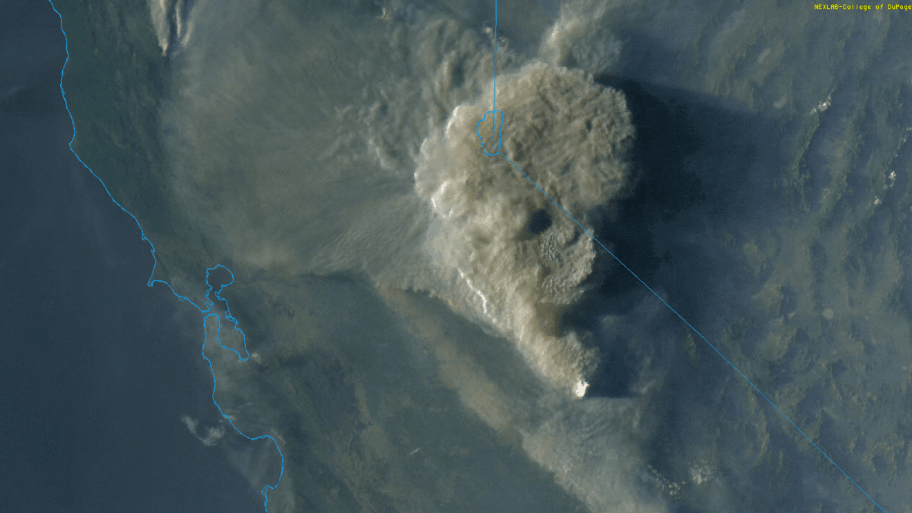
Spring sunshine is here and temperatures are heating up all over California. It was a very foggy winter in the San Joaquin Valley, and even though we didn’t see a lot of snow in the Sierra Nevada, our reservoirs are mostly full, thanks to near normal rainfall across the state. Now it’s time to look ahead and see what kind of fire season may be in store for us. We’ve got a Red Flag Warning for high fire danger in effect this weekend in the Central Valley, and that may be a sign of things to come: while individual lightning storms or gusty winds will be a strong factor later this Summer, the current situation of a very low Sierra Nevada snowpack and already a warm Spring is making our upcoming fire season look like a potentially very active one.
There are many things that can contribute to a bad fire season – drought, dry fuels, strong winds, and lightning are some of the major items, and often it takes a combination of those events, or one extreme one. Take 2008, for example. That April, we weren’t in a significant drought, and the Sierra snowpack from the previous winter was around average. Yet, the Summer of 2008 saw the 4th most acres burn in California history from wildfires. What happened? It was a combination of one significant and one extreme event that would’ve been difficult to see more than a couple of weeks ahead of time. Strong, drying, offshore winds (similar to Santa Ana winds) rapidly dried fuels out a couple of weeks before, then a vigorous but dry weather disturbance moved through northern California on the Summer Solstice (June 20th), and sparked more than 6000 lightning strikes. Since it was a dry system, there was very little rain with these lightning strikes, and they sparked more than 2000 fires!
One thing we can look at right now and analyze how it’ll impact our late Summer fire season are the fuels – grass, brush, trees – things that burn in a wildfire. Right now, they’re not exceptionally dry for this time of year, they’re ok. But a big red flag is the current snowpack in the Sierra Nevada. It’s almost gone, much earlier than normal, and that’s bad. Melting snow acts like ‘time released’ water for the forest – well after the rainy season is done, the forest continues to enjoy delayed irrigation from the melting snow, which keeps everything green. If you’ve ever tried to light a fire in your fireplace or at a camp site with green (wet) wood, you know it can be difficult – sometimes it just doesn’t want to burn. Lighting a fire with cured (dry) wood is often much easier, and the forest transitions from that wet wood in the Spring when there is still melting snow, to drier wood once the snowpack has melted off. The Sierra snowpack is melting off much quicker than usual, which will mean a longer period of dry conditions for the fuels – extra time for them to dry out.
Spring heatwaves and offshore winds are also effective in drying everything out. We had a BIG heatwave across California in late March, and May has been warmer than normal as well – which has contributed to melting the snowpack early and drying the fuels out. Winds are something else that can definitely dry us out, and we’ll see gusty winds this weekend – further drying us out.
El Nino is a bit of a wildcard for our fire season forecast. While how strong any El Nino we go into this Winter is still up in the air, it does look like we’re going into some kind of El Nino. El Nino is a warming of the Pacific Ocean off of the coast of South America, and a strong one can warm the water off of California, too. That warmer Pacific usually leads to a more active Pacific hurricane season, and while we don’t get struck with hurricanes in California, we do see their remnants pass through occasionally. The remnants of Hurricane Hilary in August of 2023 brought widespread thunderstorms to the southern Sierra Nevada and Mojave Desert – but they were wet thunderstorms, with plenty of rain. So thunderstorms from the remnants of Hilary started very few (if any) fires.
But if we go back a little further, thunderstorms from the remnants of Hurricane Olaf in September of 2021 sparked both the KNP Complex and the Windy Fire in and around Sequoia National Park. And Tropical Storm Fausto wasn’t a tropical storm for more than just a few hours in August of 2020, but thunderstorms from it’s remnants sparked the largest fire in California’s history, the August Complex – the only fire that has burned more than 1,000,000 acres. Fausto ALSO sparked our 5th largest fire (SCU Lightning Complex), 7th largest (LNU Lightning Complex), and 8th largest (Bear or North Complex).
So, whether thunderstorms will spark fires comes down to if they have rain or not – and forecasting that (and gusty offshore, drying winds) is a forecast that you can only make a week or so ahead of time.
But what we can look at are how dry the fuels are. With the snowpack essentially done, and with the rest of May continuing to look warmer than normal, fuels should definitely be drier than usual by the beginning of Summer. That’s not the only factor to consider, but it’s a big one, and it sure seems like this will be a busy fire season.