
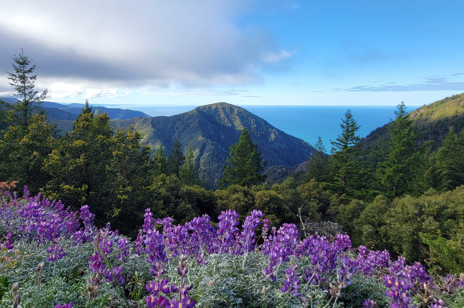
The King Range rises straight out of the Pacific in remote Humboldt County, home of the Lost Coast Trail.
Mishka Hamor / Bureau of Land Management
The White Mountains of Eastern California loom above a herd of wild horses grazing near Lee Vining.
Carlos Avila Gonzalez/The Chronicle
Last weekend, the Chronicle published an ode to the state’s must-climb mountains — the Seven Summits of California.
We sought a mix of essential experiences: Shasta, Lassen, Half Dome, Tam, Whitney, Baldy and San Jacinto. In keeping such a short list, we were bound to leave out some good ones. Emails from readers started flowing in: How could you have missed my favorite peak?
We asked people to chime in with their personal suggestions — and you did!
Article continues below this ad
Combing through dozens of responses produced 5 more worthy peaks, each showcasing the best of what California has to offer — from the coast to the High Sierra, with quick escapes and immersive wilderness adventures.
Mount Diablo, the highest peak in the Bay Area, looms above Walnut Creek.
Evan Wagstaff / For the S.F. Chronicle
Diablo
Rising 3,849 feet, Diablo is one of the highest points in the Bay Area, with great campgrounds, hiking trails, waterfalls, wildflowers, road biking, paragliding and a pyramidal profile visible from all over. Several readers advocated for it — and it did only narrowly miss the cut for our original list — offering a slew of persuasive arguments and fun facts.
San Francisco Chronicle Logo
Make us a Preferred Source to get more of our news when you search.
Add Preferred Source
Diablo’s summit was selected as the reference point for the first federal land survey of California back in 1851, readers noted. More waxed poetic about the incredible summit vista, with one reader claiming you can see into 40 of the state’s 58 counties from the historic stone watchtower on top, which is crazy!
Article continues below this ad
“On a clear day, you can also see a huge portion of the Earth’s surface,” wrote reader Rick Brown. “Shasta to the north, Sierras to the east, Tehachapis to the south and the Farallons (islands) to the west.”
Mount Tallac, near South Lake Tahoe, is one of the highest and most prominent points in the Tahoe basin.
George Rose/Getty Images
Tallac
One of the most prominent peaks in the Tahoe basin is Tallac, a steep pile of granite with a summit trail for hikers in the warm months and slopes that hold snow for backcountry skiers in winter.
Standing 9,738 feet in Desolation Wilderness, Tallac looms high above the sickle-like curve of South Lake Tahoe’s shoreline and looks directly down onto Tahoe’s neighbor, Fallen Leaf Lake. The popular summit trail is a 10-mile out-and-back that starts near Fallen Leaf and climbs 3,300 feet to the mountaintop — a proper day out.
Article continues below this ad
“Lots of lake views along the way … a hard climb,” one anonymous reader wrote. “Bonus points if you’re a backcountry skier, because in the winter you can hit that fresh pow(der).”
The waxing gibbous moon rises behind the White Mountains outside Lee Vining.
Carlos Avila Gonzalez/The Chronicle
White Mountain Peak
The state’s third-highest peak, standing at 14,252 feet, marks the pinnacle of the White Mountains in eastern California, the famous home range of ancient bristlecone pines, the oldest known trees in the world.
Some hikers crank up White Mountain in preparation for their big go at Whitney — which is about 90 minutes south, just across Owens Valley. There are a couple ways to reach the barren summit. The most common is a straight 14-mile roundtrip hike up and back on a rough service road. But there’s a harder, adventurous 15-mile route that involves some Class III scrambling along the scree-filled West Ridge.
Article continues below this ad
One reader, Bruce Kinnison, wrote that he has spied the distant Pacific Ocean through gaps in the sawtooth Eastern Sierra skyline across the valley — pretty cool. “Wonderful ‘walk on the moon’ hike to the top,” he wrote.
A view of Mount San Gorgonio, the highest peak in Southern California, from Joshua Tree National Park.
National Park Service
San Gorgonio
A few readers wrote that they were shocked — shocked! — that Southern California’s highest peak didn’t make our list. An obvious pick, they argued. Fair!
The hulking mass of “Old Greyback,” as it’s known, is tucked in the San Bernardino Mountains about 90 minutes east of Orange County and rises to 11,503 feet. The long hike to its summit starts deep in a forested canyon and climbs 5,500 feet over about 9 miles — and that’s just halfway.
Article continues below this ad
A view of the remote Lost Coast from King Peak in Humboldt County.
Bureau of Land Management
King Peak
Way up on the remote Humboldt shoreline, the mighty King Range rises practically straight out of the Pacific Ocean, leaving just enough space between the pounding surf and the steep slopes for the beloved Lost Coast Trail. Its highest point is King Peak, standing 4,091 feet.
An isolated trailhead on the peak’s east side leads on a 5.3-mile looping hike to the top. But also, the mountain is situated about midway through the popular northern section of the Lost Coast Trail, so if you’re feeling adventurous you can dip inland for a wilderness detour that culminates in a nice summit with sweeping views of the dramatic coastline.
One reader swears King “has the best views in the entire state.”