
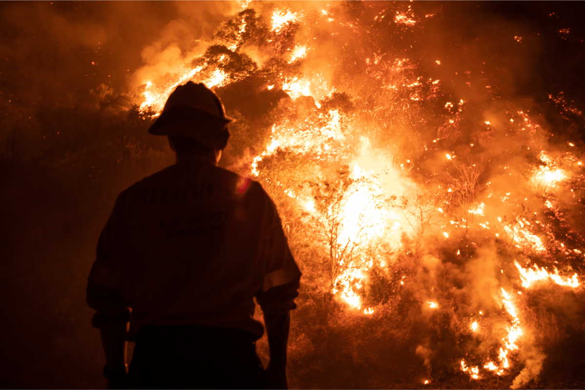
Californians in multiple regions are being urged to stay alert as multiple, fast-moving wildfires force widespread evacuations, with thousands already displaced and more communities at risk.
Shelters are under pressure, and conditions on the ground are rapidly changing as fire crews race to protect homes and lives.
For residents, the current situation remains very fluid: Evacuation orders can be issued or expanded with little notice, forcing people to leave quickly as roads close and conditions deteriorate. Even outside evacuation zones, smoke continues to spread, posing health risks and complicating travel across the state.
Where Are the Fires?
According to the map below and information provided by the California Department of Forestry and Fire Protection (CAL Fire), which is the agency responsible for wildfire management across California, 13 wildfires have been reported (although two are now 100 percent contained).
The following counties are currently impacted:
Santa Barbara County. Kern County. Simi Valley in Ventura County.Two fires in Riverside County.Campo Reservation in San Diego County.Green Acres and the Homeland area in Riverside County.Merced County, near San Luis Reservoir. Imperial County, near Holtville.Los Angeles County.Montague area in Siskiyou County.What To Do if Evacuated 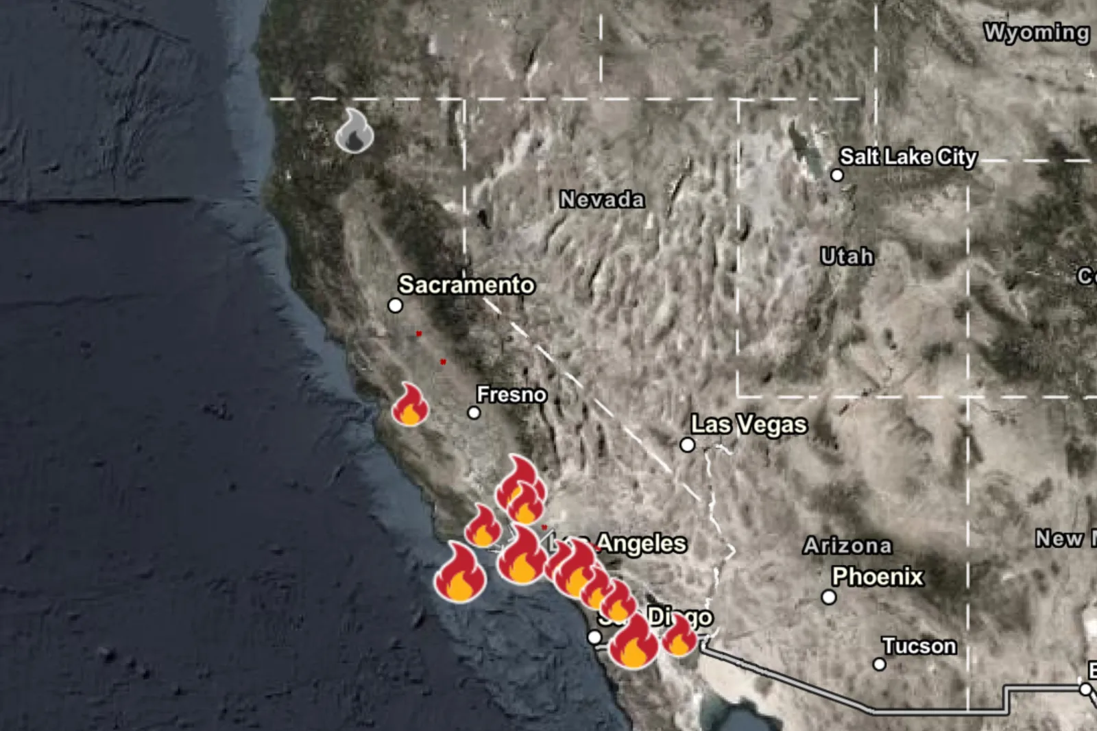
If you are under an evacuation order, go immediately—delaying is one of the biggest risks in wind-driven fires.
Where To Go
Use county-designated shelters when available; the Sandy Fire page for Ventura County lists an overnight shelter location, and in Riverside County, the Bain Fire page lists shelter sites.
If you can’t get to a shelter, head to a location outside the evacuation zone and away from smoke.
What To Bring—the EssentialsIDs, cash or bank cards, phone chargers, and keys.Any medications and prescriptions.N95/KN95 masks (for smoke inhalation protection), a basic first aid kit.Pet supplies, including a leash, food, and any medication.Before You Leave, if Time Allows
Follow official road-closure information at all times.
Close all windows and doorsurn off the gas.
List of Areas Being Evacuated
At the time of publishing, Evacuation Orders warning of an “immediate threat to life” have been issued to the following fires in the following counties:
Sandy Fire in Ventura County.Bain and Verona Fires in Riverside County.Tusil Fire in San Diego County.Foothill Fire in Santa Barbara County.
Cal Fire states that the Evacuation Orders are a “lawful order to leave now. The area is lawfully closed to public access.”
Where Each Wild Fire Currently Stands
At the time of publishing, according to Cal Fire, this is where each of the 13 recorded fires stands.
Santa Rosa Island Fire in Santa Barbara County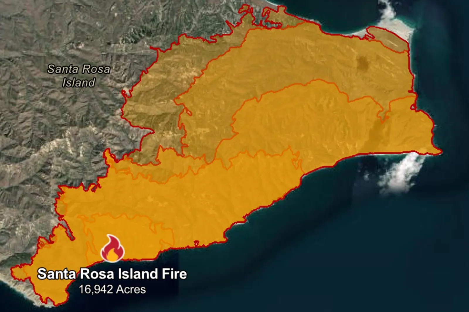 Exact location: The south side of Santa Rosa Island, between Ford Point and South Point.Acres burned: 16,942.Date started: Friday, May 15.Most recent update: The last update from Cal Fire reports that the fire is only 26 percent contained. The island is generally considered to be unihabited, with no permanent residents. River Fire in Kern County
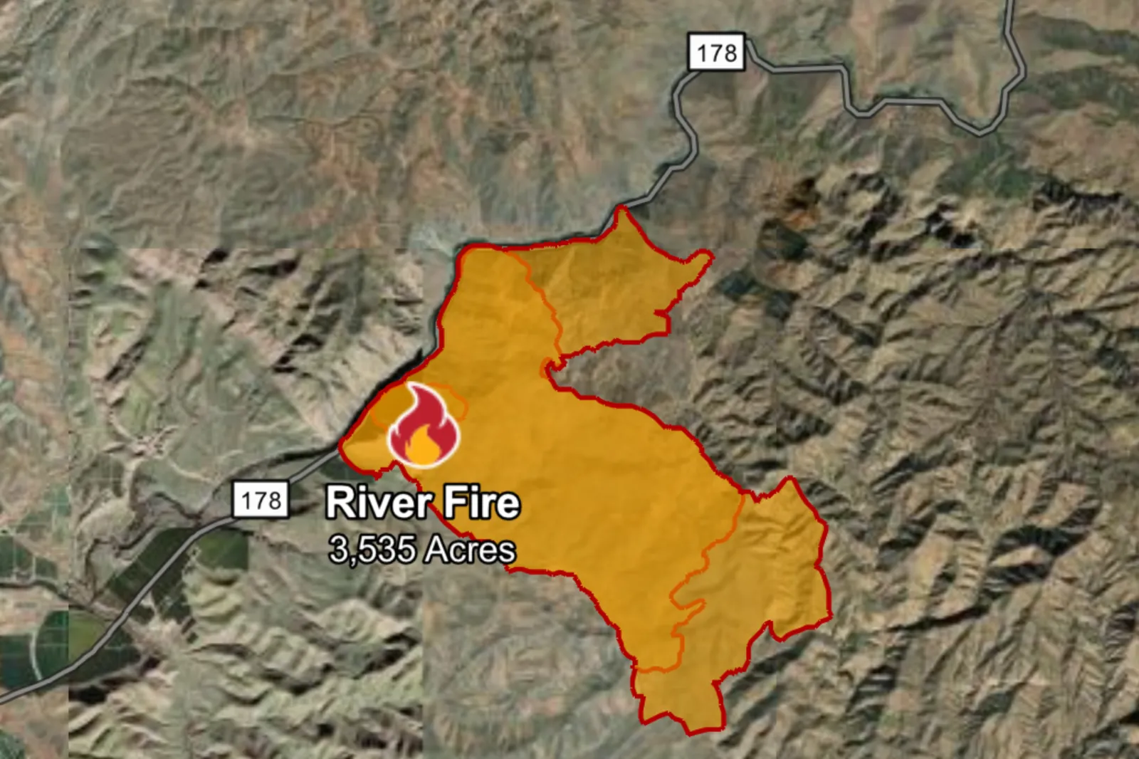 Exact location: State Route 178, east of Bakersfield.Acres burned: 3,535. Cause: Cal Fire said that the cause remains under investigation. Most recent update: The latest update, on May 19, states that the fire is only 15 percent contained, although this is 5 percent more than the previous day, despite “wind-driven” active fire behavior and “difficult access due to the remote location.” Sandy Fire in Ventura County
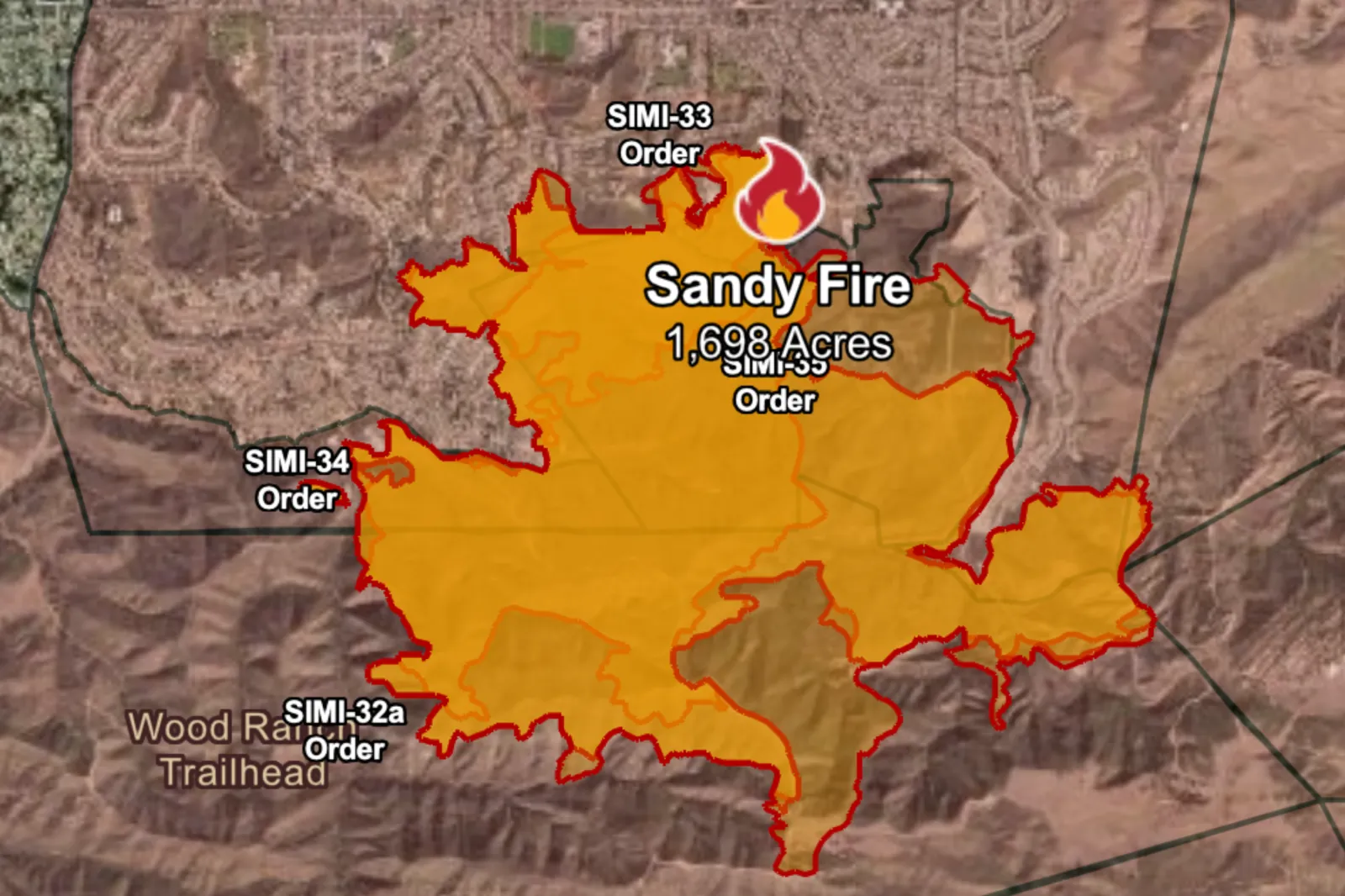 Exact location: Off Sandy Avenue in the city of Simi Valley.Acres burned: 1,698.Date started: Monday, May 18.Evacuations: Cal Fire has issued evacuation orders across multiple zones in the area. Although no official evacuee count has been provided by the agency, local news outlet KTLA has reported that, at the time of publishing, nearly 44,000 residents have been evacuated from the Simi Valley area.Most recent update: In its latest update, Cal Fire has established that the fire is only 5 percent contained, and one structure has been “destroyed.” The agency said that firefighters would “continue to fight the fire overnight from the air and the ground.” Bain Fire in Riverside County
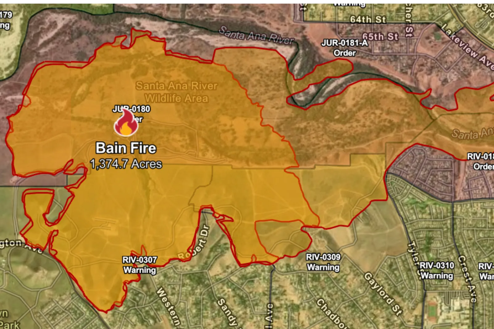 Exact location: Limonite Avenue and Bain Street, on the edge of the city of Jurupa Valley.Acres burned: 1,375.Evacuations: Evacuation orders were issued across multiple zones, and although the number of evacuees hasn’t been confirmed by Cal Fire, CBS News reports that more than 24,000 people have been evacuated.Most recent update: Although the fire is only 10 percent contained, some evacuation orders have been downgraded to warnings, which means there is just a “potential threat to life and/or property. Those who require additional time to evacuate, and those with pets and livestock, should leave now.”Tusil Fire in San Diego CountyExact location: Tusil Road, north of Live Oak Springs in the Campo Reservation.Acres burned: 1,000.Evacuations: Orders and warnings have been issued.Most recent update: Cal Fire said that “firefighters are making good progress,” although the fire is only 10 percent contained. Wood Fire in Kern County, near Tehachapi
 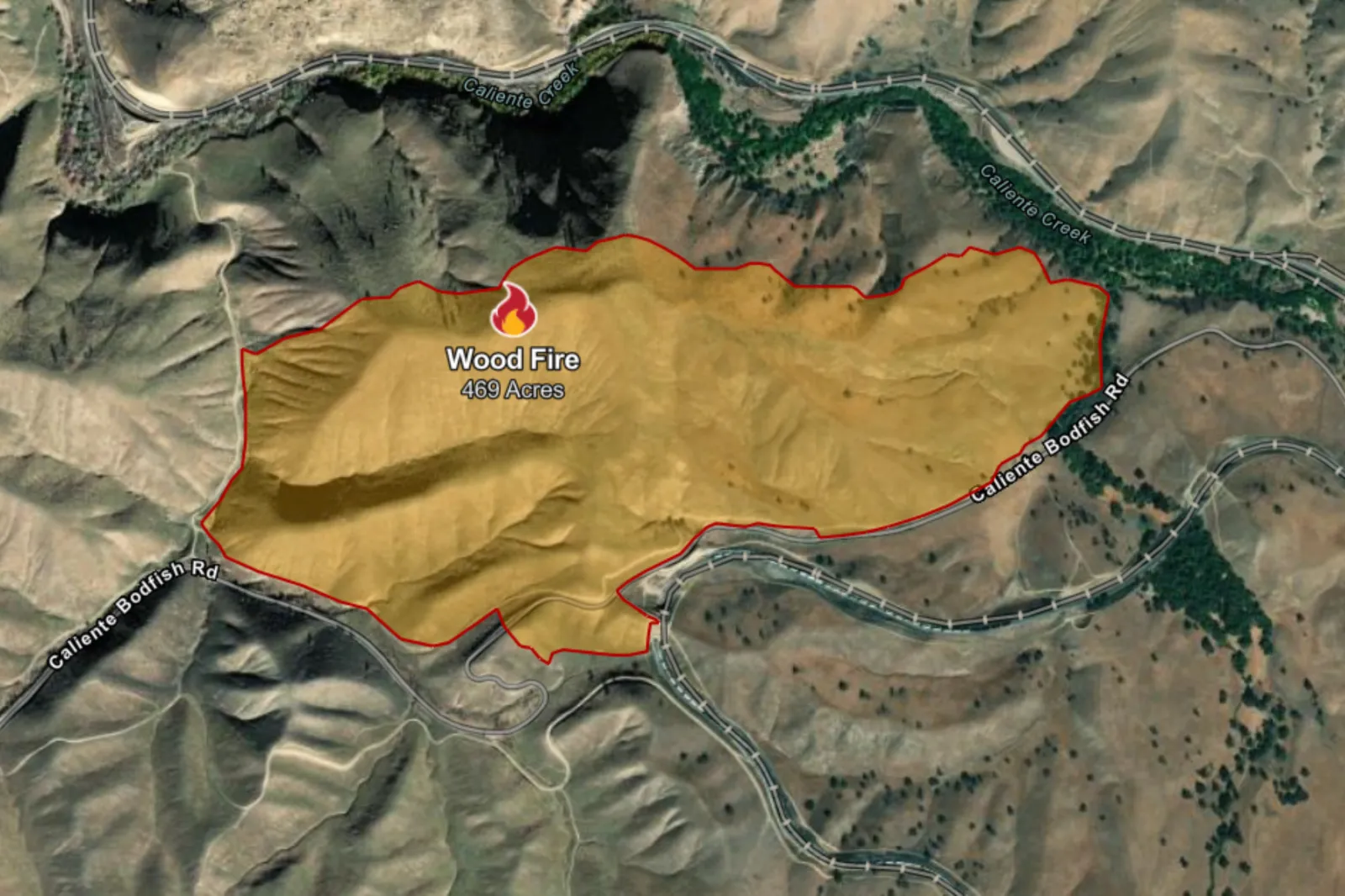 Exact location: North of Highway 223 and 58, west of Tehachapi.
Acres burned: 469.Date started: Monday, May 18.Most recent update: Although Cal Fire reported that “steep terrain continues to make access to the fire difficult,” fire crews have managed to get the fire 85 percent contained. Verona Fire in Riverside County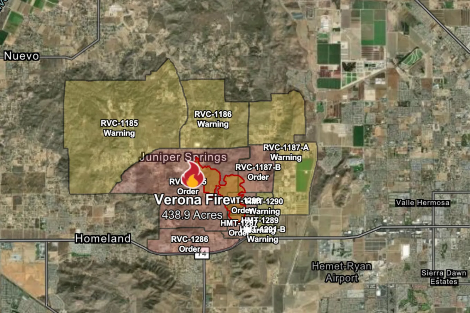 Exact location: Near Verona Road and Juniper Springs Road, in the Green Acres and Homeland area.Acres burned: 439. Date started: Tuesday, May 19.Evacuations: New orders have been issued, as residents in the affected areas were told to “leave immediately” just after midnight on Wednesday, May 20.Most recent update: The fire remains 0 percent contained, as Cal Fire confirms that the fire “is burning at a moderate to dangerous rate.”
 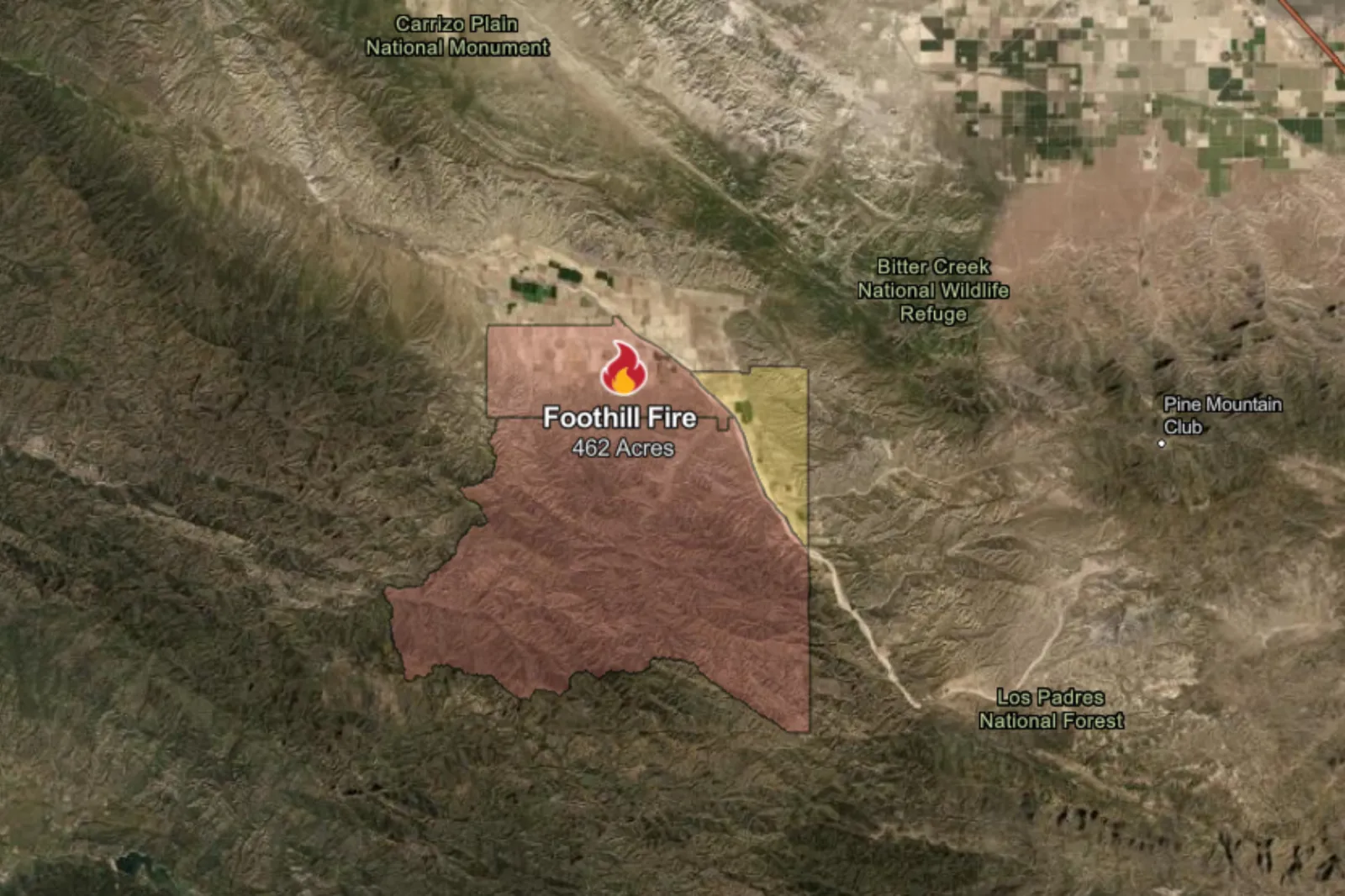 Exact location: Foothill Road and Kirschenmann Road in Cuyama.Acres burned: 250. Date started: Tuesday, May 19.Evacuations: Orders and warnings have been issued for specific zones. Most recent update: Cal Fire reported that evacuation orders and warnings have been updated, as the fire “poses an immediate threat to nearby structures,” and remains 0 percent contained.Santa Fire in Merced CountyExact location: Southeast of Highway 152, near Dinosaur Point Road, in the San Luis Reservoir region.Acres burned: 220.Date started: Tuesday, May 19.Most recent update: Cal Fire reports that the fire is only 10 percent contained and has spread rapidly from 25 acres to 220, through Tuesday. Whitlock Fire in Imperial CountyExact location: Whitlock Road and Graeser Road, near Holtville.Acres burned: 100. Date started: Tuesday, May 19.Most recent update: According to Cal Fire, the fire remains 0 percent contained, although no evacuation orders or warnings have been issued at the time of publishing. Burro Fire in Los Angeles County
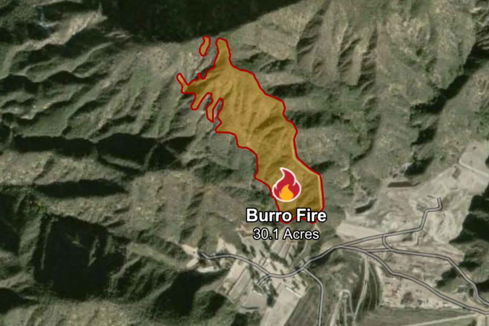 Exact location: Near Burro PeakAcres burned: 30.Date started: Monday, May 18.Most recent update: All evacuation warnings have been lifted, and containment is at 70 percent. Frontier Fire in Siskiyou County Exact location: Near the intersection of Harry Cash Road and Frontier Drive in Montague.Acres burned: 23.Date started: Monday, May 18. Most recent update: Cal Fire confirmed that the fire is 100 percent contained, although crews will continue to “strengthen containment lines and closely monitor fire activity.” Kirby Fire in Riverside County Exact location: South Kirby Road and Kenworthy Bautista Road, north of Green Acres.Acres burned: 20. Date started: Tuesday, May 19.Most recent update: According to Cal Fire, the fire is 100 percent contained. What’s To Come?
According to the NWS, “elevated fire weather” with a “moderate risk of fast-moving fine fuel fires away from the coast” is expected through Wednesday and for the rest of the week, due to breezy and dry conditions, with gustier winds possible in some foothills and Santa Barbara County zones.