
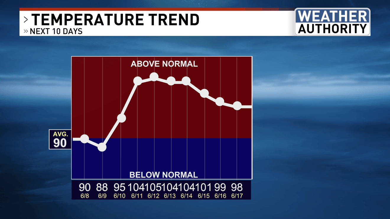
BAKERSFIELD, Calif. (KBAK/KBFX) — It’s all about the temperatures this week.
For the next two days afternoon highs will hover either around or just under “average” as a trough pushes across the Pacific Northwest and the ridge over the Pacific will be suppressed. Monday should also see some wind activity from the KRV into the Indian Wells and Antelope Valleys, and through the mountain slopes. A Wind Advisory is in effect for the Mojave Desert Slopes until very early Tuesday morning. Evening west to north/northwest winds should also kick up across the South Valley. As is expected, wildfire potential will kick up along with the winds so be aware of that.
By midweek the center of the Pacific high will approach California, bringing a much warmer airmass to the area. We should be back to above-average in the temperature department on Wednesday. Then, the heat builds in even more, and the triple digits could make a return appearance starting on Thursday for the South Valley of Kern County. If Bakersfield makes it to 100 or above for 3 days in a row a local “heat wave” will have begun. This could very well be “Heat Wave Number 1” of 2026. Right now, there is at least a moderate chance of that being the case.
Have a great day!
Comment with Bubbles
BE THE FIRST TO COMMENT
Chief Meteorologist Ilya Neyman