
The first Pacific storm of the season is on the way!
Rain is already falling in parts of California, including a few light showers in Kern, and widespread rain will arrive in Kern County Monday night.
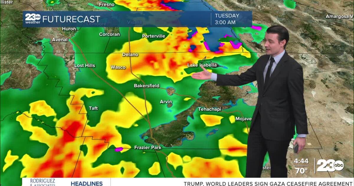
A few light showers are expected through Monday evening, but the heavier band of rain will begin to works its way through Kern after midnight.
Here in Bakersfield the most likely time for the arrival of this heavier band is around 2 AM to 3 AM.
Rain is expected to linger into Tuesday morning, with scattered showers and possibly a thunderstorm or two developing into the afternoon.
All precipitation should clear out by Tuesday evening.
All of Kern will see precipitation from this storm, and this will bring a good, soaking rain to most of the county.
Valley and desert rain totals between 0.50″ and 1.00″ are likely, and mountain areas are likely to pick up 0.75″ to 1.50″.
There will of course be some locally higher and lower amounts, too.
Given the potential for early season heavy rain, the National Weather Service has issued a Flood Watch for the Sierra Nevada foothills, as well as burn scar areas around the Kern River Valley.
We’ll be keeping a close eye on these areas, as well as the Kern Canyon for things like rockslides and debris flows.
In the Valley, no widespread flooding is expected, but minor flooding of low-lying or poor drainage areas is always possible with heavy rain in the forecast.
We are expecting some snow from this storm, too, but snow levels look fairly high, around 6,000 feet.
That means there will be no snow over the Grapevine or Highway 58, but the highest elevations in Kern are expected to see their first flakes of the season!
Behind the storm system we’re also expecting much cooler temperatures.
Highs in the Valley will be in the 60s on Tuesday, and some of our mountain areas may not even hit 50°!
Stay in Touch with Us Anytime, Anywhere: