
Northern California forecast: Below-average temperatures linger Monday
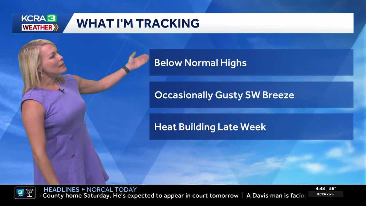
TOMORROW NIGHT. 448 IS YOUR TIME. TAKING A LIVE LOOK AT THE STATE CAPITOL. A COOLER START TO THE WORKWEEK TODAY. LET’S TURN TO METEOROLOGIST TAMARA BERG FOR DETAILS IN THE FORECAST. IF YOU LOOK REAL CLOSE, YOU CAN SEE THE FLAG GETTING A LITTLE WHISK UP THERE FROM THE DELTA BREEZE, WHICH IS HELPING TO BRING IN TEMPERATURES A BIT BELOW NORMAL. AS WE KICK OFF THE NEW WORKWEEK. FOR A LOT OF FOLKS, GETTING BACK INTO THE GRIND AND SWING OF THINGS AFTER MAYBE HAVING THE WEEK LAST LAST WEEK OFF FOR THE HOLIDAY OF INDEPENDENCE DAY, OR MAYBE YOU JUST HAD A LONG HOLIDAY WEEKEND. TEMPERATURES RIGHT NOW, MID 40S IN THE HIGH COUNTRY, 60 DEGREES MODESTO UPPER 50S HERE IN SACRAMENTO AND SAN JOAQUIN VALLEYS. IT DOESN’T MATTER WHERE YOU’RE AT. WE’VE SEEN TEMPERATURES DOWN SO FAR FOR THE MORNING BY FIVE DEGREES IN SOUTH LAKE TAHOE, TWO DEGREE DROP OFF IN THE FOOTHILLS AND ABOUT A 3 TO 10 DEGREE DROP ARE BEING FELT INTO THE VALLEY. HERE’S WHAT I’M TRACKING AS WE GET GOING INTO THE WORKWEEK. TEMPERATURES FOR AT LEAST THE FRONT HALF OF THE WORKWEEK BELOW NORMAL, OCCASIONALLY GUSTY SOUTHWEST WIND. THAT’S YOUR DELTA BREEZE AT WORK IN THE NEXT COUPLE OF DAYS, AND THEN HEAT IS GOING TO START TO BUILD, ESPECIALLY LATER THIS WEEK. A LITTLE DISTURBANCE SITTING AROUND TO THE NORTH. WE HAD SOME MOISTURE SWEEP UP FROM THE SOUTH YESTERDAY THAT KEPT SOME OF THE CLOUD COVER AROUND AND TRIGGERED A COUPLE OF ISOLATED THUNDERSTORMS IN THE SIERRA, STILL KEEPING AN EYE TO THE SKY IN THE HIGH COUNTRY TODAY. THIS IS 4:00 ON FUTURECAST. FRAMED UP. YOU CAN SEE THE BEST LOCATION WILL BE AREAS SOUTH OF HIGHWAY 50 AND REALLY ALONG THE EASTERN SLOPE OF THE SIERRA. SO IF YOU’RE DOING ANY DRIVING ACROSS THE STATE LINE INTO NEVADA TODAY, THAT’S WHERE YOU’RE GOING TO HAVE TO REALLY KEEP AN EYE OUT FOR SOME OF THOSE STORMS TO DEVELOP BY TOMORROW. TOMORROW AT 330 IN THE AFTERNOON. HERE’S A GOOD HELPING OF THAT DELTA BREEZE AND THAT WILL HELP TO KEEP OUR TEMPERATURES AGAIN BELOW NORMAL, AT LEAST THROUGH TUESDAY. NOW, TODAY IN THE SIERRA LOW 80S, TRUCKEE 90 IN QUINCY, WHERE I DON’T EXPECT THOSE AFTERNOON THUNDERSTORMS TO BUBBLE UP, BUT JUST ON THE EASTERN SIDE OR SOUTH OF TAHOE, THAT WILL BE THE BEST SPOT. WE COULD SEE A FEW STORMS MID 80S TODAY FOR YOU. GRASS VALLEY UPPER 80S, AUBURN 88. JACKSON ANGELS CAMP, PAPA MURPHY’S, RT AND SONORA. CLOSE TO 90 FAIRFIELD 83. WE’RE IN THE UPPER 60S NEAR THE BAY. 91 STOCKTON UPPER 80S JULY. EXCUSE ME FOR YOUR JULY FORECAST AND LODI 92 IN MODESTO. WE’LL GET TO 88 FOR YOU. DAVIS 90 IN VACAVILLE, 90 IN ROSEVILLE. EXTENDED FORECAST HERE AS WE
Northern California forecast: Below-average temperatures linger Monday

Updated: 6:39 AM PDT Jul 6, 2026
The Delta breeze on Monday is expected to continue influencing temperatures in Northern California to keep highs below average. Monday looks great for getting outdoors. The Delta breeze is helping to lower temperatures to start the work week. Valley highs are likely to be in the upper 80s to low 90s, while the Foothills could stay in the mid to upper 80s. The Sierra will see some afternoon clouds build with storm chances down the east slope, with highs in the low-to-mid 70s. Highs continue slightly below normal through Tuesday. Midweek, expect the heat to begin to build. Ridging begins to build from the Desert Southwest. As the ridge nudges closer to us, we will see Valley highs above average for this time of year starting Thursday. Feeling the heatPlan for highs across the valley from Thursday through Saturday, peaking in the upper 90s. The worst of the heat looks to hit on Thursday. Depending on where the ridge wobbles late next weekend, there’s a chance the heat could linger into the next work week.See more coverage of top California stories here | Download our app | Subscribe to our morning newsletter | Find us on YouTube here and subscribe to our channel | Make KCRA a preferred news source in Google
The Delta breeze on Monday is expected to continue influencing temperatures in Northern California to keep highs below average.
Monday looks great for getting outdoors. The Delta breeze is helping to lower temperatures to start the work week. Valley highs are likely to be in the upper 80s to low 90s, while the Foothills could stay in the mid to upper 80s. The Sierra will see some afternoon clouds build with storm chances down the east slope, with highs in the low-to-mid 70s.
Highs continue slightly below normal through Tuesday.
Midweek, expect the heat to begin to build. Ridging begins to build from the Desert Southwest. As the ridge nudges closer to us, we will see Valley highs above average for this time of year starting Thursday.
Feeling the heat
Plan for highs across the valley from Thursday through Saturday, peaking in the upper 90s. The worst of the heat looks to hit on Thursday.
Depending on where the ridge wobbles late next weekend, there’s a chance the heat could linger into the next work week.
See more coverage of top California stories here | Download our app | Subscribe to our morning newsletter | Find us on YouTube here and subscribe to our channel | Make KCRA a preferred news source in Google