
NorCal forecast: Morning clouds and Sierra storm chances
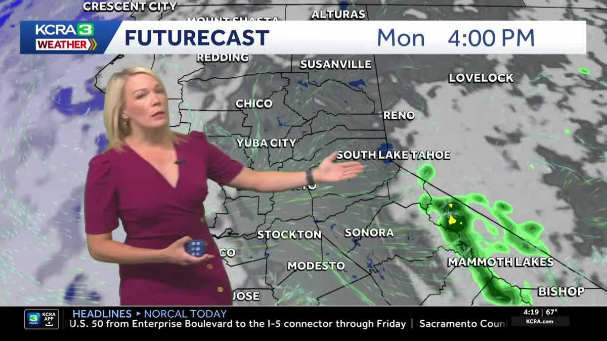
Morning clouds and warm temperatures are expected Monday in the Valley and Foothills, but thunderstorms are possible this afternoon in the Sierra with more on the way Tuesday.

Updated: 5:26 AM PDT Jul 20, 2026
The Delta breeze on Monday is expected to continue influencing temperatures in Northern California to keep highs below average. Monday looks great for getting outdoors. The Delta breeze is helping to lower temperatures to start the work week. Valley highs are likely to be in the upper 80s to low 90s, while the Foothills could stay in the mid to upper 80s. The Sierra will see some afternoon clouds build with storm chances down the east slope, with highs in the low-to-mid 70s. Highs continue slightly below normal through Tuesday. Midweek, expect the heat to begin to build. Ridging begins to build from the Desert Southwest. As the ridge nudges closer to us, we will see Valley highs above average for this time of year starting Thursday. Feeling the heatPlan for highs across the valley from Thursday through Saturday, peaking in the upper 90s. The worst of the heat looks to hit on Thursday. Depending on where the ridge wobbles late next weekend, there’s a chance the heat could linger into the next work week.See more coverage of top California stories here | Download our app | Subscribe to our morning newsletter | Find us on YouTube here and subscribe to our channel | Make KCRA a preferred news source in Google
Monday morning begins with clouds and light winds and mild temperatures. Valley high temperautres will be down slightly from Sunday and near normal, peaking in the low to mid 90s.
The Sierra may see a brief shower this morning with a few thundershowers possible in the afternoon. Tuesday is an IMPACT DAY for the Sierra with better chances for thunderstorms. Lightning could spark fires. A few lingering thundershowers are possible Wednesday afternoon, but mainly on the Eastern slopes.
The valley will see fewer clouds late week with no triple digits days in the 7 day forecast.
Monday Forecast
Temperatures will remain relatively mild for July’s standards on Monday, but the clouds will continue to increase and the weather pattern is expected to become more active, especially in higher terrain.
Chance for showers arrive from the west
By mid-morning Monday, attention will shift west as showers begin developing in the Coastal Range while remnant moisture from Tropical Storm Elida continues to stream into the region.
Sierra storm chances
By Monday afternoon, more storms are expected to pop up in the Sierra, once again focused mainly along the eastern slopes.
Forecasters will be watching both mountain ranges for showers and isolated thunder and lightning, with dry lightning remaining a concern.
Storm activity in the Coastal Range should taper off by around dinnertime, but Sierra storms may linger into the evening.
IMPACT DAY on Tuesday in the Sierra
The most active day in this pattern is expected to be Tuesday, which has now been designated an Impact Day in the Sierra.
Scattered thunderstorms could bring downpours, gusty winds, and dry lightning, creating potentially hazardous conditions in the mountains.
Foothills & Sierra 7 day forecast
Storm chances will continue into Wednesday, though activity is not expected to be as widespread.
Valley 7 day forecast
After that, the forecast turns quieter for the rest of the week, with the Delta breeze returning and temperatures staying mild, especially in Delta cities.