
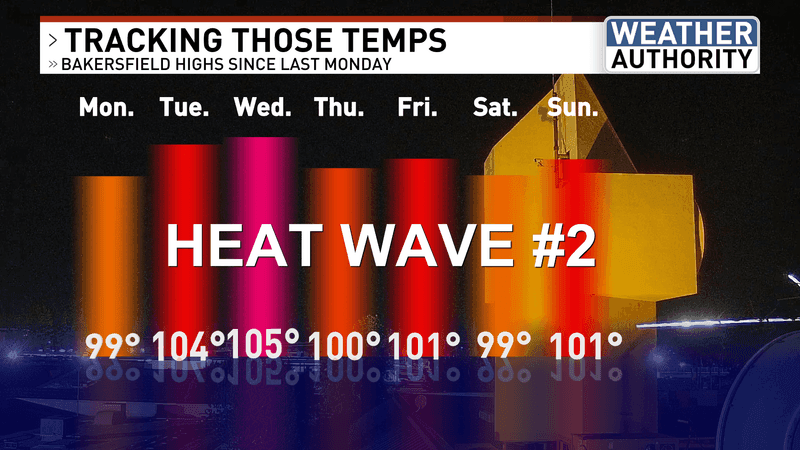
BAKERSFIELD, Calif. (KBAK/KBFX) — THE HEAT CONTINUES
Sunday’s highs reached the triple digits across most South Valley, Antelope Valley and Indian Wells Valley locations. The KRV came up to the upper 90s and the mountains were generally in the mid to upper 80s, along with a few readings at 90 (at Tehachapi as an example).
The upper-level ridge of high pressure has been sitting over or near the area and it is expected to continue doing that in some shape or form for the foreseeable future. This, in turn, is expected to continue the heat for our area. However, considering the time of year the actual temperatures are not extreme, and in some cases right at or slightly above average.
PACIFIC IS HEATING UP TROPICALLY
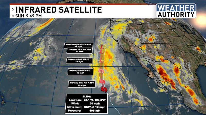
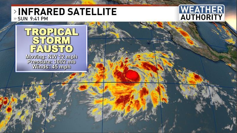
Across the Pacific we’ve got more tropical action as Tropical Storm Elida is moving north, well west of southern Baja and now a new system – Tropical Storm Fausto – has developed south southwest of Baja. These systems are feeding off of warmer-than-average sea surface temperatures and with that situation expected to continue through the summer, combined with an exceptionally strong El Nino further feeding the warmth closer toward the equatorial region, it looks like the eastern Pacific will get even busier in the weeks and months ahead. Some of the northward flowing moisture from Elida is moving across northern California and generating scattered showers, with the possibility of thunderstorms around the northern Sacramento Valley, and surrounding areas.
WATCHING A MONSOONAL PUSH MONDAY
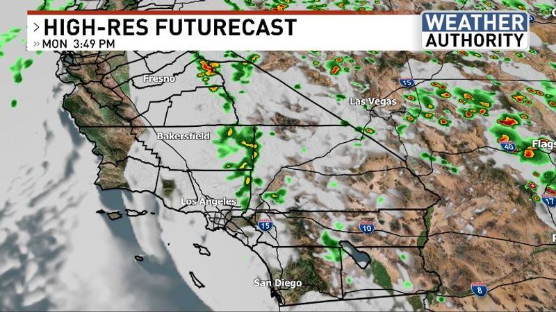
Kern County weather has been less eventful with generally “Nonsoon” conditions continuing. However, some of the forecast models are picking up on a subtle easterly wave traversing southern California on Monday. It seems like this could be the impetus explaining why these computer runs are indicating pop-up showers at some point during the day slowly riding in from the east. It’s too tough to say what that means with much certainty as the atmosphere doesn’t currently look particularly unstable, or moisture-rich this far west, but we sometimes do experience surprises in the world of weather. So, plan for continued heat but don’t be surprised if some clouds, or even sprinkles come in for a visit later on Monday. This may be most likely across the desert, up into the KRV and maybe the mountains. Will there be any thunderstorm potential? We’ll keep tracking that and try to update that forecast if necessary!
Have a great new week ahead!
Chief Meteorologist Ilya Neyman