
Two years ago, the city of Oakland created an innovative program to speed up street safety improvements: The city allowed, for the first time, community members to apply for curb extensions, traffic circles, and other quick fixes to slow cars down and protect pedestrians and bicyclists. The idea was to speed up interventions that could save lives, and give neighborhoods more power to implement changes.
But as of July 1st, only three small pilot projects have been built under the initiative, known as the Community-Led Traffic Safety Pilot Program.
This slow pace has proved frustrating for a group of people who know just how badly Oakland needs new infrastructure to make walking, biking, and driving safer.
“We want to reduce the incidents of traffic violence in the city of Oakland,” George Spies said at a meeting of the city’s Bicyclist and Pedestrian Advisory Commission last Thursday where updates about the community pilot program were presented.
Spies said the city has been slow to process applications and has not provided an explanation for the weeks-long delays. He told the commission he’s been informed that, behind the scenes, city engineers are “overloaded” with work, even though they want to help residents build traffic calming infrastructure more quickly.
The Oaklandside has previously reported that the department’s and the city’s low staffing levels, sometimes due to budget constraints, have resulted in fewer completed projects.
Spies said at the commission meeting that, given these challenges, the best neighborhood groups and advocates can do is remind OakDOT staff to process the applications and hope they listen.
Spies is one of the main volunteers for Traffic Violence Rapid Response, a group that advocates for safer roads, maintain close communication with the city’s Department of Transportation. They say they are grateful for the pilot program, noting that it is unusual for cities to give regular people the opportunity to improve infrastructure. Other cities are taking note and moving forward with similar initiatives.
“San Francisco is launching a program right now for daylighting only, and Atlanta has a similar program,” said Spies.
The idea for the pilot program emerged when Traffic Violence Rapid Response installed a temporary chalk-and-wood crosswalk in front of Oakland Technical High School on Bike to Wherever Day in 2023. A student from the high school had been hit months earlier while crossing Broadway to get food during their lunch hour, prompting the group to take action. While the teen was not seriously hurt, the students and advocates used the incident to highlight the need for more crosswalks.
Around the same time, community members in the San Antonio neighborhood placed traffic circles and speed bumps on East 21st Street to stop sideshows. The neighbors’ guerrilla infrastructure work was illegal and led the city to admonish them because the changes could put the city and its residents in legal jeopardy, especially after one man crashed into one of the installations.
But that attention, Spies said, made the city pay more attention and forced their hand to come up with a solution.
“This clearly has become a kind of a way of communicating from the neighborhoods up right into the city infrastructure about what’s needed,” he told the Bicyclist and Pedestrian Advisory Commission.
Two of the pilot builds completed over the last two years are adjacent to Oakland elementary schools. One of them, located next to Highland Community School, daylighted a corner of an intersection with tall white bollards to force drivers to pay attention to students crossing the road.
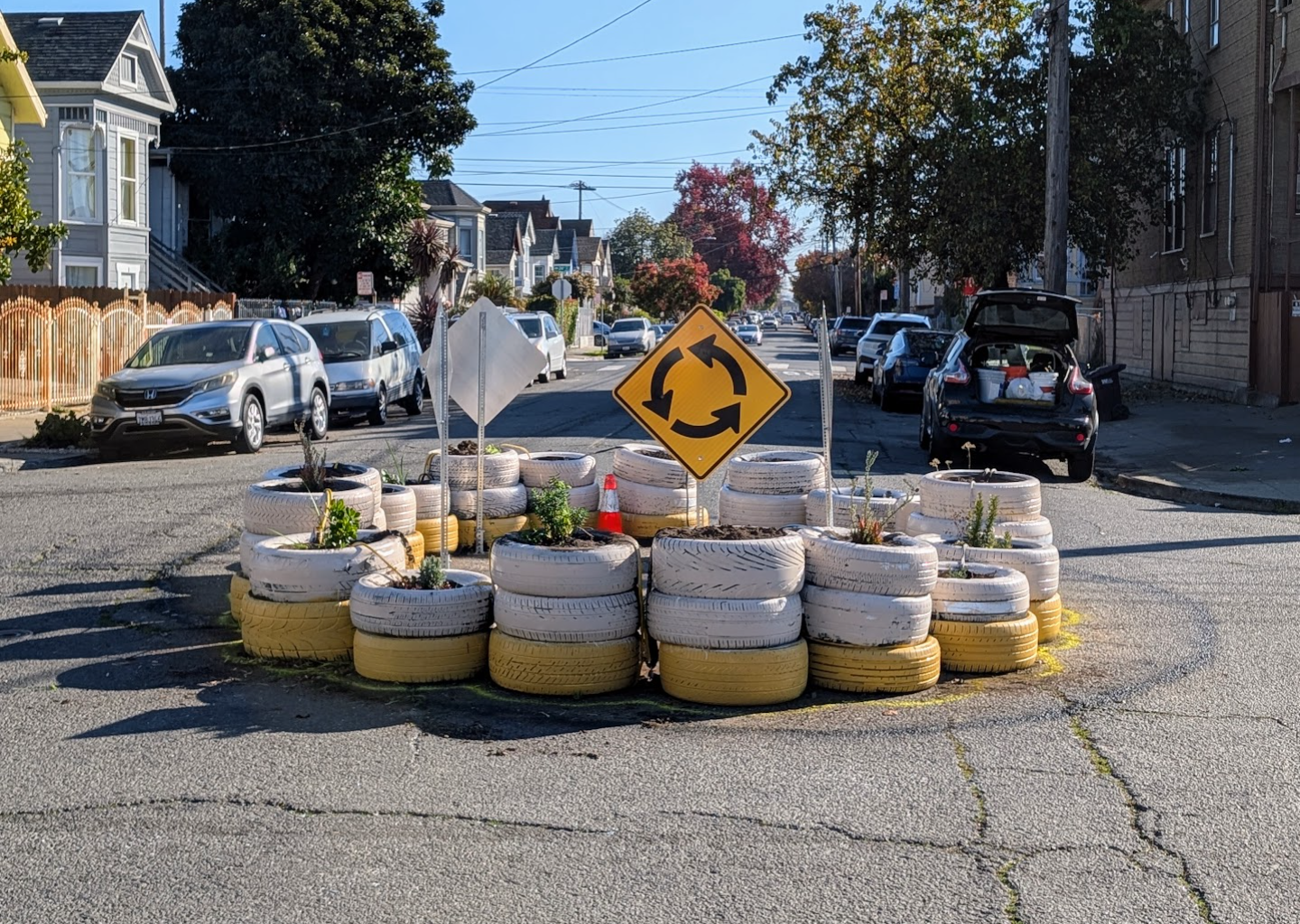
The third, and the only one independently submitted to the program and built by Oakland residents that has been approved for a permit, is a traffic circle made up of painted vehicle tires at Miller Avenue and 16th Street in San Antonio. The permit cost the community about $1,100.
Other builds that have been submitted to OakDOT for review but not yet accepted include traffic circles on 32nd Street at the intersections of Linden Street and Chestnut Street in West Oakland. Walk Oakland Bike Oakland, the nonprofit organization, is helping residents prepare their submissions with additional support from the Traffic Violence Rapid Response group. The advocates are maintaining a map of all the pilot projects and their status on Google Maps.
If residents want to submit a request for their own traffic safety pilot, they are advised, besides reaching out to Walk Oakland Bike Oakland for guidance, to read OakDOT’s program page, its application guidelines document, and to review the city’s ArcGIS mapping tool, which helps people visually identify locations eligible for quick builds.
“*” indicates required fields