
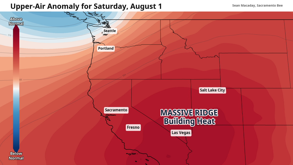
The air pressure of the upper atmosphere will be well above normal across California and the southwest U.S. this weekend
Sacramento Bee
The hottest temperatures of summer so far are on the way for much of California later this week as an immense heat dome is set to take shape, with triple digit temps lingering into early August for much of the Central Valley.
The presence of both this strong heat dome and very low humidity levels will likely pose an elevated risk for wildfire conditions late this week, as much of the Pacific Northwest deals with its own wildfire outbreak.
For the time being, these well-above-average temps are still a few days away for most.
This week – temps climb day by day 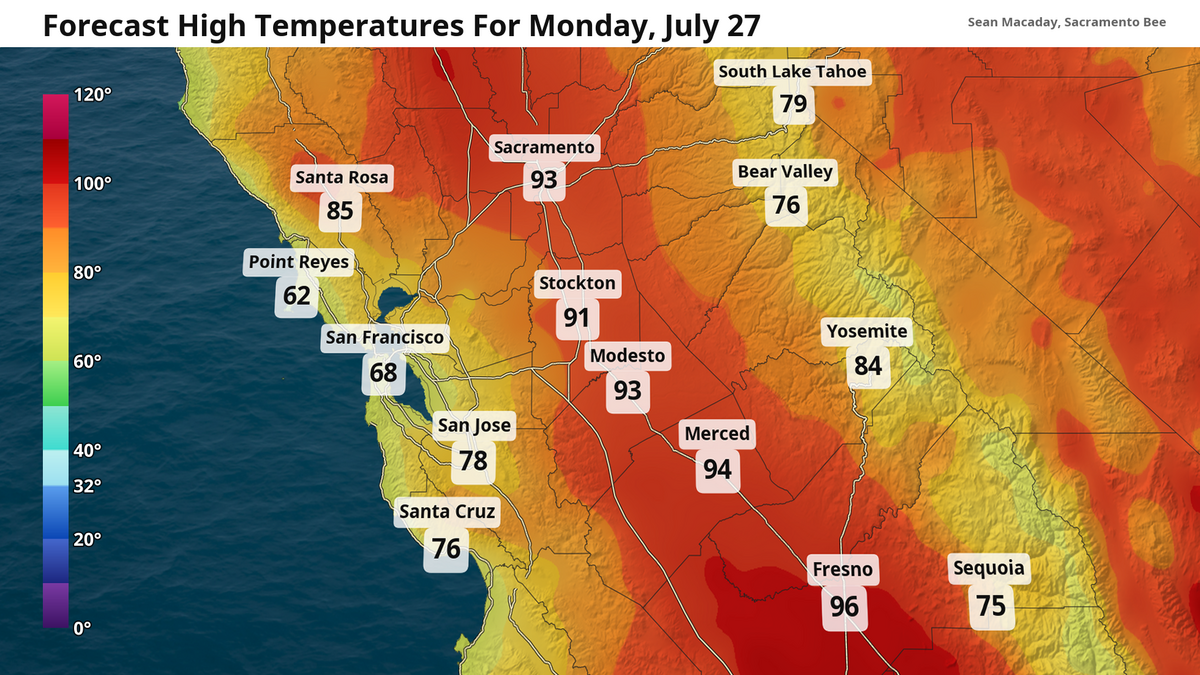 Sacramento Bee
 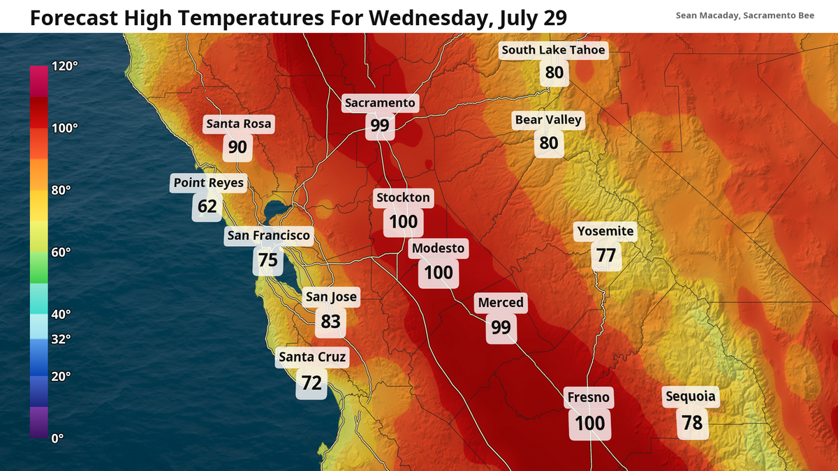 Sacramento Bee
Temperatures Monday will be average for this time of year. Highs in the mid-90s are expected for most of the Central Valley, including Sacramento and Modesto. Some spots in the Delta region will only rise into the 80s amid a decent Delta breeze.
The San Joaquin Valley will be a touch higher, with highs average for this time of year in the upper 90s for Fresno.
Temperatures will slowly rise each day as the week progresses. By Wednesday, highs will be in the upper 90s for Sacramento, with triple digit heat north to Redding and south to Bakersfield. The accumulation of high pressure in the upper atmosphere will slowly work to increasingly push down on the air below, heating up temperatures under clear sunny skies.
Hottest temps of summer so far this weekend
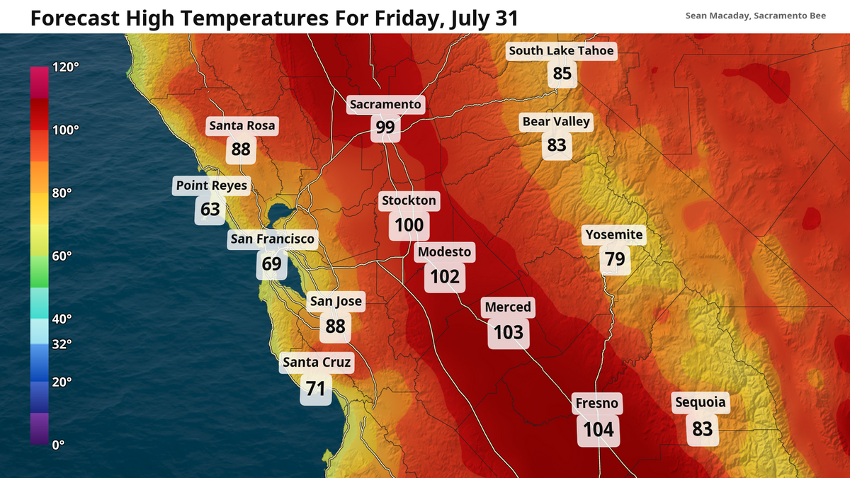
By Saturday, high temps will have risen into the triple digits for the entire Central Valley. Temps between 105 and 110 degrees are possible in the San Joaquin and northern Sacramento Valley between Friday and Sunday. These would be the hottest temperatures of the summer so far for much of the Central Valley. Fresno’s highest temp so far, for reference, was 105 degrees on July 15 two weeks ago.
The Delta breeze may save Sacramento from 100 degrees on Friday, but given the heat dome’s positioning nearly directly overhead this weekend, that Delta breeze will be snuffed out under the suffocating high pressure. Warming to 105 degrees or more is in the cards for much of the Sacramento region.
Further south, anomalously warm ocean temperatures in Southern California will add a usually dangerous humidity factor. Thanks to a sprint-pace El Niño, humidity is feeling tropical across coastal Southern California. Combine that with the high pressure overhead, and the feels-like temperature could climb to 110 degrees or more across inland Southern California by the weekend.
 Sacramento Bee
 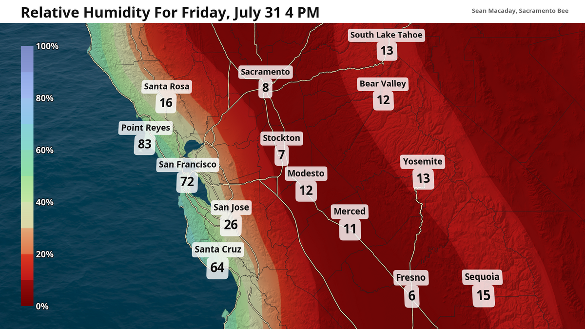 Relative humidity levels (in percent) for Friday afternoon. Very dry air will exacerbate fire risk. Sacramento Bee
That is the opposite problem further north and for the Central Valley. Relative humidity values could plummet all the way into the single digits across much of Central and Northern California for the mid-afternoon hours through the weekend. This will increase wildfire risk across much of the state, and red flag warnings are not out of the question for Northern California where the wind will be a touch stronger.
This pattern will linger into the first week of August at least, so enjoy the comparatively cooler temps of this week before the heat truly arrives.

The Sacramento Bee
Sean Macaday covers the weather for McClatchy Media in California. Originally from Chicago, Sean worked 6 years covering the weather on local television in Minnesota. He holds a bachelor’s degree in meteorology and marine science from the University of Miami.