
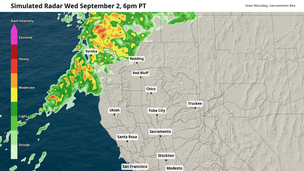
Scattered showers, mixed with a few sparse thunderstorms, are expected Wednesday afternoon across Northern California, pushing east into the Sacramento Valley and northern Sierra by the evening and into Thursday morning.
The Sacramento Bee
As temperatures cool and the atmospheric pressure falls, Northern California and the Sacramento Valley is set for a splash of what will become increasingly familiar in a few months time — rain.
A trough of lower pressure draped across the western United States is continuing to deepen, prompting temperatures to lower one day after the next. As this occurs, there comes a point where the atmosphere cannot physically hold all the moisture it could before. The result is not just clouds, but a swath of showers moving in across the Pacific Northwest and Northern California.
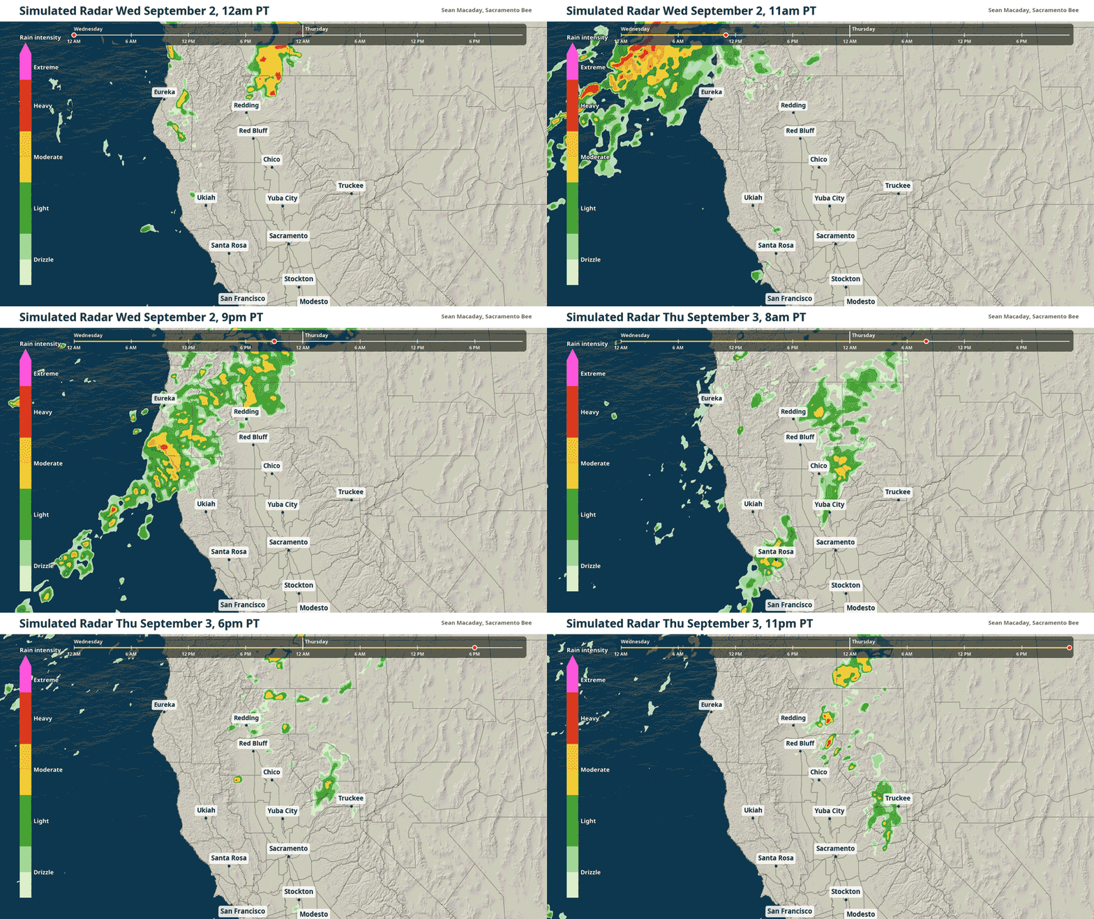 Simulated radar through Thursday shows heavy showers possible across the Klamath Mountains of Northern California Wednesday, and lighter showers near Sacramento. SEAN MACADAY sean.macaday@sacbee.com
These showers will arrive to the northern Coast Ranges on Wednesday morning, with rain growing more widespread by the afternoon across the Klamath Mountains and into the northern reaches of the Sacramento Valley by Wednesday evening. Some of these showers could be more than just a light drizzle, with a few thunderstorms in the mix Wednesday afternoon and at elevation.
For Sacramento, the northern Sierra, and the lower Sacramento Valley, most of the showers will arrive Wednesday night and early Thursday — although they are expected to be weaker and more scattered. Sacramento in particular would see only sparse raindrops in between more cloudy skies.
.png "rain_prob025_norcal_wedthu_v2 (1).png") Across the different members of an AI ensemble weather model, a quarter inch of rain is expected across the northern Coast Ranges, Klamath Mountains and the Redding area. The Sacramento Bee
Across the different members of an AI ensemble weather model, a quarter inch of rain is expected across the northern Coast Ranges, Klamath Mountains and the Redding area. The Sacramento Bee .png "rain_accum_norcal_rrfs_wedthu (1).png") Forecast rainfall potential through Thursday. The Sacramento Bee
Forecast rainfall potential through Thursday. The Sacramento Bee
By the time Thursday wraps up, much of Northern California along the Coastal and Klamath ranges should expect at least a quarter inch, with lesser amounts in the Sacramento Valley.
Rain showers bring cooler temps, frost in far northern CA
If September has you ready for pumpkin spice and fall leaves, then you might enjoy what these rain showers are ushering in — some surprisingly cool temps.
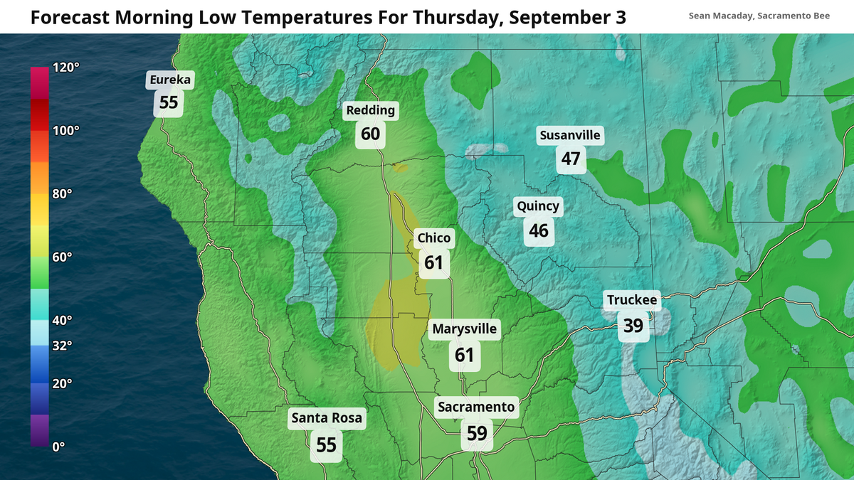
Wednesday morning low temperatures across the Sacramento Valley all the way north to Redding will dip well into the 50s, with 40s and even 30s widespread across Northern California at areas at elevation. They will repeat Thursday, when Truckee could dip down into the 30s.
Frost will be possible in spots that dip into at least the mid-30s. A frost advisory was in effect earlier this morning in Modoc County, and more frost will be possible Thursday and Friday morning at high enough elevations.
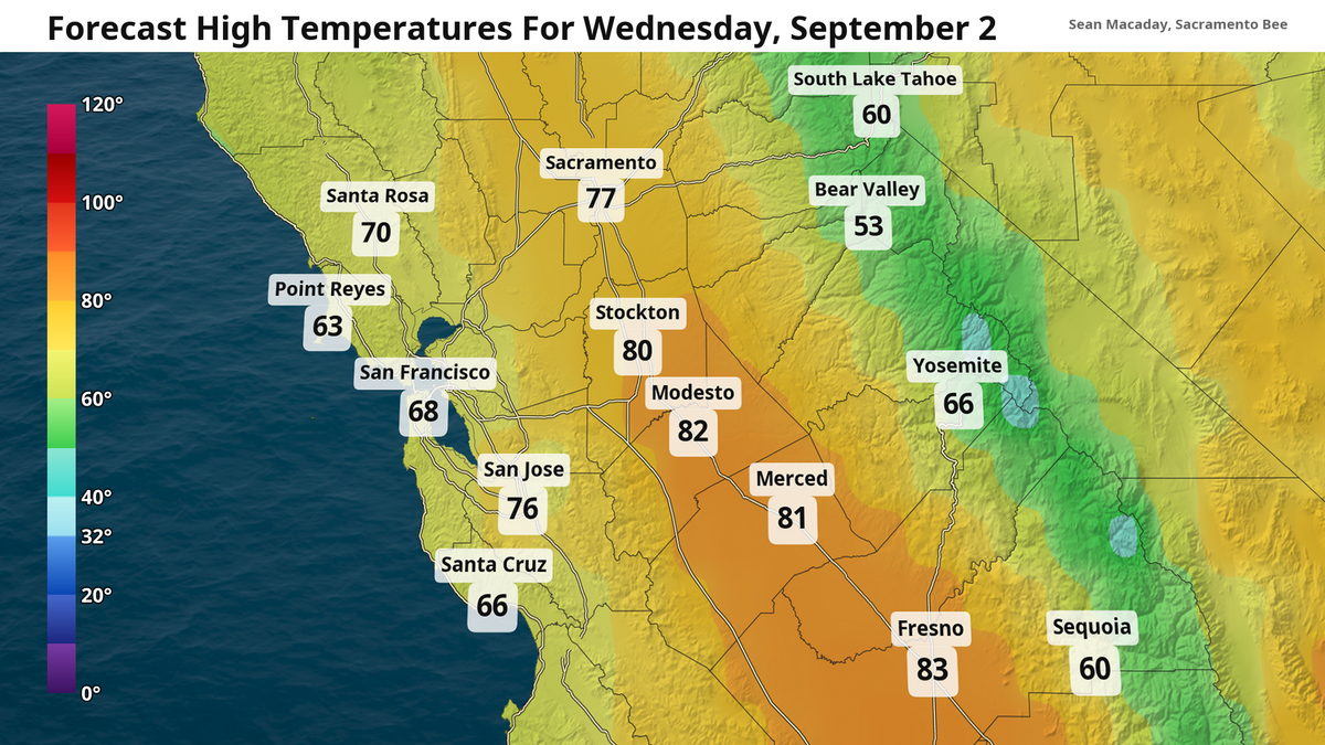
Meanwhile, high temperatures through the rest of the week will hold 15 to 20 degrees below average for this time of year. Mid- 70s for Sacramento several days in a row is nothing short of spectacular. And while a warmup is likely next week and through the month, it’s a reminder that fall is just right around the corner.
 The Sacramento Bee
  The Sacramento Bee

The Sacramento Bee
Sean Macaday covers the weather for McClatchy Media in California. Originally from Chicago, Sean worked 6 years covering the weather on local television in Minnesota. He holds a bachelor’s degree in meteorology and marine science from the University of Miami.