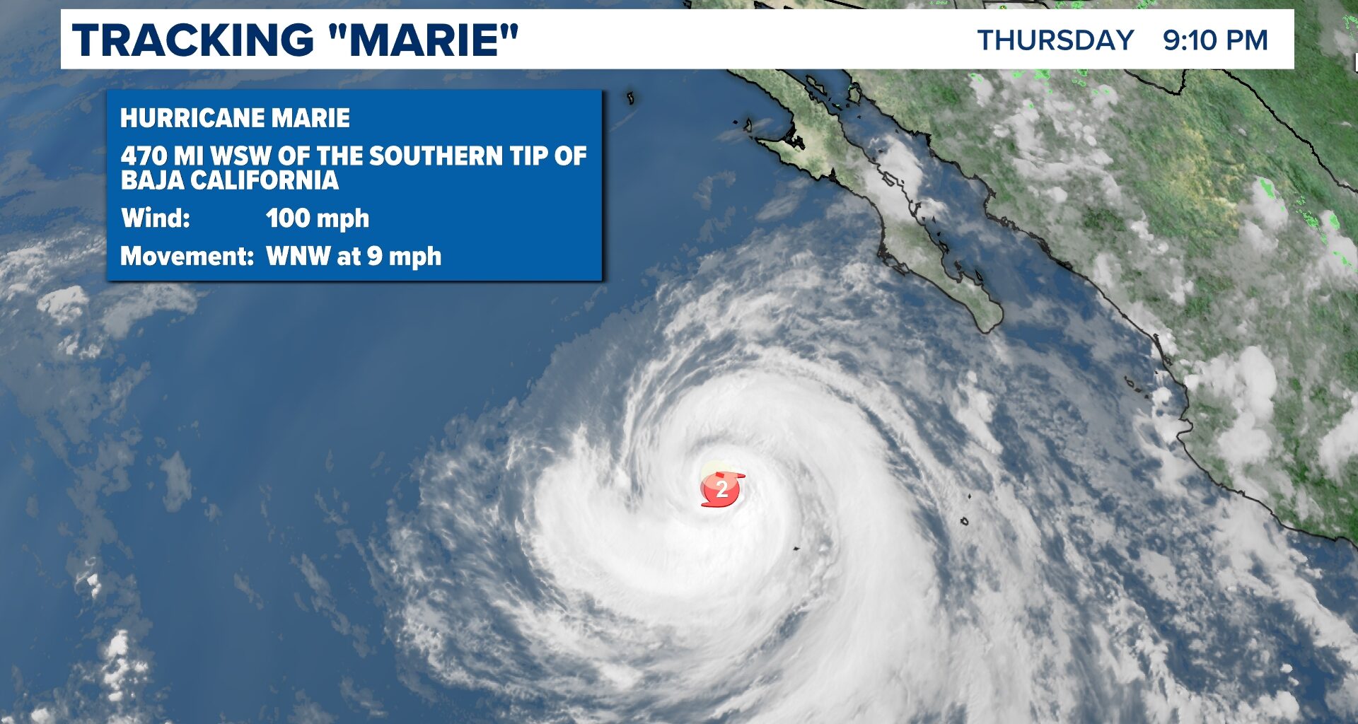
As of Thursday evening, Marie has strengthened to a CAT 2. It’s expected to maintain this strengthen on Friday over the open waters of the Eastern Pacific.
SAN DIEGO — As of Thursday evening, Marie has strengthened from a category 1 to a category 2 hurricane over the Eastern Pacific. Some weakening will take place, but it will maintain hurricane status through the weekend.
Despite its strengthening, Marie poses a minimal risk for landfall in North America. While there has been speculation about it affecting the Southern California coastline, recent forecast models indicate that Marie will take a more westerly trajectory and remain over open waters.

This story continues below.
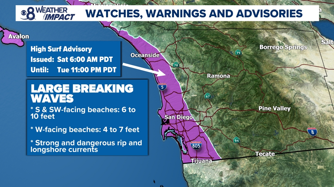
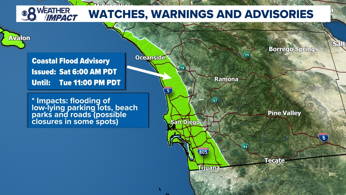
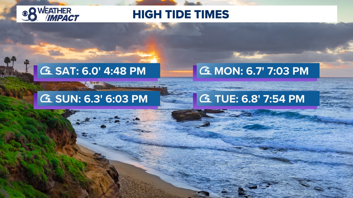
Despite Marie’s expected trajectory, Southern California will still feel some indirect impacts this weekend and into the start of next week, mainly in the form of high surf due to a south swell. The National Weather Service has issued alerts ahead of large breaking waves, strong rip currents, longshore currents and coastal flooding during the afternoon and evening high tides.
A High Surf Advisory and Coastal Flood Advisory will be in effect from 6:00 a.m. Saturday through 11:00 p.m. Tuesday. Large breaking waves will be highest along south and southwest-facing beaches, like Windansea Beach in La Jolla, with the presence of strong rip currents and longshore currents. These are particularly dangerous conditions for those who are inexperienced swimmers or surfers.
Additionally, the coastal flooding will be an issue due to high surf and high astronomical tides leading to tidal overflow into parking lots, along boardwalks, and adjacent roads during the high tide times listed below. Additionally, coastal erosion will be a hazard.
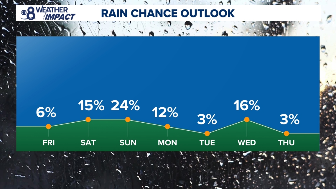
Regarding the possibility of rain, chances are increasing for scattered showers to appear over the weekend, mainly on Sunday. There is a slight chance for activity on Saturday and Monday with the abundant cloud cover that will be around.
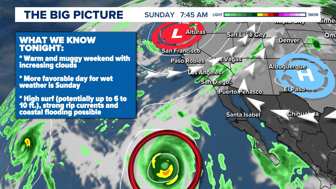
While there is nearly no threat of Marie making landfall in San Diego, outer bands of moisture could till be sent our way as the storm makes its closest swipe to the southwest, over the open ocean. These far outer bands can vary in strength but are typically much less intense than hurricane-strength rain and wind. Models show a 50-60% chance of widespread light rainfall (amounts 0.10-0.50 inches) Sunday through Tuesday and about a 10-15% chance of heavy rainfall and thunderstorms.
Essentially, there’s a high chance for light scattered showers, and a much lower chance for anything widespread or heavy. As for winds, there will be about a 10-15% chance of moderate to strong easterly winds ahead of any rainfall, which could produce some fire weather concerns.
The storm’s continued path will be crucial in determining the intensity of rainfall in the region.