
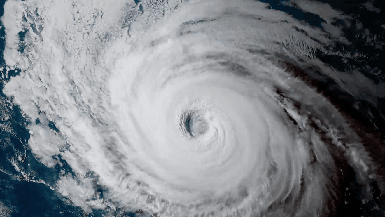
It doesn’t happen often. But every few years or so, a Hurricane or Tropical Storm in the eastern Pacific heads north on a path to California. I’m not talking about the leftover moisture from a dead hurricane; that happens almost every year. I mean the actual storm.
Officially, the only landfall in California came from a Tropical Storm in 1939 in Long Beach.
But a few others have been close. Here’s a look back at 11 of the closest since 1960, and the one thing that over 80% of them have in common.
I chose to look back to only 1960 because that’s when the first weather satellite (TIROS 1) was launched. After that, meteorologists had a much better idea of the number of storms that formed every year; before TIROS 1, if a hurricane didn’t make landfall or encounter a ship, it would often be missed.
Tropical Storm Jen-Kath, 1963: Meteorologists at the National Hurricane Center thought that Tropical Storm Jennifer had dissipated, and named the new storm Kathleen. But it turns out Jennifer had just weakened, not dissipated, so this storm gets two names.
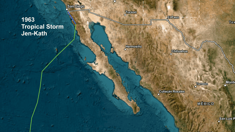
Tropical Storm Jen-Kath in 1963.
Despite multiple names, Jennifer-Kathleen never made hurricane status. She made landfall in Baja, and dropped a lot of rain in the mountains outside of San Diego.
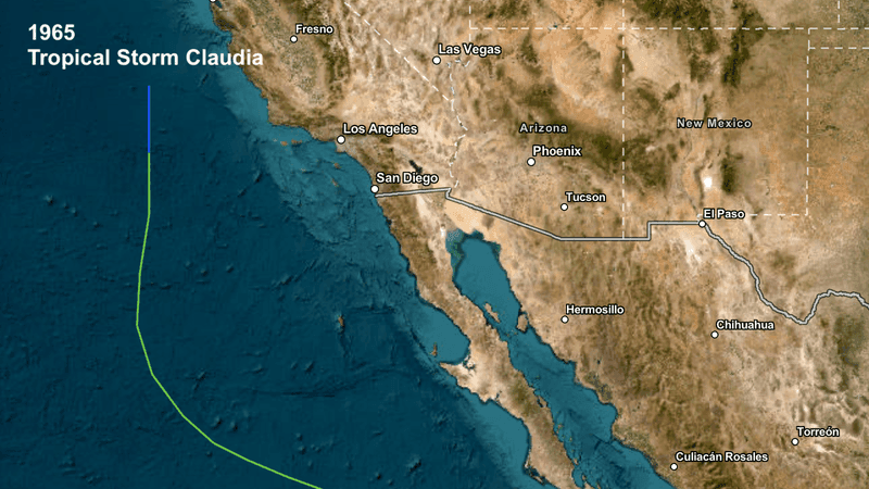
Tropical Storm Claudia in 1965.
Tropical Storm Claudia, 1965: Claudia held together as a Tropical Depression off of central California… but that was about the only thing remarkable about Claudia.
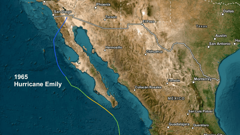
Hurricane Emily, 1965: Emily approached southern California in early September of 1965, when the SEALAB II experiment was going on off of San Diego. SEALAB II was a large submersible where several ‘Aquanauts’ spent a couple of weeks underwater, to study the effects of undersea living on the human body. As Emily approached, there was talk of canceling the project, but Emily took a turn towards Baja after a while. Emily caused flooding in the desert, but SEALAB II was uneffected.
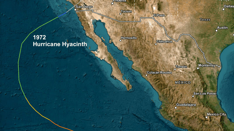
Hyacinth made landfall near Oceanside in 1972 – as a Tropical Depression.
Hurricane Hyacinth, 1972: Ok, this storm held together long enough to make an actual landfall in California, near Oceanside. But not as a hurricane, or even a tropical storm: the cool waters of the California Current weakened Hyacinth to a Tropical Depression by the time it reached Oceanside. With winds speeds of barely 30 mph, it caused minimal damage to San Diego County.
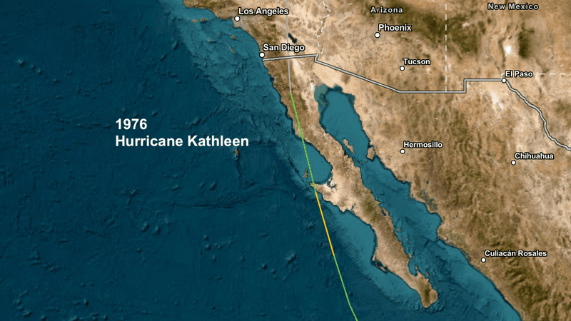
Hurricane Kathleen in 1976.
Hurricane Kathleen, 1976: Kathleen made landfall in Baja California, and brought some flooding to the desert, but not much else.
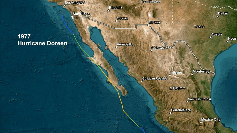
Hurricane Doreen in 1977.
Hurricane Doreen, 1976: Doreen also made landfall in Baja California, and also brought some flooding to the desert.
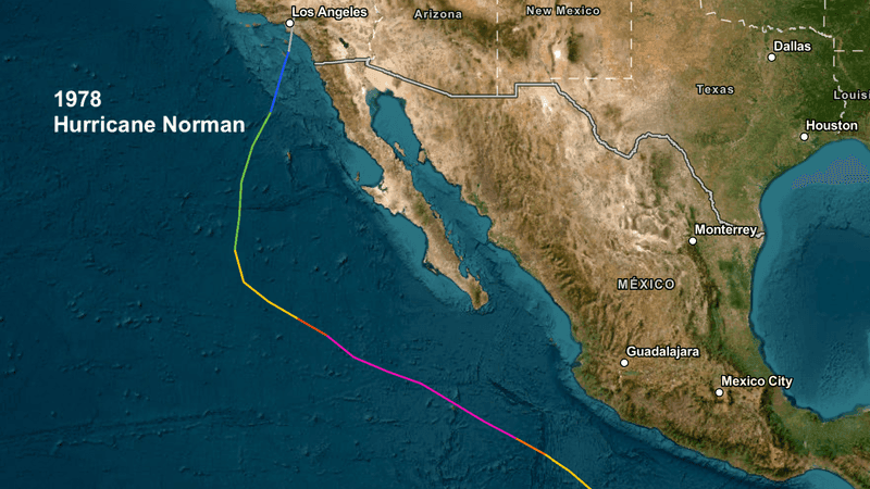
Hurricane Norman brought heavy rain in 1978.
Hurricane Norman, 1978: Norman approached Los Angeles as a Tropical Depression in 1978, but ultimately dissipated before landfall. Nevertheless, Norman caused a lot of destruction: many boats were capsized or sank off of southern California, Lodgepole in Sequoia National Park reported 7″ of rain from Norman, and this storm destroyed around 95% of California’s raisin crop in 1978!
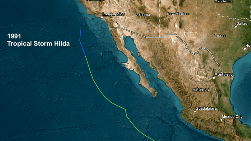
Tropical Storm Hilda in 1991.
Tropical Storm Hilda, 1991: Hilda followed a similar path as Claudia did in 1965, and likewise, did minimal damage to California.
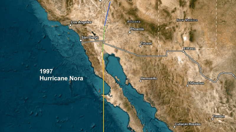
Hurricane Nora brought strong winds to the desert in 1997.
Hurricane Nora, 1997: Nora made landfall as a hurricane in 1997 in Baja California, then held together long enough to remain a Tropical Storm when it entered the United States. Nora brought flooding and strong winds to the desert.
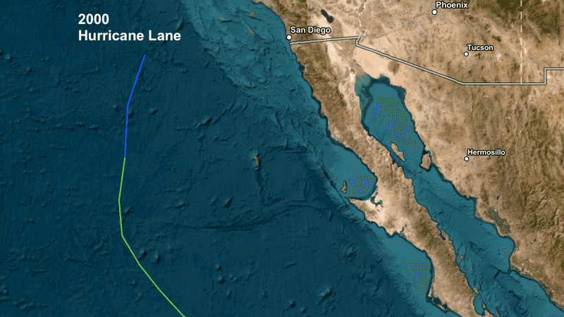
Hurricane Lane, 2000: Lane’s last gasp was to approach southern California in 2000; it didn’t make it.
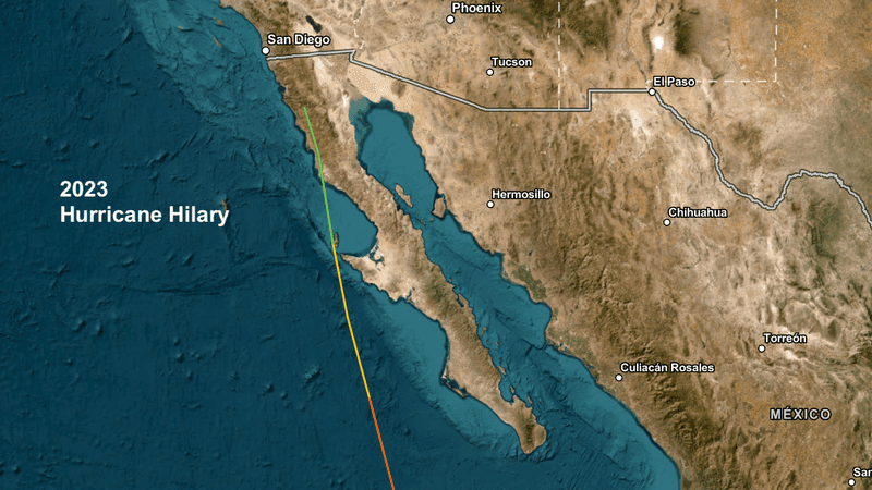
The official path of Hurricane Hilary shows it dissipating before it reached California in 2023. Unofficially, it sure felt like a Tropical Storm over Los Angeles.
Hurricane Hilary, 2023: Saved the best for last. Hilary officially made landfall in Baja California in August of 2023, merged with an upper low off of southern California, and dissipated. But if you remember Hilary’s arrival, it was much different at the time. It didn’t seem like a dissipating Tropical Storm when it roared across southern California; even the meteorologists at the National Hurricane Center kept it as a Tropical Storm until much later. It may have lost it’s warm core characteristics, but it definitely looked and acted as a Tropical Storm over southern and central California at the time. Hilary caused major flooding all over the Southland; damages were estimated at around $900 million dollars. In my opinion, if you’re curious as to what a Tropical Storm would look like over California, look no further than Hilary.
The reason hurricanes don’t reach California is because the ocean temperatures off of California are just too cold: a hurricane generally needs ocean temperatures of at least 80, and our water temperatures are nowhere close to that.
However, if you’re really concerned about a Tropical Storm possibly impacting California, it would most likely will happen during an El Nino year. 9 of those 11 storms (or 82%) happened during a developing El Nino! It does make sense – hurricanes need warm water, and that’s what El Nino brings us. But 82% shows a very strong correlation.
One more: 60% of the 15 strongest eastern Pacific (east of 130 longitude) hurricanes (9 of 15) have happened during El Nino conditions, including the 4 strongest EPac storms ever.
They love that warm water.