
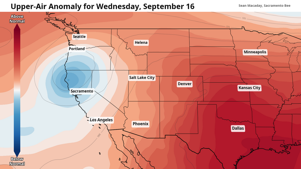
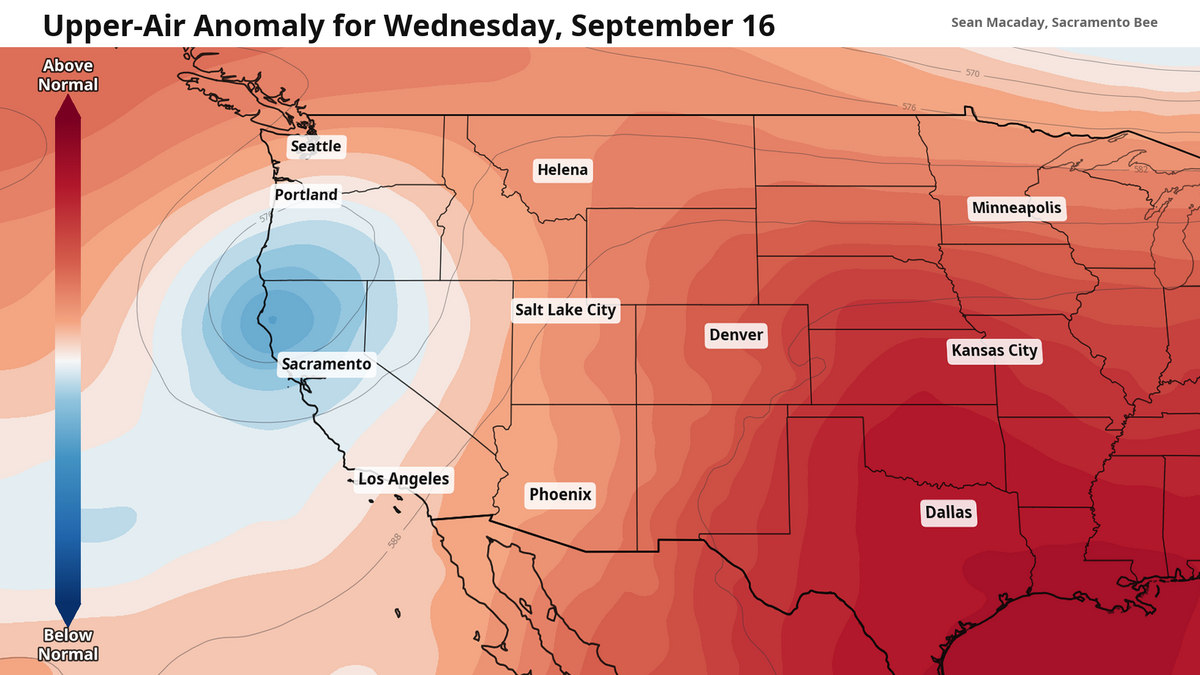
A cut-off low will visit Northern California this week, ushering in cooler temperatures and a little extra cloud cover.
McClatchy Media
Temperatures last week were well above average, with high temps for Fresno and much of the Central Valley reaching into the triple digits Wednesday and Thursday.
Now, as cooler temps in the 80s rush in out of the north with a persistent autumnal breeze, you may begin to truly feel like fall is in the air — even if there are still some days that reach 90 degrees in the forecast.
Cooler temps arrive this week
Winds out of the north will be a consistent feature today across the entire Central Valley. From Redding to Bakersfield, this breeze will be capable of gusting up to 30 mph mid-Monday, bringing cooler temps and drier air.
But this breeze is not the only thing diving in from the Pacific Northwest. In the upper atmosphere, a cut-off low is developing that will cool down temperatures substantially by Wednesday and Thursday.
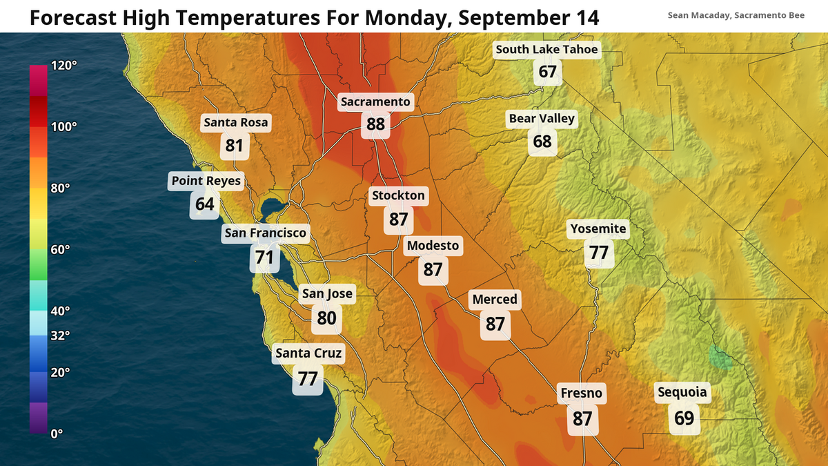 High temperature forecast Monday, Sept. 14 McClatchy Media
 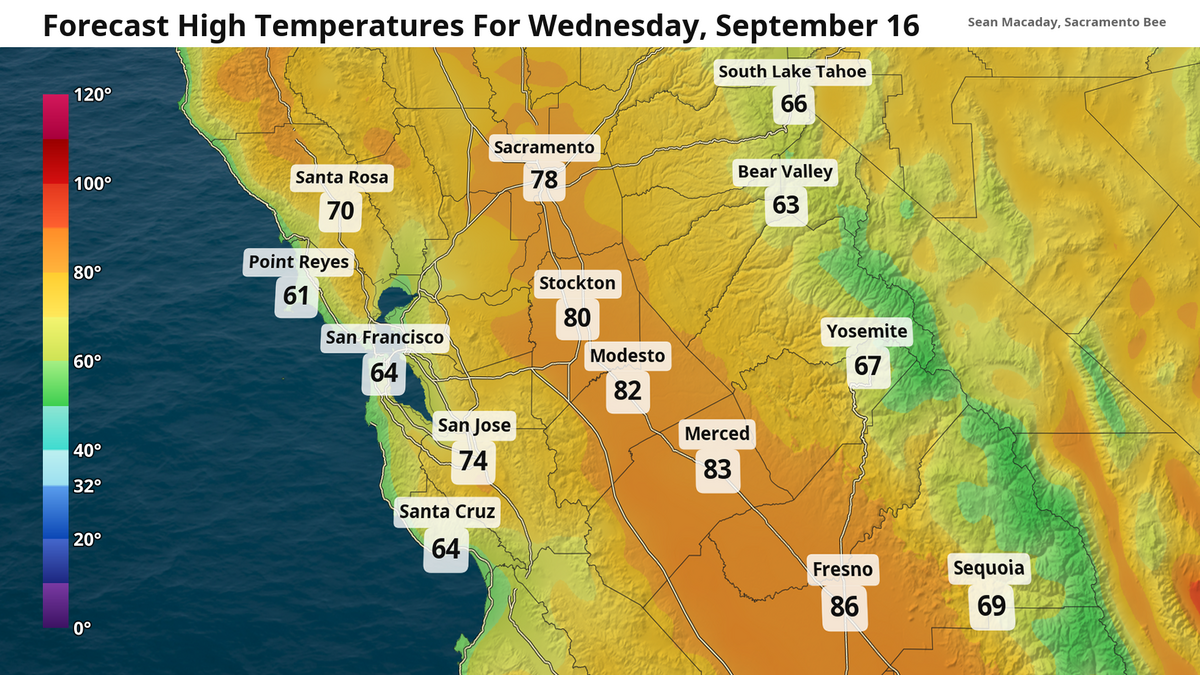 High temperature forecast Wednesday, Sept. 16 McClatchy Media
A cut-off low is a region where the jet stream — the current of fast moving air at about the level where plans fly that divides the warm air to the south from the cold air to the north — pinches off in an eddy and begins to flow around itself. This vortex comes with lower air pressure and atmospheric heights around its center, cooling down temperatures nearly evenly and producing extra cloud cover in its wake.
For the San Joaquin Valley, the north breeze Monday followed by the arrival of this cut-off low will mean a forecast that is consistently slightly below average for this time of year. While high temps should still be in the low 90s, most days this week will only top out a few degrees below that. A few extra clouds will be visible from Modesto to Fresno on Wednesday as the cut-off vortex arrives, but should clear for a rather sunny afternoon. High temps will be the coolest Wednesday and Thursday, with a rebound back into the low 90s likely in store for the weekend.
Red flag warning Monday for Sacramento Valley 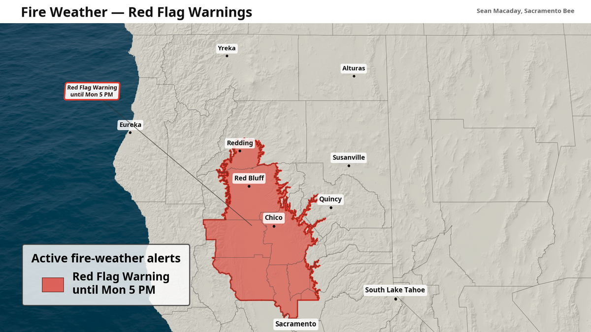 A red flag warning is in effect Monday for the Sacramento Valley from Redding south to the northern Sacramento metro area. McClatchy Media
Further north, the combination of slightly stronger winds and drier air is potent. Gusting between 15-35 mph, winds will be widespread across the Sacramento Valley on Monday from Redding to Sacramento. The combination of low humidity, low soil humidity and strong winds will mean that any fire that does spark could spread quickly.
Relative humidity values are between 10-20% Monday, with the strongest wind gusts occurring north of Sacramento this morning and midday.
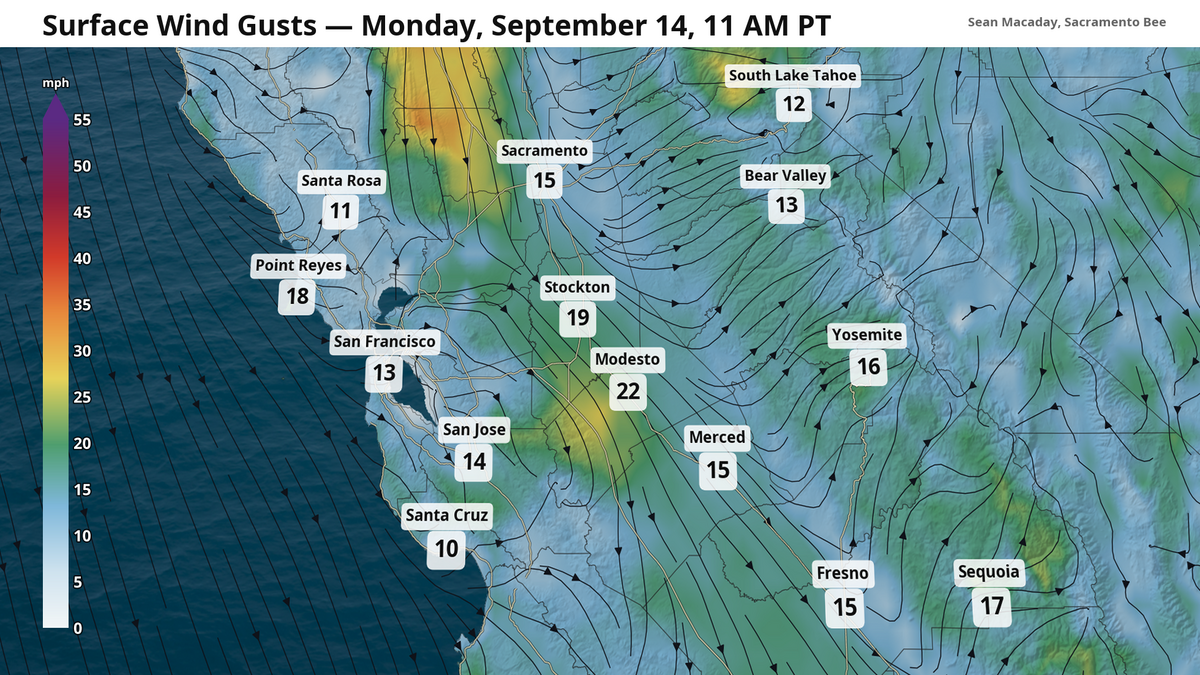 Strong wind gusts up to 35 mph out of the north will be possible Monday in the Sacramento Valley, with that northerly breeze persisting southward all the way to Fresno with cooler temps. McClatchy Media
While not in the red flag warning area or the Sacramento Valley, the Lucas Fire continues to burn in Lake County north of Clear Lake near Hog Point. At 4,109 acres and 25% contained, some growth is possible today as these northerly winds will be present.
The red flag warning is set to expire at 5 p.m. Monday. However, the fire risk will continue with low humidity levels lingering through the week, even further south in the San Joaquin Valley.

The Sacramento Bee
Sean Macaday covers the weather for McClatchy Media in California. Originally from Chicago, Sean worked 6 years covering the weather on local television in Minnesota. He holds a bachelor’s degree in meteorology and marine science from the University of Miami.